Mount Kilimanjaro Climb July 13-20, 2023
Mount Kilimanjaro Climb July 13-20, 2023
 |
| Mount Kilimanjaro Uhuru Peak. 5,895 meters (19,341 ft) |
 |
| From Top Left: Akshay, Jai, Kanika, Monika, Srinivas, Vibhakar, Vikram and Yashvi |
- Monika Agrawal: My batchmate from IIT Kanpur. She is very athletic and is a marathon runner. She is incredibly helpful and is always concerned about everyone in the group. First time at high altitude.
- Srinivas: Mr. Monika! Always calm and collected. I have never seen him perturbed. The very definition of Hakuna Matata. First time at high altitude.
- Vikram Chalana: My batchmate from IIT Kanpur. Successful serial entrepreneur. Really jovial and fun. He was the life of the group. First time at such high altitude.
- Akshay Chalana: Vikram's son. Works at a hedge fund. It was great to see a father-son duo climbing together. Quietly confident. First time at such high altitude.
- Vibhakar Tripathi: My batchmate from IIT Kanpur. Avid hiker. We have done several hikes together in the past including Stok Kangri and Annapurna Circuit. Bird watcher with encyclopedic knowledge.
- Kanika Khandelwal: My niece. She is so full of life and energy. It is really fun to be around her. She has accompanied me previously on Stok Kangri and Chadar Trek.
- Yashvi Rawat: My daughter and the youngest member of the team. She is really petite but super strong mentally and physically. Loves outdoors. Happy to wake up at ungodly hours to join me for hikes. I am very proud of her. This was her first major trek with hopefully many more to come.
- Jai Rawat: That's me! I discovered the love of outdoors at the age of 47 in 2016. Since then I have done a number of treks, long bike rides, marathons, ultra-marathons etc. Hope I can continue it for 20 more years to make up for the lost time!
Trek Overview
- Day 1: Machame Gate to Machame Camp. Net elevation gain: 3,400 ft. Distance: 11km
- Day 2: Machame Camp to Shira Camp. Net elevation gain: 3,000 ft. Distance: 5km
- Day 3: Shira Camp to Baranco Camp. Net elevation gain: 500 ft . Distance: 10km
- Day 4: Baranco Camp to Karanga Camp. Net elevation gain 300 ft: Distance: 5km
- Day 5/6: Karanga Camp to Barafu Camp to Summit then down to High Camp. Net elevation gain: 6,350 ft. Distance 18km
- Day 7: High Camp to Mweka Gate. Net elevation loss 7,600 ft. Distance covered: 13.5km
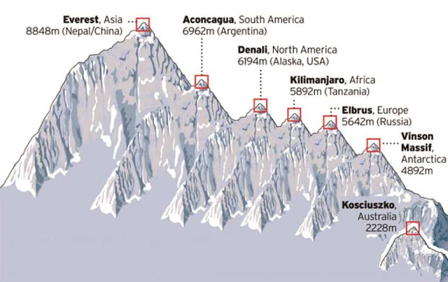 |
| Seven Summits |
 |
| Three Peaks of Kilimanjaro (source) |
 |
| Six Climbing Routes with Machame Route highlighted |
 |
| Our actual trek route as captured by my Garmin. We started from Machame Gate (left) and ended at Mweka Gate (right) |
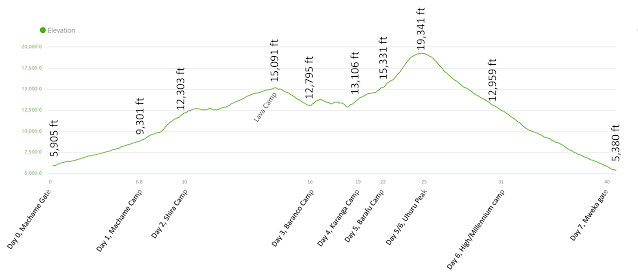 |
| Daily Elevation and Distance Profile from my Garmin. We covered 40 miles (64km) and climbed 17,220 ft. |
Preparation
 |
| X-Ray of my left ankle 15 days before the climb |
 |
| Ankle brace to protect my damaged ankle |
 One thing you cannot really prepare for is high altitude. Oxygen level drops to 50% at around 18,000 ft elevation. How your body reacts to that can be quite unpredictable. Previous treks can be an indication but no guarantees. During our Annapurna trek, we saw one of the sherpas get AMS (Acute Mountain Sickness). The best you can do is walk slowly and hope that attitude wins over altitude! While it is always tempting to go faster, it is utter foolishness to do so. This is not a race.
Day 0 (July 12): Arrival to Kilimanjaro Airport
 |
| Hello Kilimanjaro! |
 |
| Sunflower fields |
- A daypack which he/she will carry. The daypack will have water, snacks, clothing layers for the day and other essentials like sunblock.
- A duffle bag which the porters will carry. It will have everything else like sleeping bag, extra clothes, extra snacks, footwear for the camp etc.
 |
| Duffle bag and daypack |
 |
| Monika and Srinivas: lovely couple with amazing chemistry |
Day 1 (July 13), Part 1: Moshi to Machame Gate to Machame Camp
 |
| Bus ride to Machame Gate. Eight of us plus guides and some porters |
- Mambo: How are you?
- Poa: I am good, usually in response to Mambo
- Twende: Let's go. ("Team Super Nane, Twende" beame our battle cry)
- Karibu: Welcome
- Asante Sana: Thank you very much
- Lala Salama: Sleep well (peacefully)
- Habari za asubuhi: Good morning
- Pole Pole: Slowly. This is how you are supposed to climb. Sloooowly.
- Morning is 'asubuhi' in Swahili and 'subah' (सुबह) in Hindi
- Pen is 'kalamu' in Swahili and 'kalam (कलम) in Hindi
- Medicine shops are called 'duka la dawa' in Swahili and 'dawa ki dukan' (दवा की दूकान) in Hindi
 |
| Both shoes just broke apart |
 |
| Signpost at Mchame Gate. There was a similar signpost at each campsite. It became a ritual to take a picture with these signposts everyday after arriving at the campsite. |
 |
| Machame Gate, one of the Kilimanjaro National Park entrances. |
Day 1 (July 13), Part 2: Start of the trek. Machame Gate to Machame Camp
- Starting Point / End point: Machame Gate / Machame Camp
- Start / End Elevation: 5,905 ft / 9,301 ft
- Distance Covered: ~7miles
- Ascent/Descent: 3,851 ft / 16ft
- Max/Min Elevation: 9,325 ft / 5,483 ft
- Start Time/End Time/Duration: 1:35pm / 6:25pm / 4:50 hrs
 |
| We will probably need some good luck so this was an apt sign at the start of the trek |
 |
| We immediately spotted some blue monkeys |
 |
| The greenery was simply spectacular. It provided the perfect start for our trek |
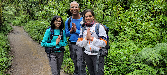 |
| Yashvi, Sriniva, Kanika - asking for forgiveness...should we? :) |
 |
| The scenery was surreal. We felt like we were walking in some fairyland forest |
 |
| Jubilation at the end of Day 1 |
 |
| We arrived just in time to see the magic of setting sun. The mountain peaks are glowing as if they are on fire! |
General Setup
- four guides
- one cook
- one waiter
- one toilet crew
- one tent crew
- five summit porters
- 11 normal porters
 |
| Support Team |
There was always one guide in the front and another one at the back, making sure that everyone was taken care of.
 |
| Porters carrying heavy load |
 |
| We saw porters carry all sorts of things. This one is carrying a metal stretcher up a steep slippery terrain |
 |
| Camp setup. At 10 o' clock is the small blue toilet tent. In the front is washing area with warm water. What luxury! |
 |
| Don't pooh-pooh the importance of clean toilets, it is the #1 throne for happy campers! |
 |
| Dining tent. This is where we had our meals everyday. Served hot by the cooks. |
- Wake up at around 6am or 6:30am.
- Hot coffee/tea was served in the tent.
- Get dressed and pack up for our hike for the day.
- Go to the dining tent for breakfast. Breakfast usually consisted of pancakes/crepes followed by toast and omelet.
- Start hiking.
- Arrive by lunch time.
- Have lunch. Lunch was usually some kind of porridge or soup, boiled cabbage, fries etc. Not great but filling.
- Rest and/or do acclimatation hike.
- Have dinner. Dinner was usually again some kind of porridge or soup, rice and vegetables or pasta etc. followed by fruits.
- Get briefing for the next day.
- Sleep.
Day 2 (July 14): Machame Camp to Shira Camp
- Starting Point / End point: Machame Camp / Shira Camp
- Start / End Elevation: 9,301 ft / 12,303 ft
- Distance Covered: ~3.5miles
- Ascent/Descent: 2,798 ft / 197 ft
- Max/Min Elevation: 12,303 ft / 9,297 ft
- Start Time/End Time/Duration: 8:30am / 1:45pm / 5:15 hrs
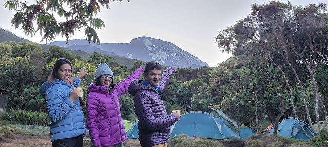 |
| Paraphrasing John Muir "The mountain is calling and we must go!" |
 |
| Look at the steep, rocky terrain |
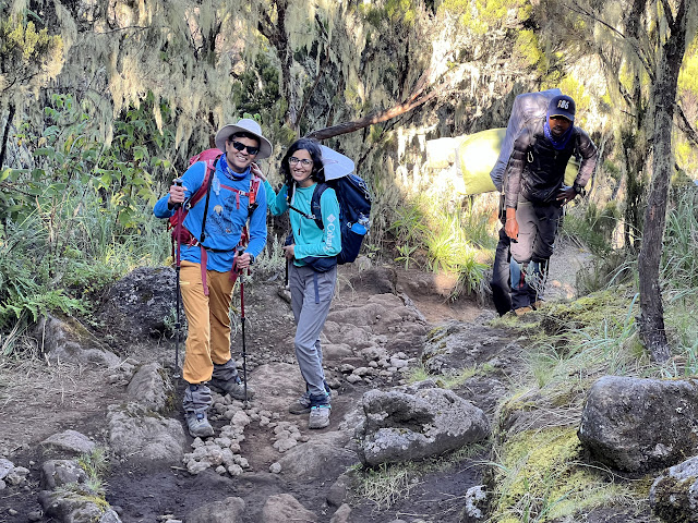 |
| This trek was extra special for me because my daughter joined me for the first time |
 |
| One of the many rest stops we took along the way |
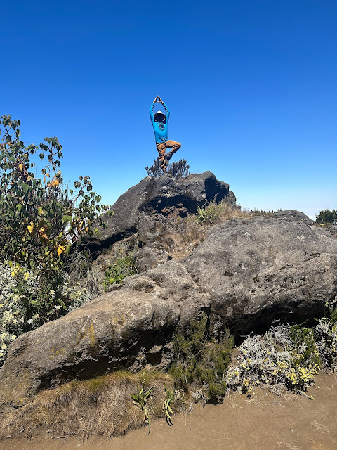 |
| Bad ankle or not, I can't resist climbing random rocks... |
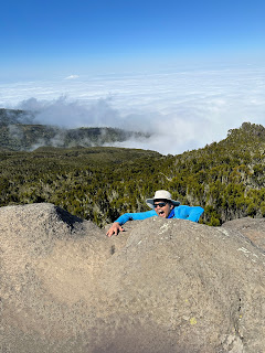 |
| ...or trying random antics :) |
 |
| Yashvi loves to climb rocks too... wonder where she got that from :) |
 |
| We were well above the clouds. The scenery was simply spectacular |
 |
| How do you caption something like this? |
 |
| Arrived at Shira Camp at 1:45pm |
 |
| Panoramic view of the campsite |
 |
| Kilimanjaro in golden hue of the setting sun. Someone mentioned that it looks like a pregnant lady and now I cannot unsee that 😅 |
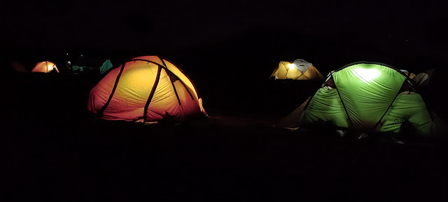 |
| Night time was magical |
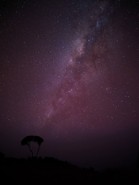 |
| Going out to the loo at night was never harder but never prettier. I often stayed out in the extreme cold just to stare at the night sky in amazement. |
 |
| Uhuru peak |
Day 3 (July 15): Shira Camp to Baranco Camp
- Starting Point / End point: Shira Camp / Baranco Camp
- Start / End Elevation: 12,303 ft / 12,795 ft
- Distance Covered: ~6.5miles
- Ascent/Descent: 2,605 ft / 2073 ft
- Max/Min Elevation: 15,091 / 12,303 ft
- Start Time/End Time/Duration: 8:20am / 5:00pm / 8:40 hrs
 |
| Mount Meru is in the background. We are pointing to Uhuru peak |
The terrain changed again today and we found ourselves walking through large lava rocks. We split up into three different pace groups today.
 |
| Some lava rocks were enormous |
 |
| Walking through the field of lava rocks |
 |
| Even chest pain and breathing difficulties couldn't keep Yashvi away from climbing some rocks :) |
 |
| Lunch at Lava Camp |
 |
| Lava Camp signpost |
 |
| There is a massive lava tower at the camp. You can get an idea of how big it is by looking at its size relative to us. |
 |
| We saw all sorts of interesting lava formations along the way |
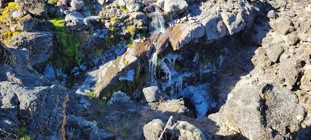 |
| This waterfall was partially frozen. It looked really pretty |
In this area of the trek, we started seeing a lot of Giant Groundsel trees. These are prehistoric plants that have evolved over a million years ago and are found at high altitudes. They can grow up to 30 ft and have a very unique appearance of a cactus combined with a pineapple. They have several adaptations that help them survive bitter, sub-zero temperatures. E.g., the dead leaves fold over the trunk to create insulation.
 |
| Giant Groundsel Trees |
 |
| Happy to put a hard day's climb behind us |
Day 4 (July 16): Baranco Camp to Karanga Camp
- Starting Point / End point: Baranco Camp / Karanga Camp
- Start / End Elevation: 12,795 ft / 13,106
- Distance Covered: ~3.5miles
- Ascent/Descent: 1,500 ft / 1,190 ft
- Max/Min Elevation: 13,841 / 12,795 ft
- Start Time/End Time/Duration: 9:15am / 3:00pm / 5:45 hrs
 |
| We had a late start today but we are rearing to go now |
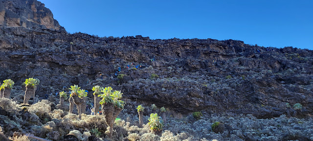 |
| First section of Baranco Wall. You can see some climbers against the wall |
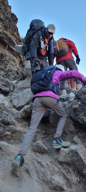 |
| Yashvi loves this kind of terrain and enjoyed thoroughly |
 |
| Accumulated some rock climbing extra credits :) |
 |
| Vibhakar scrambling up followed by Monika, Akshay and Vikram |
 |
| Yashvi enjoying the view from the top. You can see Mount Meru in the distance |
 |
| Akshay jumping above the clouds! |
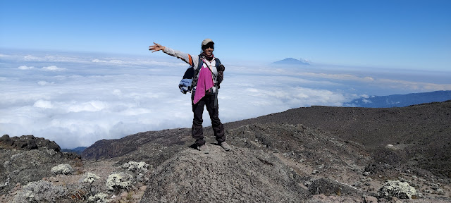 |
| Kanika enjoyed her solitude and being one with the nature |
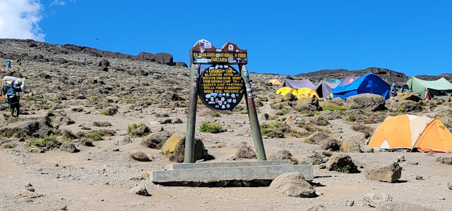 |
| Karanga Camp |
 |
| View from our tent |
 |
| At night the clouds cleared up and we could see the city of Moshi down below. It was a magical view. |
Day 5 (July 17), Part 1: Karanga Camp to Barafu Camp
- Starting Point / End point: Karanga Camp / Barafu Camp
- Start / End Elevation: 13,106 ft / 15,331 ft
- Distance Covered: ~2.5miles
- Ascent/Descent: 2,225 ft / 0 ft
- Max/Min Elevation: 15,331 ft / 13,106 ft
- Start Time/End Time/Duration: 8:20am / 12:30pm / 4:10 hrs
 |
| Morning sunrise lighting up the tip of Mount Meru |
 |
| Last couple of days of waking up to this magical vista |
 |
| Let's do this! |
 |
| Keeping a slow and steady pace |
 |
| Ab Killi Door Nahi !😀 |
It was a short but steep hike, climbing 2,200 ft in just 2.5 miles. This would be hard at any altitude. At 14K+ ft, it was definitely a challenge. But what doesn't Kili you, makes you stronger 🤣
 |
| Almost there.. |
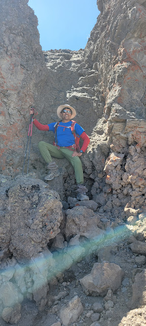 |
| This rock formation looked like a throne so I had to oblige.. :) |
 |
| We arrived at the Barafu Camp at 12:30pm |
 |
| Packet of chips nearly bursting at the seams due to the pressure difference! |
We had our lunch and then rested for some time, trying to get some sleep before the overnight summit push. However, sleep was hard to come by. I wasn't able to get any sleep but tried to rest as much as I could.
 |
| View of Mawenzi Peak from the tent |
Day 5/6 (July 17/18): Barafu Camp to Summit and Back
- Starting Point / Summit / End point: Barafu Camp / Uhuru Peak / Barafu Camp
- Start / Summit / End Elevation: 15,331 ft / 19,341 ft / 15,331 ft
- Distance Covered: ~6.5miles (round trip)
- Ascent/Descent: 4,000 ft / 4,000 ft
- Max/Min Elevation: 19,341 ft / 15,331 ft
- Start Time/Summit Time/Duration: 11:25pm / 9:25am / 10:00 hrs
- Summit Time / Descent Time / Duration: 9:55am / 11:45am / 1:50 hrs
- Sunrise looks spectacular from the top.
- Mountain starts to catch clouds later in the morning, obstructing the views.
- You have to descend back down to Barafu camp and then continue descending down to the Millennium Camp. If you start the ascent in the morning, you may not be able to complete the descent in daylight.
- Sub-zero temperatures make the ground more stable. Rocks and scree are loose during the day, consuming more energy.
- In case of emergencies, it is better to have a lot of daylight available.
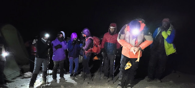 |
| Ready for summit push |
 |
| It was pitch dark, we could only see a few feet ahead of us |
 |
| 5:45am. Ray of hope? |
Here's another short video capturing the tiredness 6.5 hours into the climb.
 |
| 6:15am |
.jpg) |
| This hug from Kanika gave Yashvi the much needed strength to carry on |
Sunrise finally happened at 6:45. It was absolutely magical. I have not seen anything like this. It is impossible to capture it in pictures or words. The sun rose up from the middle of the clouds. A growing red dot in the sea of absolute white. It was mesmerizing.
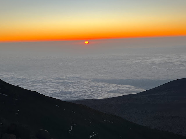 |
| Magical Sunrise |
 |
| Icefields on the way from Stella Point to Uhuru Summit |
 |
| Some sections felt like a different planet! |
Kanika and Yashvi reached the summit first, followed shortly by Vibhakar and me. It was such an emotional moment to summit Kilimanjaro with my daughter. Both Yashvi and I had tears in our eyes. Yashvi later told me that she had started hallucinating a bit at the end. She saw me as an astronaut walking on the moon. She also lost the depth perception and thought that rocks were appearing out of nowhere as she walked down the trail.
 |
| Since I am upside down, can I claim to have reached higher than the official peak? |
I had designed and custom printed t-shirts for our group which said "Kilimanjaro, Been There, Climbed That". It was in anticipation that we will all summit successfully. We all carried the t-shirts to the top and got some memorable group photos.
 |
| Our custom t-shirts |
 |
| Feeling top of the world! |
 |
| With our guides who were instrumental in our success |
Day 6 (July 18): Barafu Camp to High Camp
- Starting Point / End point: Barafu Camp / High Camp
- Start / End Elevation: 15,331 ft / 12,959 ft
- Distance Covered: ~2.5miles
- Ascent/Descent: 0 ft / 3,000 ft
- Max/Min Elevation: 15,331 ft / 12,959 ft
- Start Time/End Time/Duration: 4:30pm / 6:15pm / 1:45 hrs
Day 7 (July 19): High Camp to Mweka Gate
- Starting Point / End point: High Camp / Mweka Gate
- Start / End Elevation: 12,959 ft / 5,380 ft
- Distance Covered: 8.5miles
- Ascent/Descent: 0 ft / 7,600 ft
- Max/Min Elevation: 12,959 ft / 5,380 ft
- Start Time/End Time/Duration: 9:20am / 2:50pm / 5:30 hrs
 |
| We enjoyed our last day of waking up to this view |
 |
| Gabriel, the head guide is a budding artist and drew an outline of the mountain on the flag |
 |
| Group picture with the support staff and guides. They were instrumental in our success |
 |
| Vikram felt that he is doing all the heavy lifting :) |
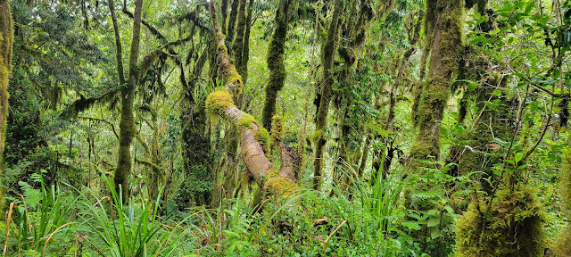 |
| What a change from the cold, harsh, outer-worldly landscape just yesterday morning. |
 |
| Steep, slippery, rocky and muddy terrain |
 |
| Shoes Cleaning Operation. They did an amazing job with just a brush and a bucket. |
 |
| Waiting at the parks office for our official certificates |
 |
| From 13,000 ft down to 5,300 ft in just a few hours |
 |
| We may have descended but we still felt 'top of the world' |
 |
| Did we really climb THAT! |


2 comments
Wow! Amazing to read it. I can imagine how much you guys had fun! Congratulations to all!
ReplyDeleteThanks Awadhesh. It was hard but totally worth it!
Delete