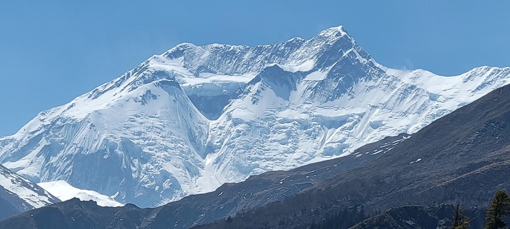
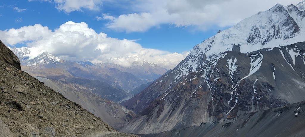
Annapurna Circuit has been voted one of the best long-distance treks in the world. The trek encircles the Annapurna Massif which is in central Nepal. Massif is a compact group of mountains. The Annapurna Massif contains the infamous Annapurna I peak (8,091m/26,545 ft) with a fatality rate of nearly 30%! It also contains 13 other peaks over 7,000 meters (22,966 ft) and sixteen more over 6,000 meters (19,685 ft). Some of the prominent peaks include Annapurna I – IV, Tilicho, Nilgiri, and Gangapurna. We were able to see most of these peaks during our trek.
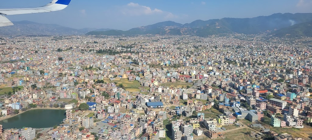
Great view of The Annapurna Massif from aircraft. (Courtesy Solundir – Own work, CC BY-SA 3.0)
Great view of The Annapurna Massif from aircraft. (Courtesy Solundir – Own work, CC BY-SA 3.0, https://commons.wikimedia.org/w/index.php?curid=17635720)
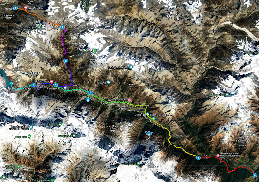
Our trek route. Color coded to show the daily itinerary
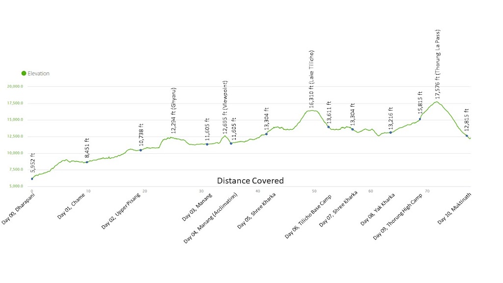
Daily Elevation and Distance Profile from my Garmin. We covered 78 miles (125km) and climbed 28,836 ft.
We were welcomed by Shree Ghimire, our tour operator, at the airport with flower garlands. The other two (Arun and Vibhakar) had arrived earlier.
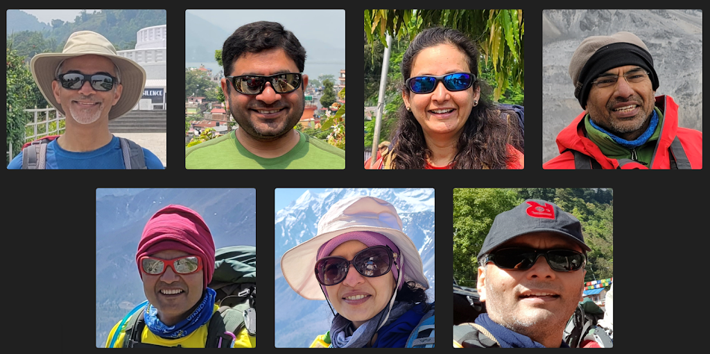
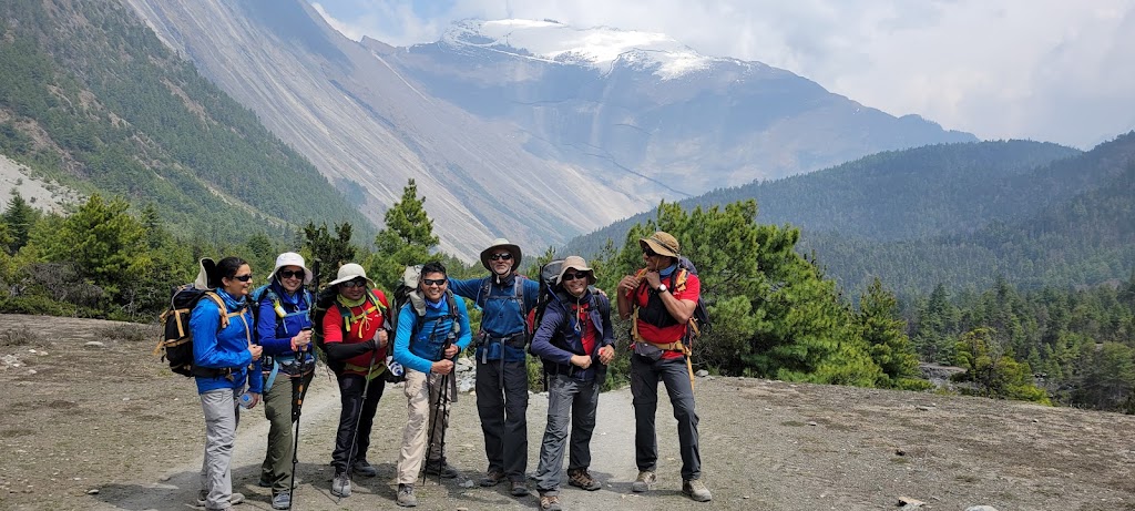
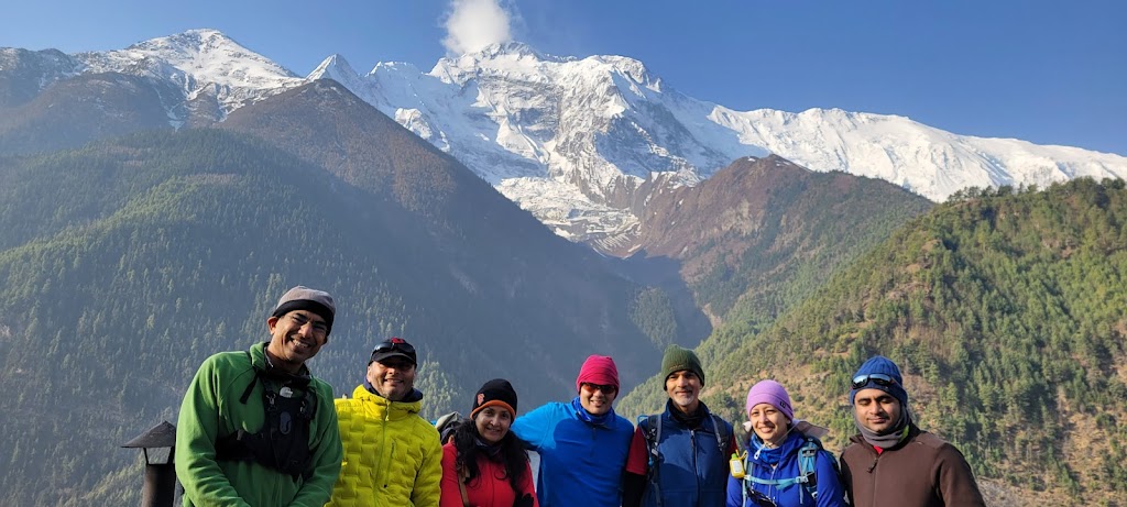
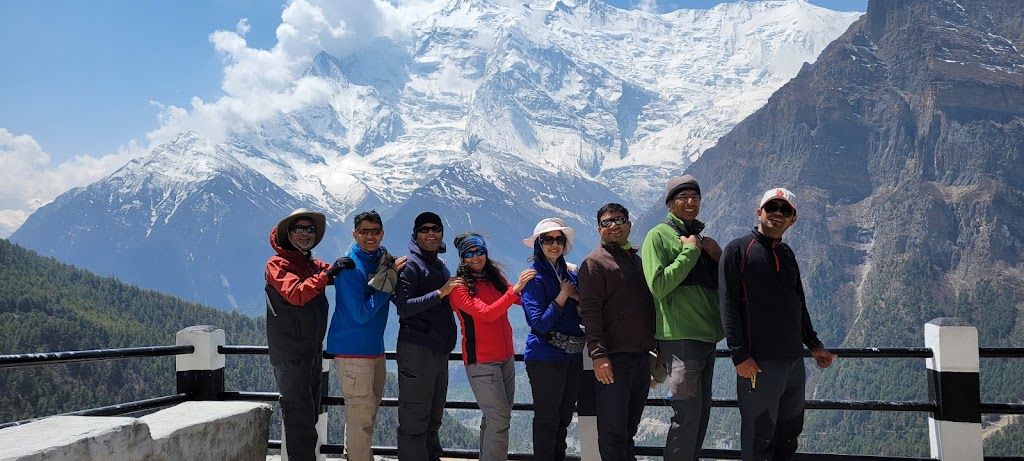
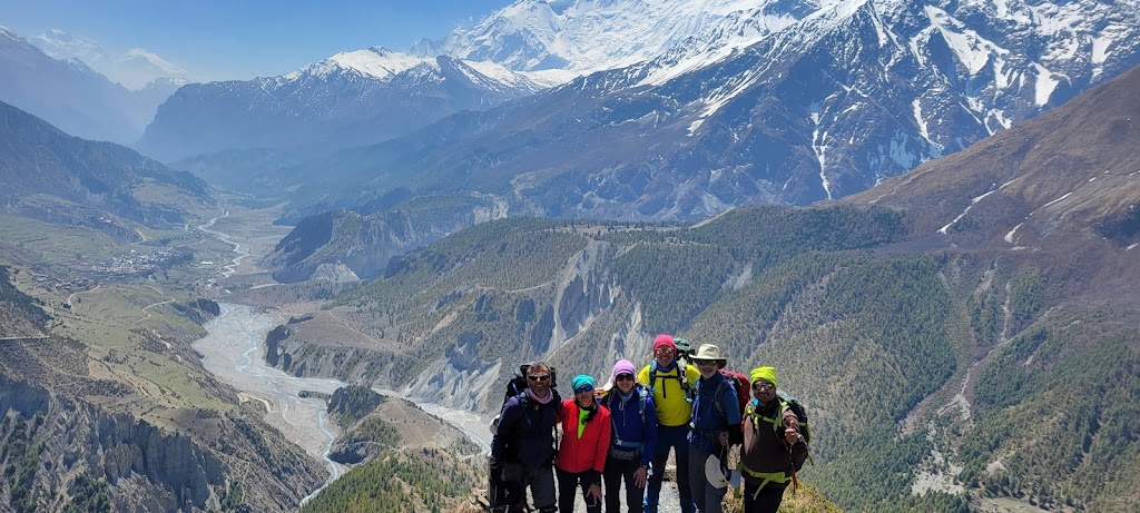
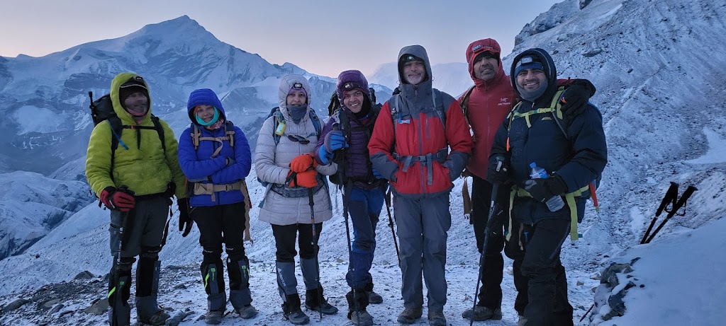
From left to right: Meenal, Anu, Jai (me), Awadhesh and Samir
We stayed at the “The Address, Kathmandu Hotel”. It’s a funny name and caused much confusion when we asked for the hotel address 😆The hotel was in the Thamel area, a busy, chaotic place with a lot of shops selling inexpensive but fake branded trekking gear. Be prepared to bargain! I had forgotten my snow gaiters and bargained them down to 500 NPR from the asking price of 1,200 NPR. After that I was designated the official bargainer and was forced to accompany anyone who wanted to buy anything.
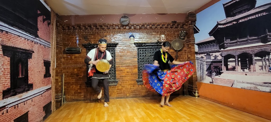
We went to a traditional Nepalese restaurant for dinner which included a dance show. The music and dance was very similar to Bollywood.
Day 0 (April 17): Drive from Kathmandu to Dharapani
It was my daughter Yashvi’s 18th birthday today and I was very sad about missing it. Nevertheless, I decided to celebrate it and ordered a cake. The cake was shared with everyone in the breakfast room and in return they all wished Yashvi a happy birthday! Yashvi was so thrilled to receive these birthday wishes from complete strangers that she didn’t even mind that her name was misspelled on the cake 🙂
Yashvi getting birthday wishes from complete strangers
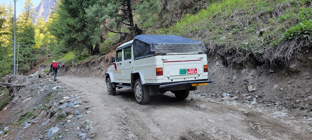
After breakfast we drove from Kathmandu to Dharapani. We started at 7:45am in a 12 person van, but were told that we will have to switch to a jeep in Besisahar because the road would be bad after that. However the ‘good’ section turned out to be so bad that it left us wondering what was in store next. Sure enough, the ‘road’ after Besisahar was non-existent. We were essentially driving on stones and boulders. It was a jolting, lurching, jumpy, jarring, bone-breaking turbulent ride – and that’s putting it mildly. However, the views were quite spectacular and I was excited to start the journey on foot the next day.
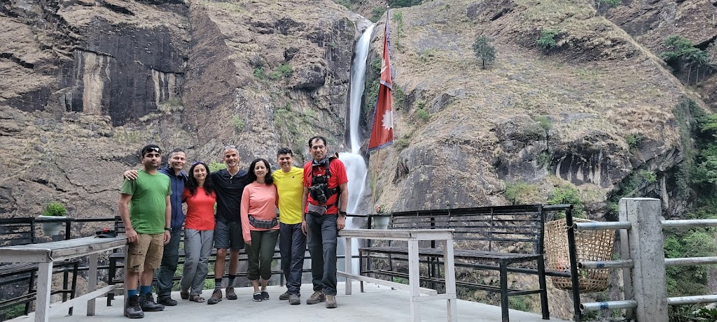
We stopped frequently to enjoy the waterfalls and other scenery along the way
See the above video clip for a glimpse of the road conditions. This was a relatively better section of the road.
We finally reached our hotel (Phulbari Guest House) at 7:30pm in the dark – 12 hours of ordeal which left us more tired than a full day of hiking. We had our dinner and retired quickly after agreeing to an early start the next day. This became our daily routine – retire early and start early.
Day 1 (April 18): Dharapani to Chame
Start / End Elevation: 5,952 ft / 8,451 ft
Distance Covered: 10 miles
Ascent/Descent: 3,386 ft / 889 ft
Max / Min Elevation: 8,546 ft / 5,880 ft
Start Time / End Time / Duration: 7:30 am / 2:15pm / 6:45 hrs
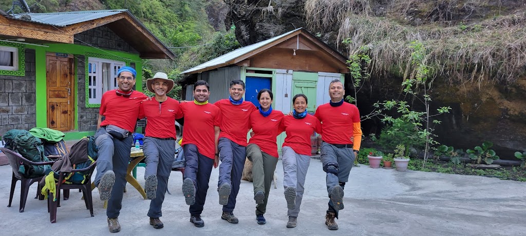
Yay! We were all excited to finally get started with our trek. We all wore matching T-shirts that were custom designed by Anu for the trek. Our main guide, Prakash Adhikari and four porters (Nabhraj, Beer, Pramod and Beerta) accompanied us. We carried a day pack which included layers of clothing, water and food and the rest was packed up in a duffel bag which the porters carried. With guest houses to stay in, porters carrying our load and three cooked meals every day, this was a luxury trek compared to the wilderness backpacking trip we did last year!
We saw the Manaslu Peak immediately after we started. At 8,163 meters (26,781 ft), Manaslu is the eighth tallest mountain in the world and is in the elite ’14 peaks’ club that are 8,000+ meters tall.
Manaslu Mountain
Unfortunately, most of the trail was on the dusty road with constant vehicular traffic. We had to stop frequently and cover our mouth and nose. I understand the need to connect these remote villages via road but the trekking route should be separated. It will kill trekking tourism otherwise.
We passed through a landslide area where the wind was blowing small stones and debris down the slope. Fortunately it was safe to cross although weren’t as lucky at a later point in the trek.
Glimpse of our jeep ride – not for the faint of the heart!
We had decided not to stop for lunch because that would’ve added an additional hour or so. As we sat down for lunch (at around 2:30pm), Awadhesh said he was not feeling well and wanted to go to his room. I stopped him and asked him some more questions, and he mentioned that he is diabetic. Within a minute he fainted in my arms! We immediately gave him some sugar and laid him down. Within a few minutes he was fine and had a hearty meal. It was very scary for all of us and from then on everyone reminded him to keep eating during the trek.
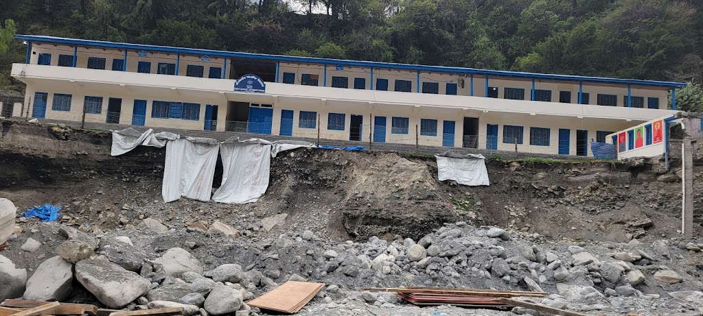
After lunch we walked around the town and saw many areas that were destroyed or severely damaged by flash floods.
There were other buildings in front of this school which got washed away
We had a pot of ginger lemon tea at a nearby hotel. This was to become our favorite drink throughout the trek.
Day 2 (April 19): Chame to Upper Pisang
Start / End Elevation: 8,451 ft / 10,346 ft
Distance Covered: 9.4 miles
Ascent/Descent: 2,638 ft / 722 ft
Max / Min Elevation: 10,354 ft / 8,411 ft
Start Time / End Time / Duration: 7:18 am / 2:35pm / 7:17 hrs
Today’s distance was similar to yesterday so we decided that we should stop frequently to eat and also have lunch along the way to avoid a repeat of Awadhesh’s low sugar episode.
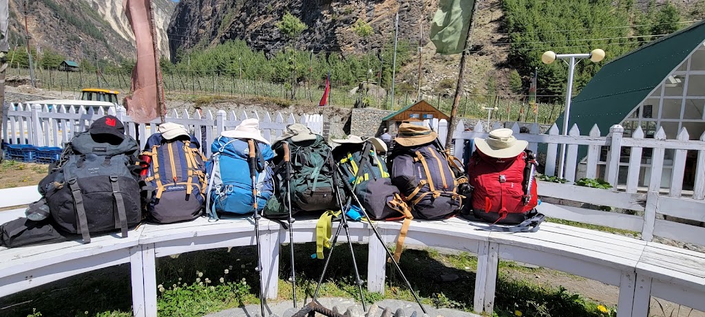
At around 11am we stopped at a place called Bhartang to rest for a bit. Our backpacks enjoyed the break as well 🤣
What are they plotting??
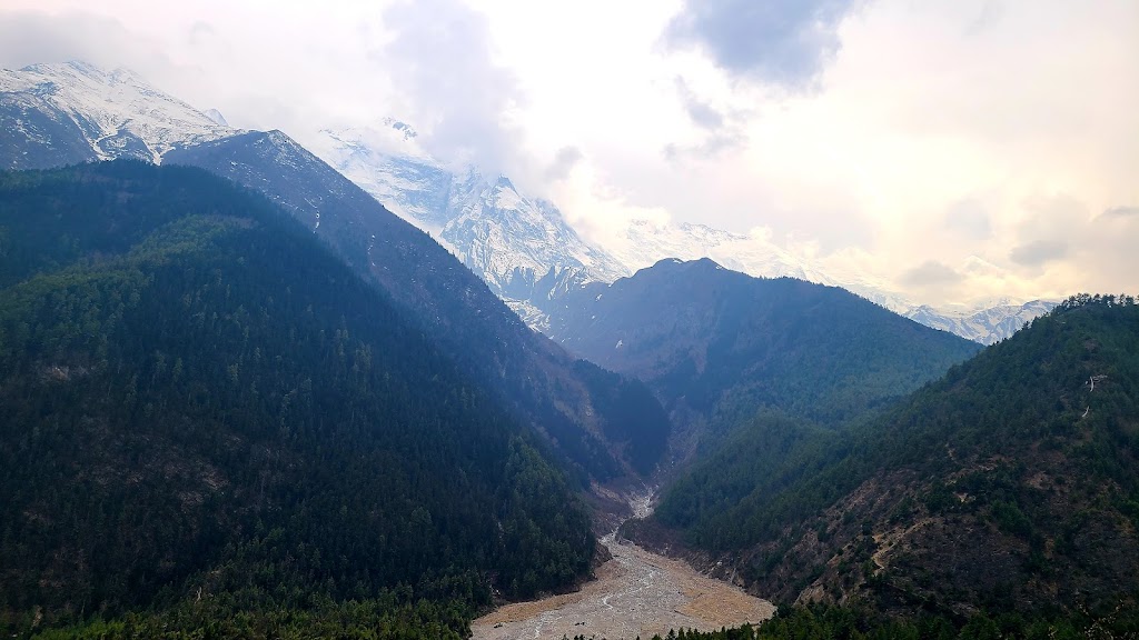
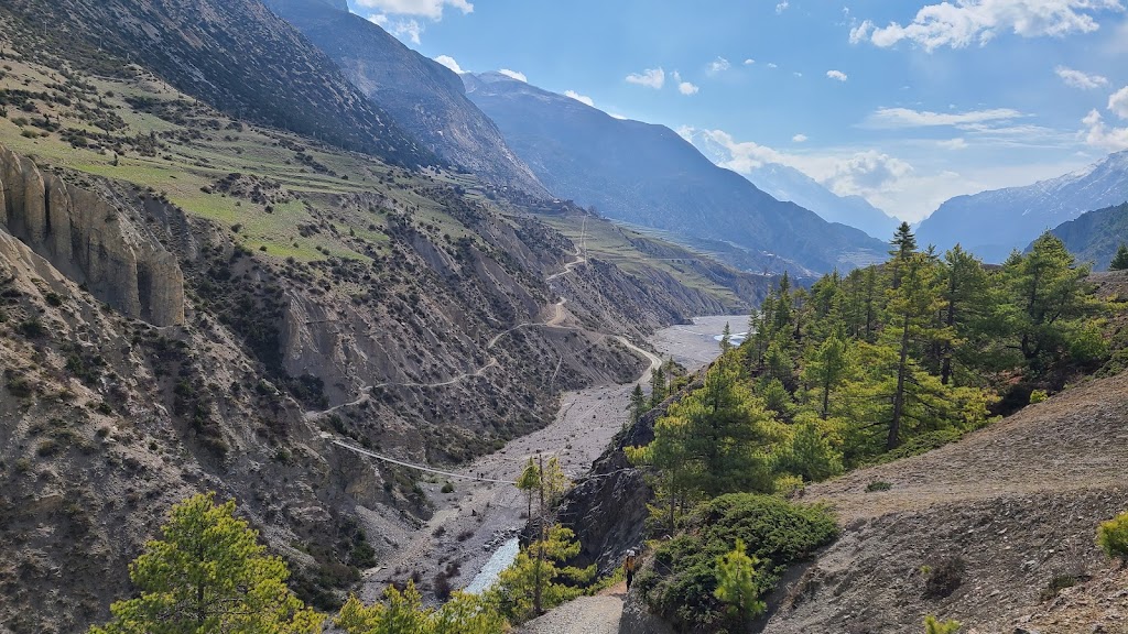
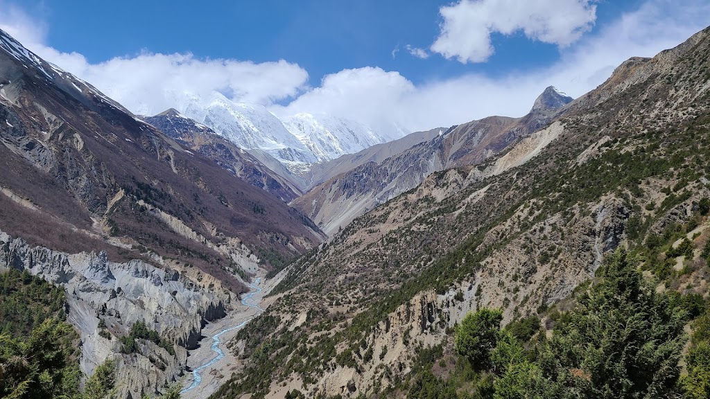
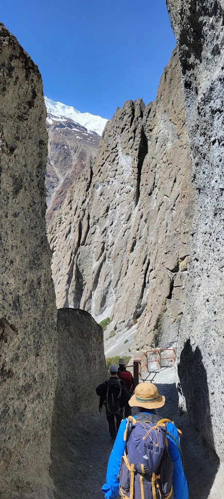
Sections of the trail had sheer cliffs on one side. The river is called Marsyangdi. We walked along this river for most of our trek.
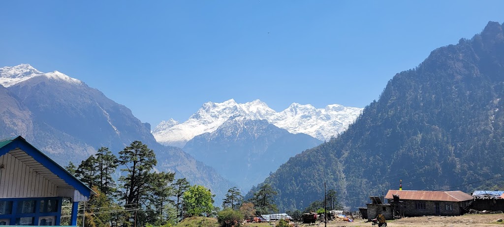
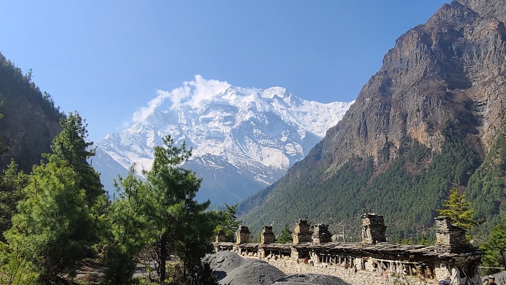
We saw great views of Annapurna II (7,937 m / 26,040 ft) – alas! not tall enough to join the exclusive 8,000+ m club
Paungda Danda is one of the most recognizable features of the Annapurna Trek. The western face of this mountain rises dramatically 4,900 ft above the river. It is locally referred to as “Swarg Dwar” (Gate to Heaven) because they believe that after death, spirits must ascend this wall in order to reach heaven.
Dramatic Swarg Dwar (Gate to Heaven)
This place is already heaven on earth – why ascend the wall to heaven? 😁
I tried walking with the load porters were carrying. They use a head strap which puts a lot of load on the neck. I found it to be a pain in the neck
We stopped for lunch at a place called Dhukur Pokhari at 12:15pm
Most days the weather came in after 2pm. That’s one drawback of stopping for lunch.
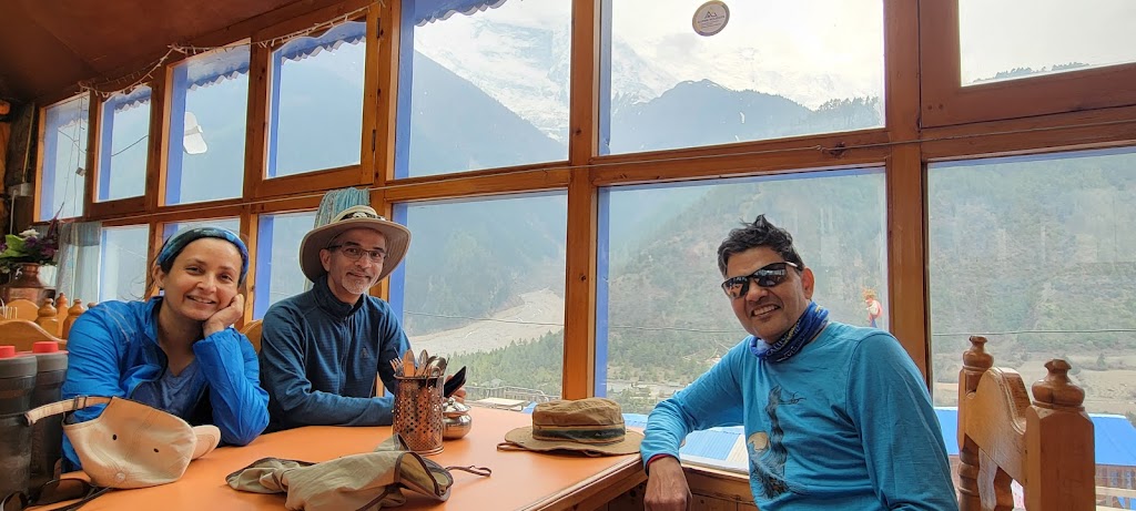
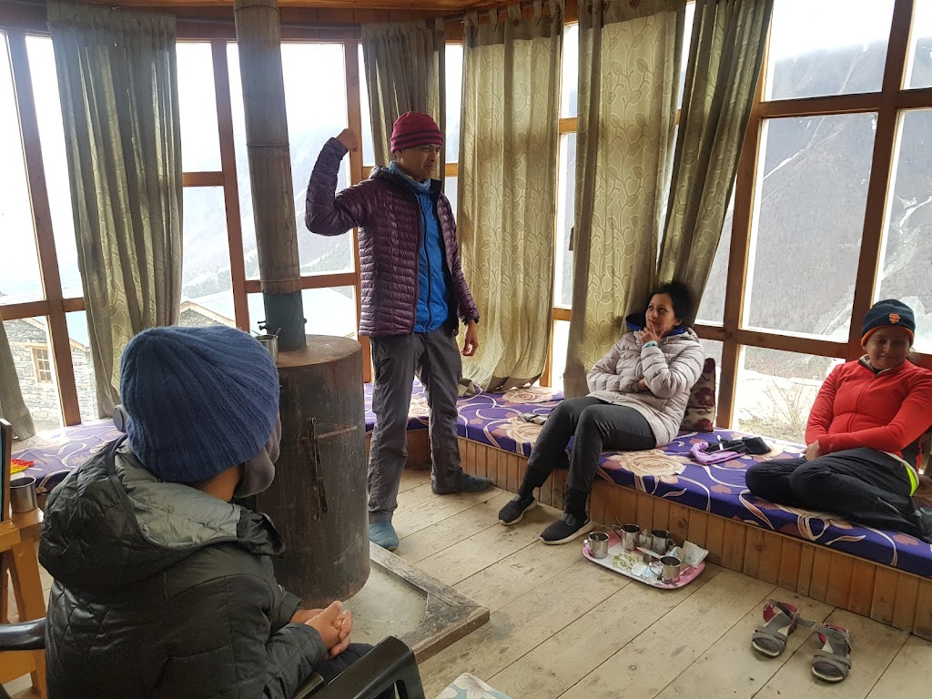
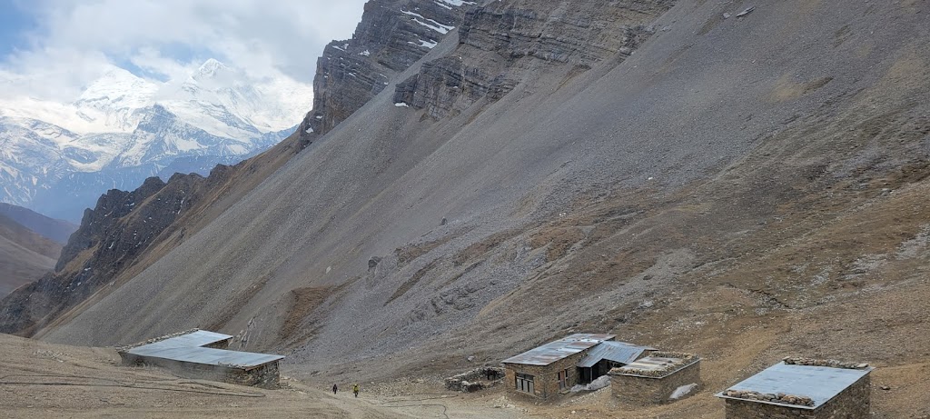
Dining room of our “Hotel Sweet Home” guest house. All guest houses have these sunrooms with spectacular views. In the evening they use wood fire heating to heat up the room.
View from the guest house roof top
We decided to go for a short acclimation hike to a nearby stupa and were rewarded with some panoramic views. You can see lower and upper Pisang villages
Beautiful stupa
We sat down for meditation for 10-15 minutes in this peaceful chamber
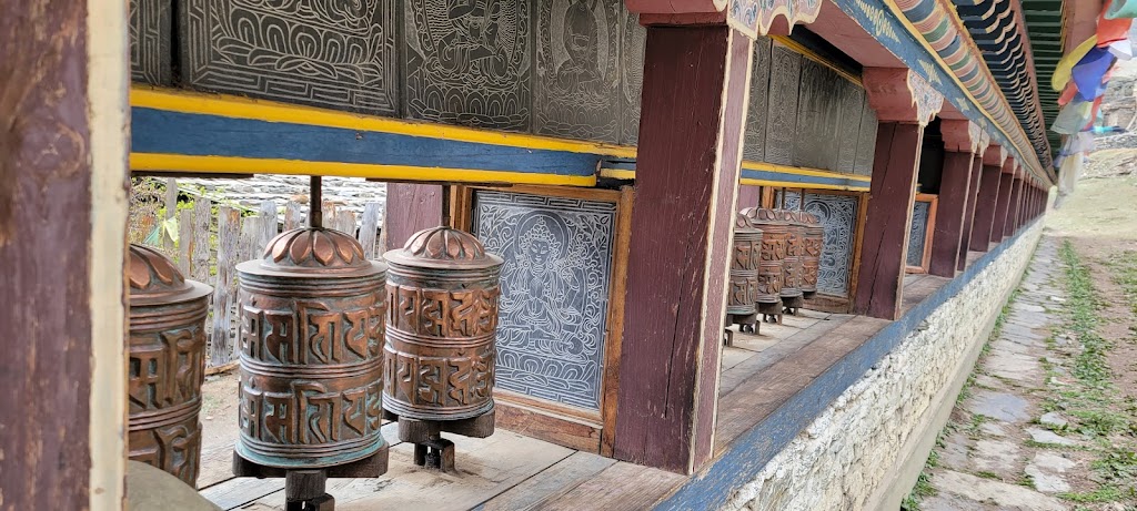
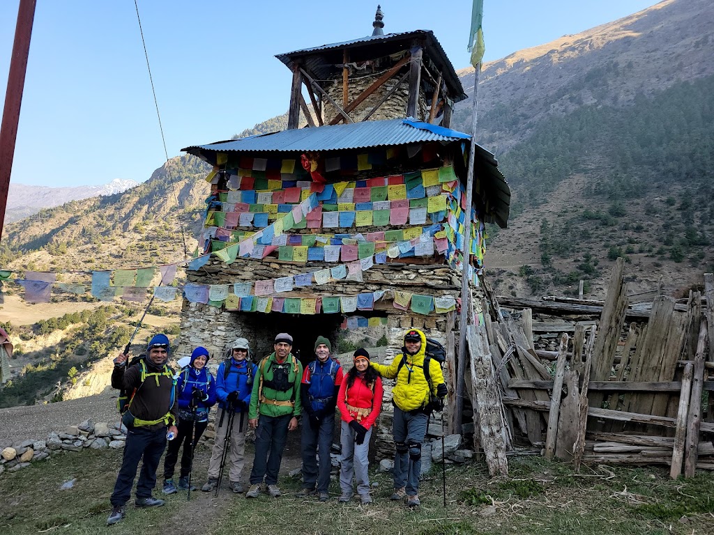
Tibetan Buddhists believe that saying the mantra “Om Mani Padme Hum” invokes the blessings of Chenrezig, the embodiment of compassion. This mantra is often carved into stone and prayer wheels. You are supposed to pass these on the left and spin them as you go along.
These prayer wheels and engraved stone tablets can be found everywhere
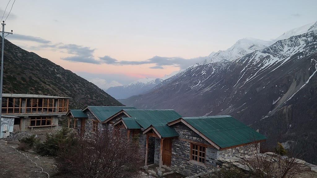
These are the types of guest houses we stayed in. Some of them even had attached toilets!
After dinner we played Antakshari (game of songs) and then retired to our rooms at around 9pm.
Day 3 (April 20): Upper Pisang to Manang
Start / End Elevation: 10,740 ft / 11,605
Distance Covered: 12.1 miles
Ascent/Descent: 2,913 ft / 2,080 ft
Max / Min Elevation: 12,294 ft / 10,740 ft
Start Time / End Time / Duration: 7:30 am / 5:20pm / 9:50 hrs
What a day! The net elevation gain was only 900 ft but the total climb was nearly 3,000 ft! बहुत नाइंसाफी है ये ! (totally unfair)
Our guide gave us the option of a shorter road route (10km), or a longer but prettier trail route (~15km). We picked the latter. As it turned out, the trail route was nearly 20km and involved a lot of climbing and descending. It was still very much worth it though.
We woke up to beautiful views of Annapurna II with the moon still in the sky.
Views of Annapurna II
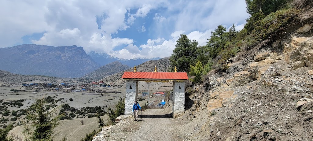
We passed many such gates decorated with prayer flags
Look at the black and white contrast between the two mountains. Also the one on the right is much shorter but looks taller. That perception changed as we climbed up!
After a relatively easy amble, we came across a steep trail which took us to the village of Ghyaru (elevation 12,150 ft). The trail climbed 1,000+ ft in less than 0.5 miles. At this elevation where walking on level ground is also an effort, this monstrous climb sapped us all. The views from the top were spectacular and washed away all the tiredness.
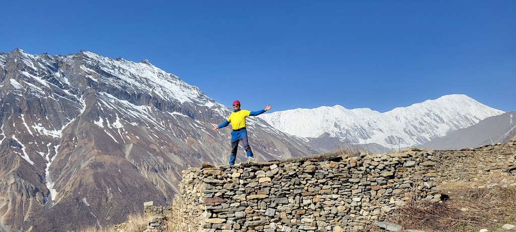
Time for some fun pictures. Also notice the (perceived) relative heights of the mountains now.
choo choo..
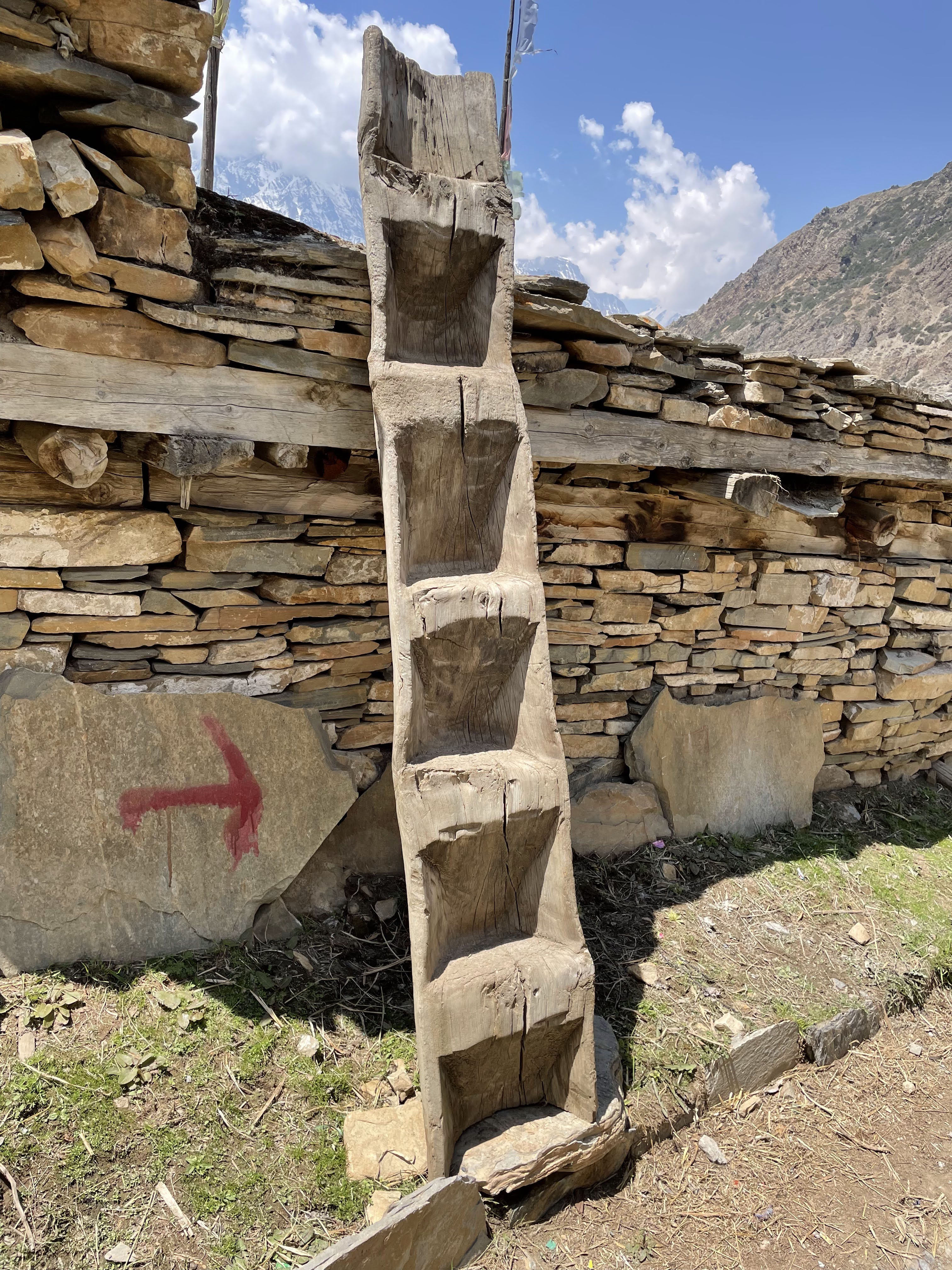
Guess what this is? It is a ladder!! I climbed up one of these but coming down was not easy so I simply jumped 🙂
From Ghyaru we continued on to Ngawal village
Village of Ngawal (11,500 ft). We had ‘high’ lunch here
We finished our lunch at 2:30pm and then continued our march towards Manang. As always, the weather began to look threatening in the late afternoon.
Mountains getting covered with clouds
It began to look somewhat ominous
Vibhakar, Arun and I were in the front. Vibhakar spotted a place selling buckthorn juice in Braka village, and we stopped by to try it. Soon the rest of the group joined us. Meenal was really tired and had a bad headache, so we almost hired a motorcycle to take her to Manang but then Samir convinced her to walk instead. She showed amazing grit and managed to cover the rest of the distance on foot.
Meenal entering the gates of Manang. Tired but unbroken.
We stayed at the Himalayan Singi guest house. At 11,600 the effects of altitude was now visible. Anu had a bad headache and nausea and decided to skip dinner. Most of us had minor headaches as well, but thankfully nothing serious. Samir had an oximeter and we all used it frequently during to trek to assess our oxygen levels and pulse. It kind of became a game over time where we started comparing our results.
We were all especially worried about Anu because she had always suffered from AMS (Acute Mountain Sickness) in all the previous treks and even had to turn back one time. Meenal, Awadhesh and Arun were also going to go beyond their previous highest altitudes. Fingers crossed. 🤞
Day 4 (April 21): Manang Acclimatization Day
Start / End Elevation: 11,600 ft / 11,600
Distance Covered: 2.8 miles
Ascent/Descent: 1,424 ft / 1,424 ft
Max / Min Elevation: 12,700 ft / 11,530 ft
Start Time / End Time / Duration: 7:50 am / 12:10pm / 4:30 hrs
It is important to have at least one acclimatization day for any high altitude trek (8,000+ ft). At high altitudes, the air pressure and oxygen levels drop. The body tries to compensate for it. Breathing becomes labored, the heart pumps more rapidly and the body tries to generate more red blood cells. All this is already hard work for the body. Add strenuous hiking to the mix and you risk your body shutting down and going into survival mode. Throbbing headaches, loss of appetite, nausea, lack of sleep are all early warning symptoms.
For these reasons it is essential to give your body some rest and time to acclimatize to the new environment. Acclimatization strategy is ‘Climb high, sleep low”. A short hike to a higher altitude, spend some time there and then come back down to sleep.
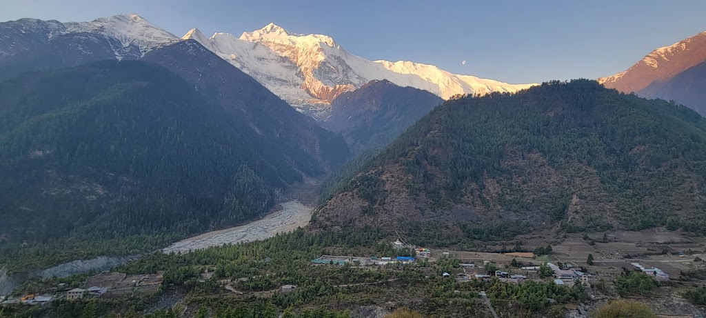
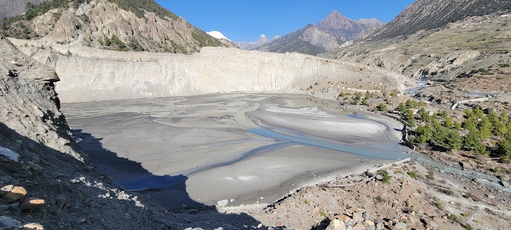
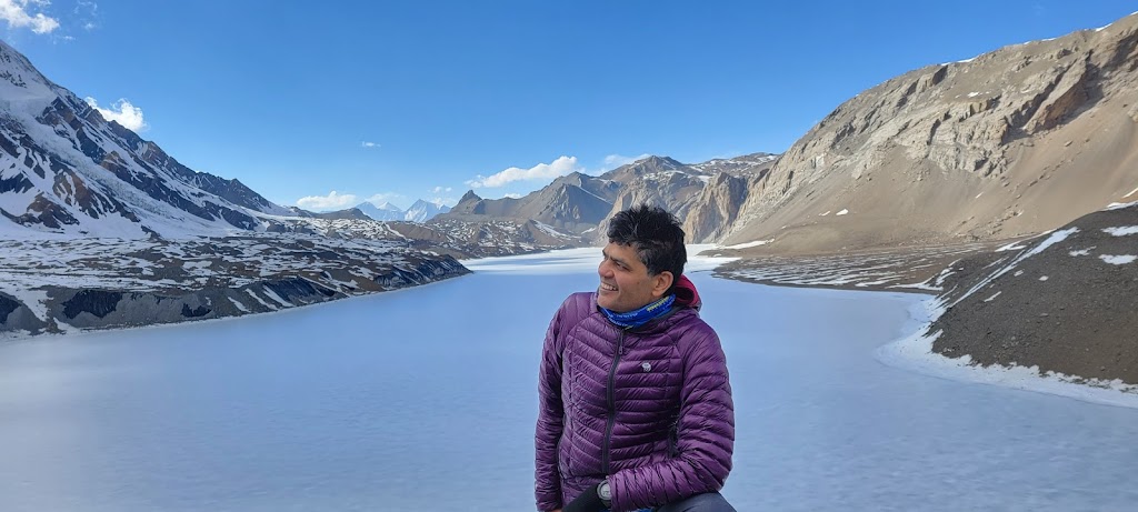
We decided to climb to the Gangapurna Lake view point. However, to our disappointment we found that the lake no longer had any water. A freak monsoon last year created many landslides which deposited so much silt in the lake that all the water drained out. Now the ‘lake’ is just a patch of gray sludge. Somehow it still looked pretty!
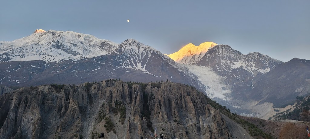
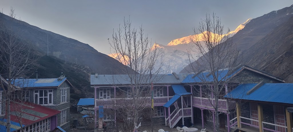
Sunrise typically happened at 5:30am and I was always ready to capture the magic
You can clearly tell who is the boss – the mountain lighting up first is the tallest
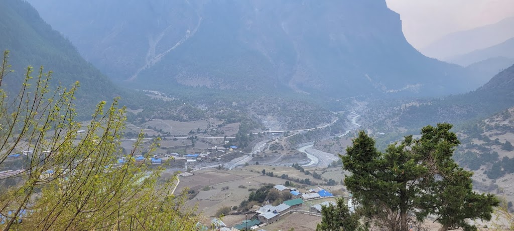
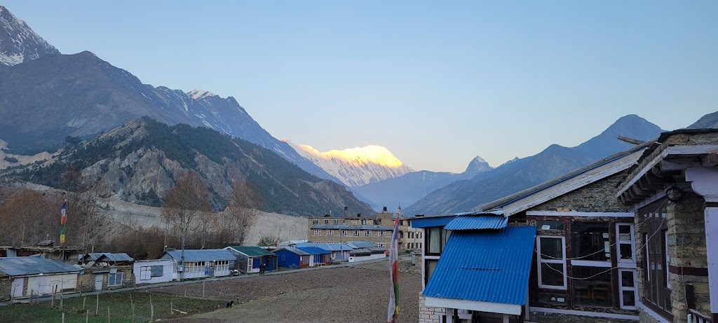
All villages have colorful houses. They look so pretty especially in the brown and white backdrop of the mountains
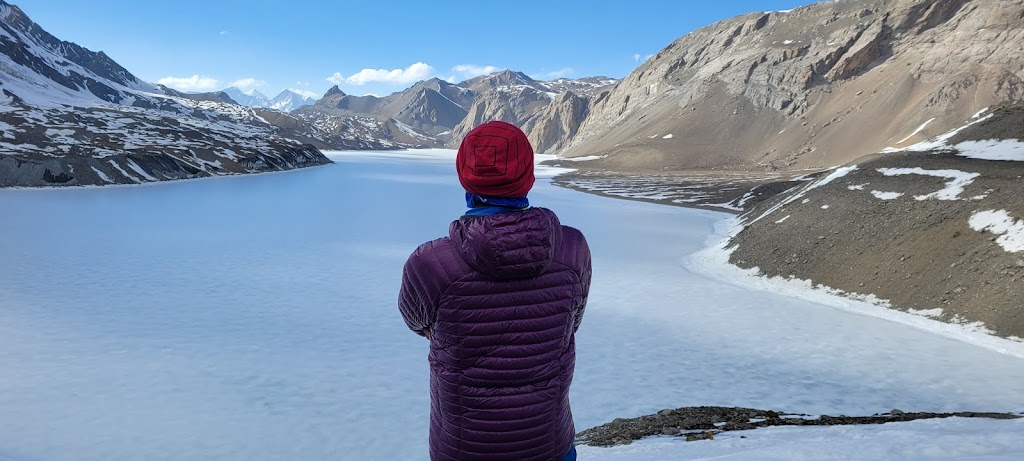
Gangapurna Lake which is no longer..
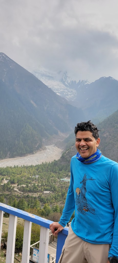
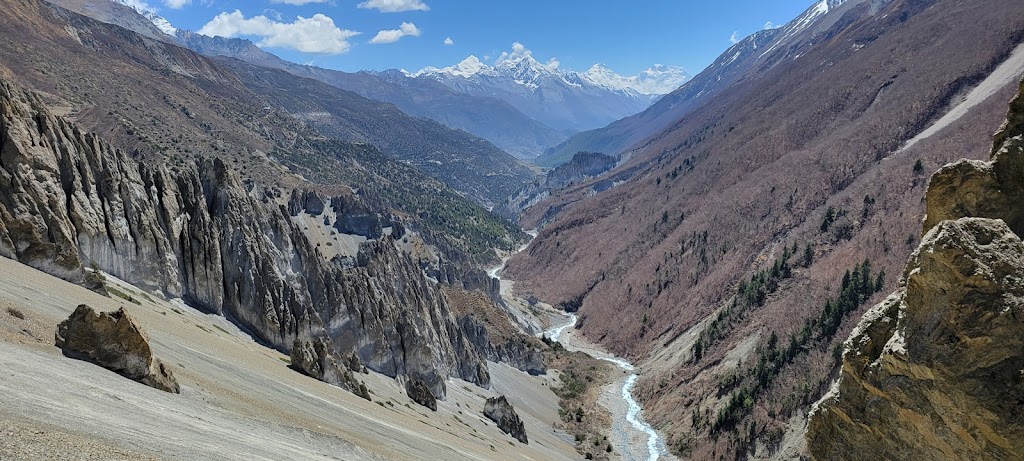
This entire valley was carved by that tiny looking Mersyangdi river! Time and persistence indeed move mountains
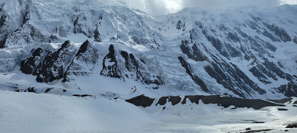
Gangapurna glacier to the left – unfortunately it has been receding due to climate changes
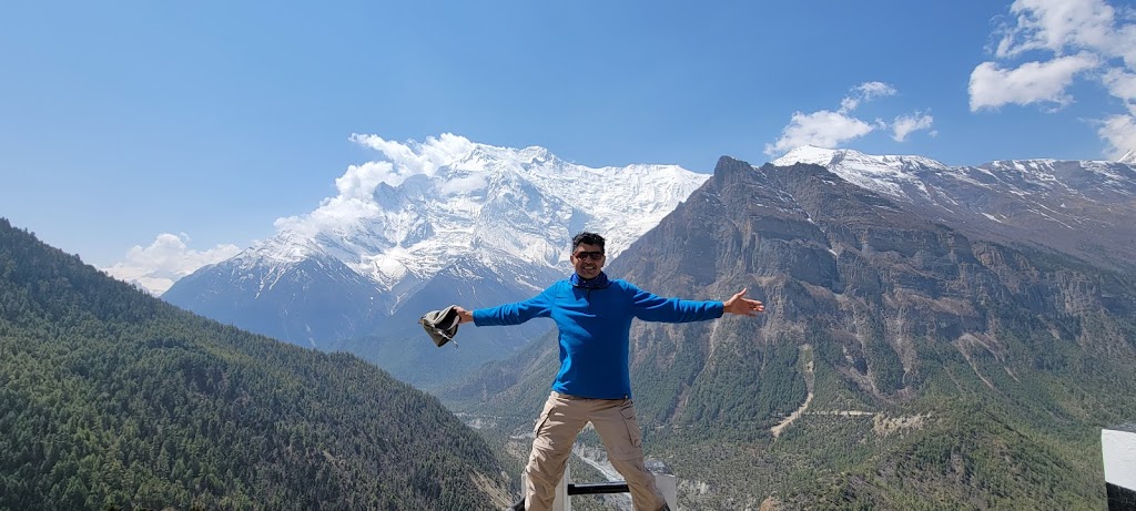
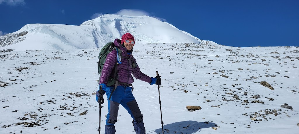
Very distinctive shape of Annapurna IV (7,525 m / 24,688 ft). It looked deceptively close and accessible
Did I just punch through a rock?? 😆
I have to have this trick shot in every trip
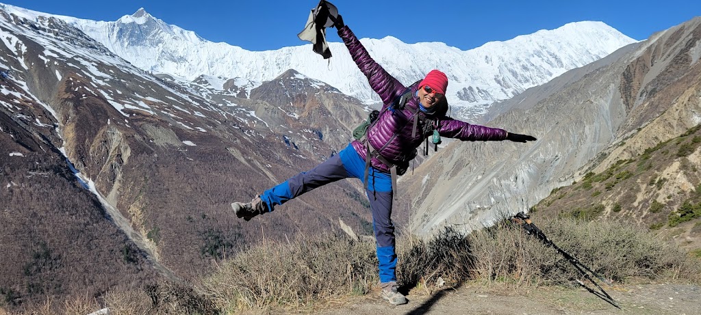
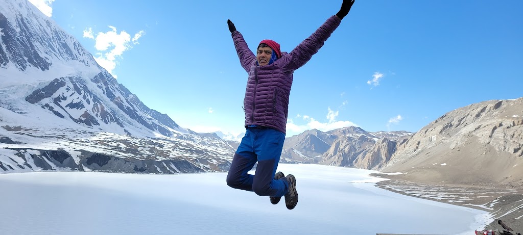
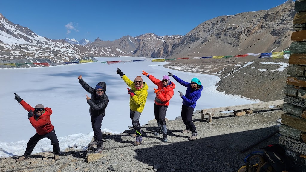
We had to spend a long time at the top so might as well have some fun!
This is not easy even at ground level, let alone at nearly 13,000 ft
Prayer flags blowing in the wind – looked really pretty
An interesting incident happened during today’s hike. Awadhesh found an iPhone at the top which was left behind by a previous group. I came down quickly and told the guide of that group to stay back to collect the phone, which belonged to a girl. But Awadhesh insisted on meeting the owner to verify the ownership by unlocking the phone. It was the right thing to do but we teased Awadhesh to no end after that, saying his real intention was to meet the girl 🤣🤣
Overall today was a relaxing day. We played Antakshari, went to a nearby bakery and ate apple pie, chocolate cake etc. and played cards. Everyone felt fine with all headaches and tiredness gone. It was a big relief.
Day 5 (April 22): Manang to Shree Kharka
Start / End Elevation: 11,660 ft / 13,300
Distance Covered: 5.74 miles
Ascent/Descent: 2,080 ft / 443 ft
Max / Min Elevation: 13,300 ft / 11,660 ft
Start Time / End Time / Duration: 7:15 am / 12:00pm / 4:45 hrs
Lots of ups and downs, but overall it was an easy day with plenty of stops to enjoy the scenery.
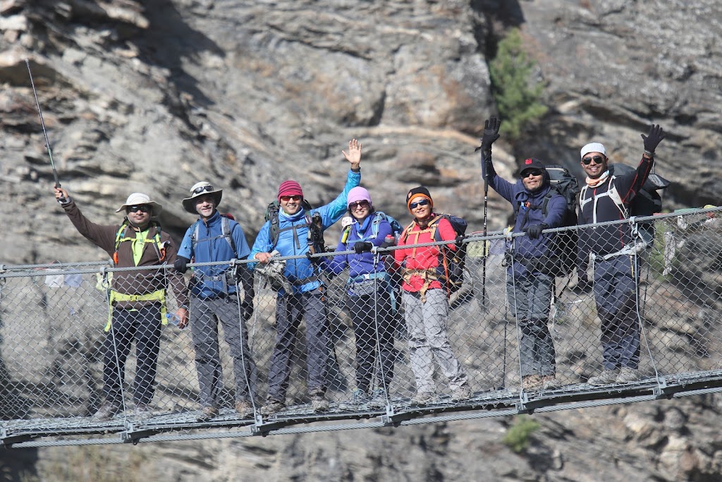
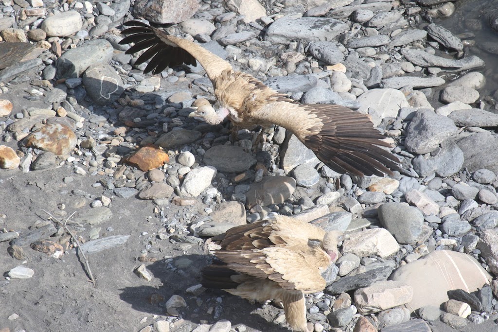
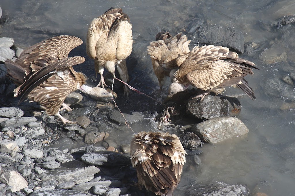
About an hour after we started, we crossed a bridge and immediately saw a number of himalayan vultures soaring in the sky. The guide told us that they had found a carcass of a blue sheep. Unfortunately I had already crossed that point and by the time I went back to see it, the party was over. Vibhakar and Arun got a good look at it. Vibhakar also managed to capture some incredible pictures using his fancy DSLR. See below.
One of the many steel bridges we crossed during the trek as we zig zagged across the river
Look at that wingspan!
Vultures feasting on a carcass – looks like they have pulled out a sinew
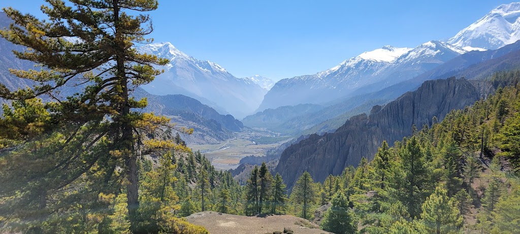
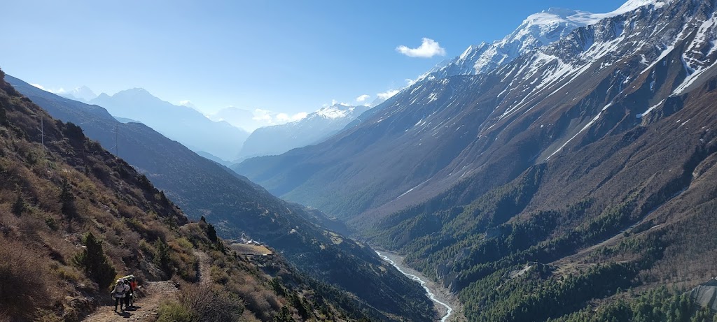
Panoramic view of how the trail is weaving through the mountains and valleys
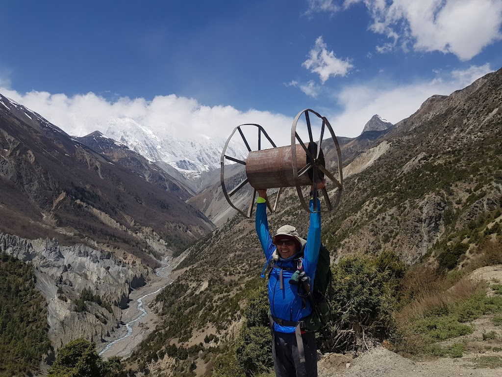
I found some random wheel as we got close to Shree Kharka and decided to test my strength 😉
Just wow!
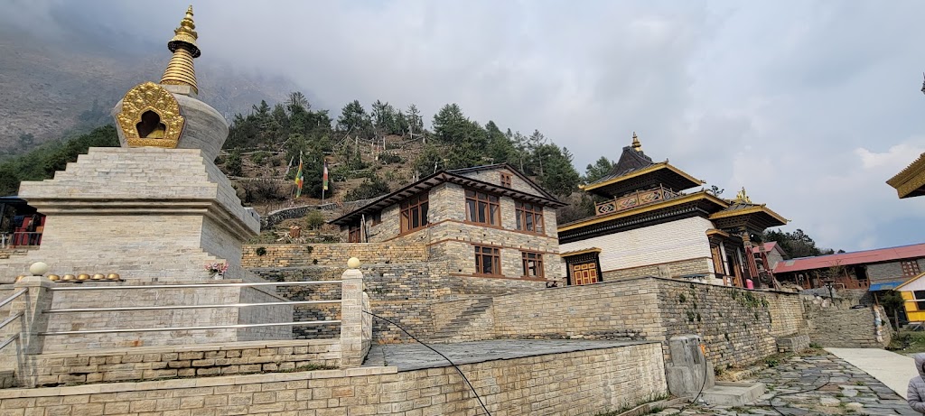
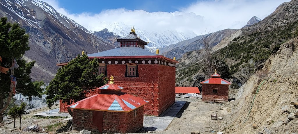
Colorful monastery just before Shree Kharka
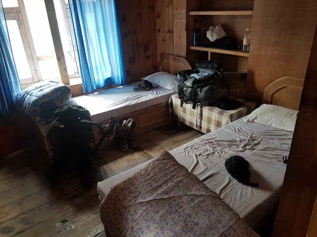
Typical room layout during our guest house stay. Basic but comfortable. Here we stayed at the Tilicho Peak guesthouse
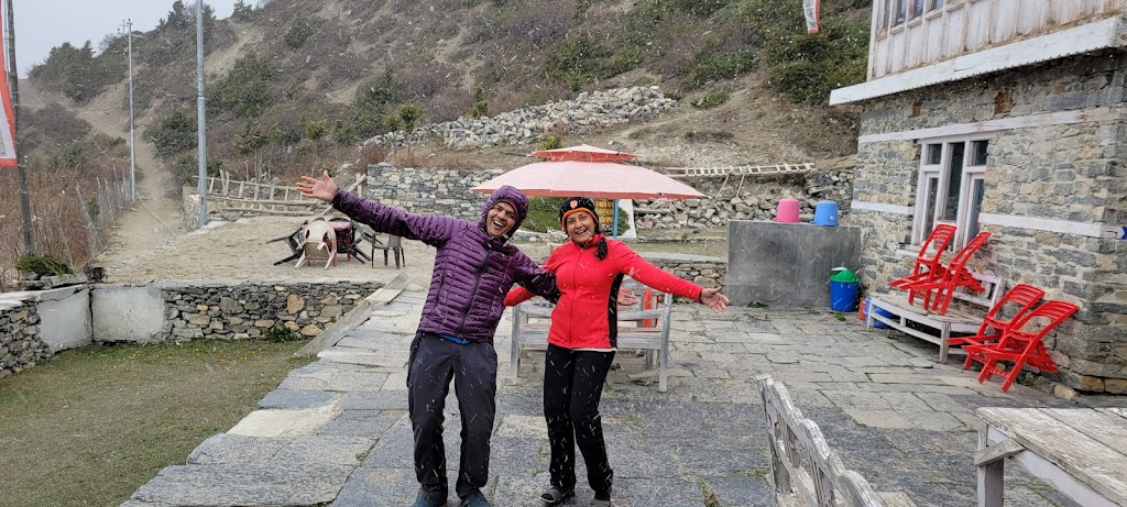
Soon after we arrived it started snowing heavily. We briefly stepped out to have some fun
Rest of the day was spent playing Antakshari, dumb charades and cards
Sunset hours
Day 6 (April 23): Shree Kharka to Tilicho Base Camp + Tilicho Lake (Highest Lake in the World)
(from Shree Kharka To Tilicho Base Camp)
Start / End Elevation: 13,300 ft / 13,600 ft
Distance Covered: 4 miles
Ascent/Descent: 1,108 ft / 853 ft
Max / Min Elevation: 13,932 ft / 13,324 ft
Start Time / End Time / Duration: 7:25 am / 11:30pm / 4:05 hrs
(from Tilicho Base Camp to Tilicho Lake and back)
Distance Covered: 6.84 miles
Total Ascent/Descent: 2,821 ft
Max Elevation: 16,310 ft
Start Time / End Time / Duration: 1:00pm / 5:30pm / 4:30 hrs
Today was a classic example of Nepalese flat. Nepalese flat means the net altitude gain or loss is very little but you end up climbing and descending a lot anyway. We gained only 300 ft today but climbed over 1,100 ft!
We were greeted with a long climb just as we started the day…
…but that did nothing to dampen the spirits 🙂
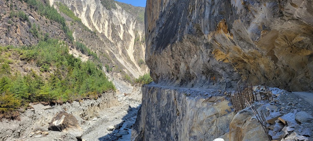
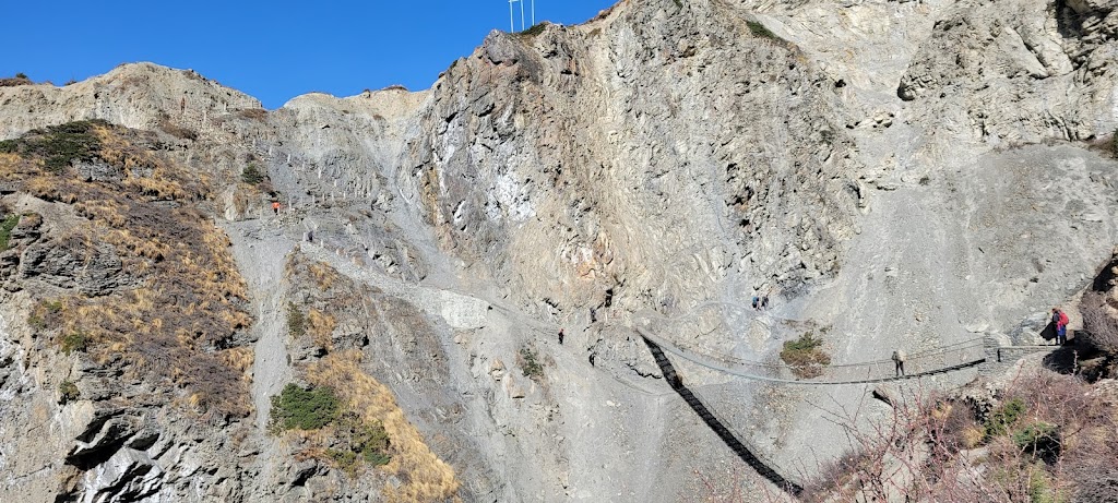
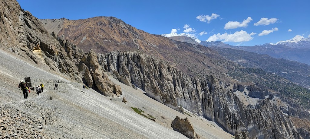
Surprisingly, there was a lot of misinformation being passed around by other guides and hikers during the trek about blocked routes. Apparently the lodges on alternate routes were spreading rumors to get more business their way. One such half-truth rumor was about a destroyed bridge en route to Tilicho Base Camp. Turns out the bridge was intact but the section of the trail after the bridge was indeed washed out. As you can see in the picture below, instead of simply catching the trail to the left, you had to go right, loop around under the bridge and then meet the trail. This was somewhat tricky and treacherous as there was little margin for error. One false step and you would go plunging down in the Marsyangdi river.
Zoom in to see the trail path at the end of the bridge
Steep climb full of slippery scree with no margin for error. Somehow it didn’t feel very scary though and I crossed with ease
Bird’s eye view of the whole section
Hard work was always rewarded with spectacular views
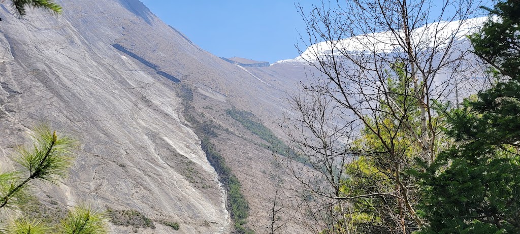
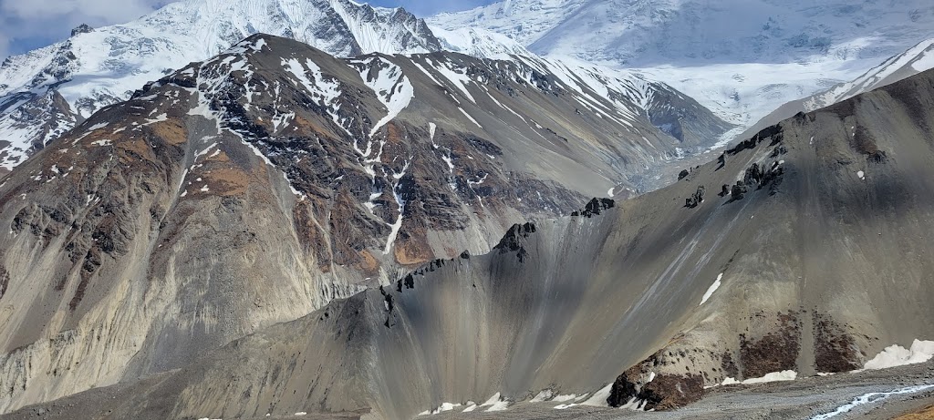
Zoom in to see the amazing erosion patterns and also how the trail has been cut into the steep slopes. Heavy winds/landslide and quickly that small level section as we will find out later
Long moraines, erosion patterns and rocks ready to slide on the left side..
This was a unique area where we walked through a tunnel like section
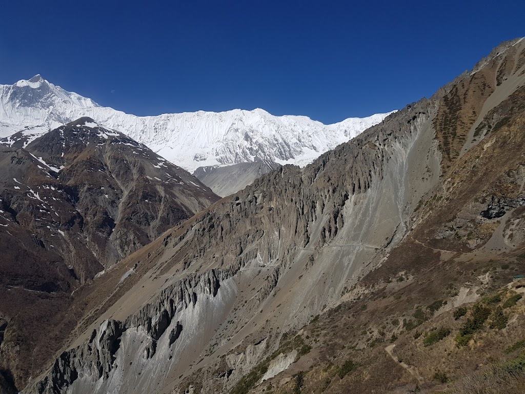
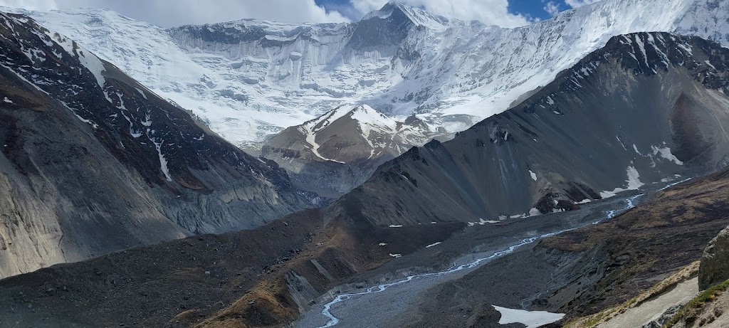
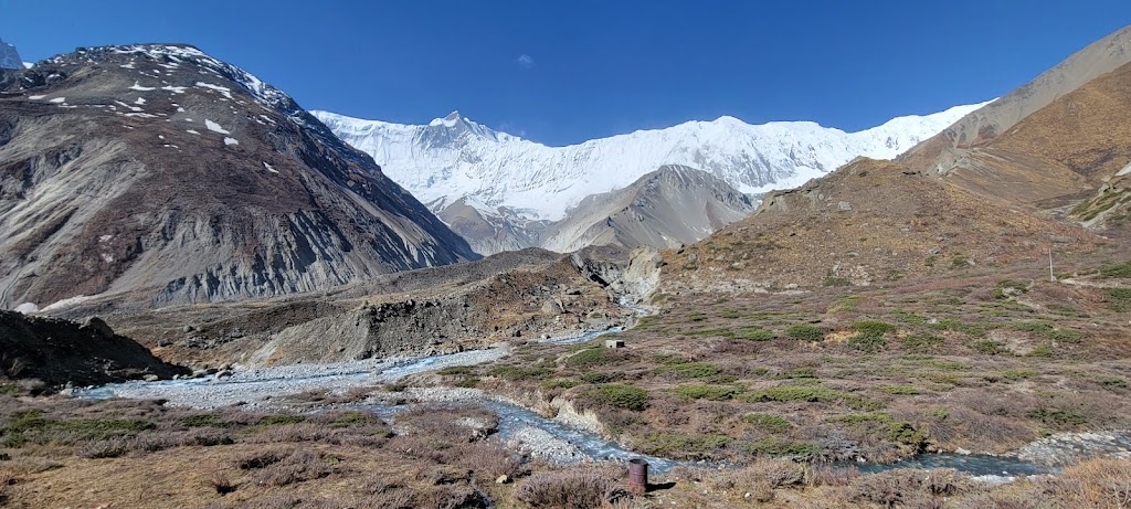
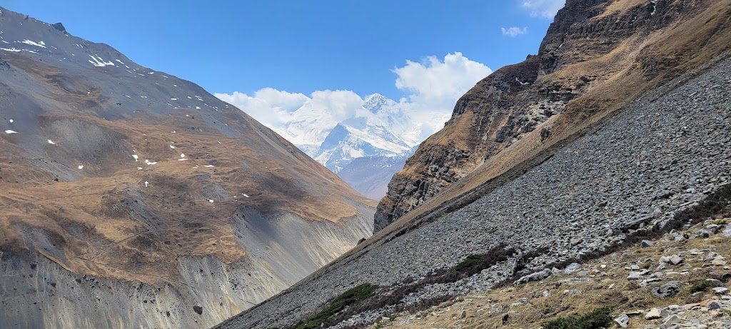
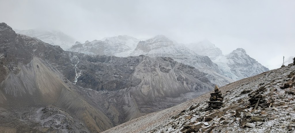
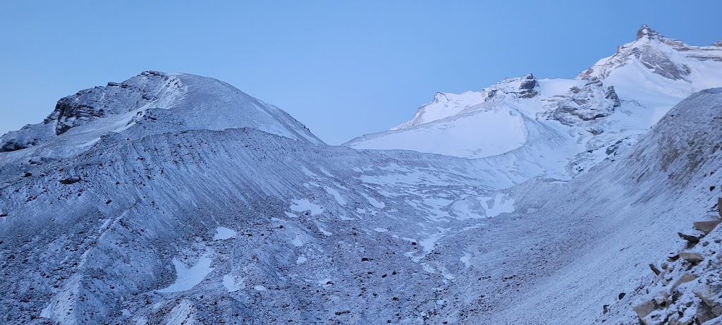
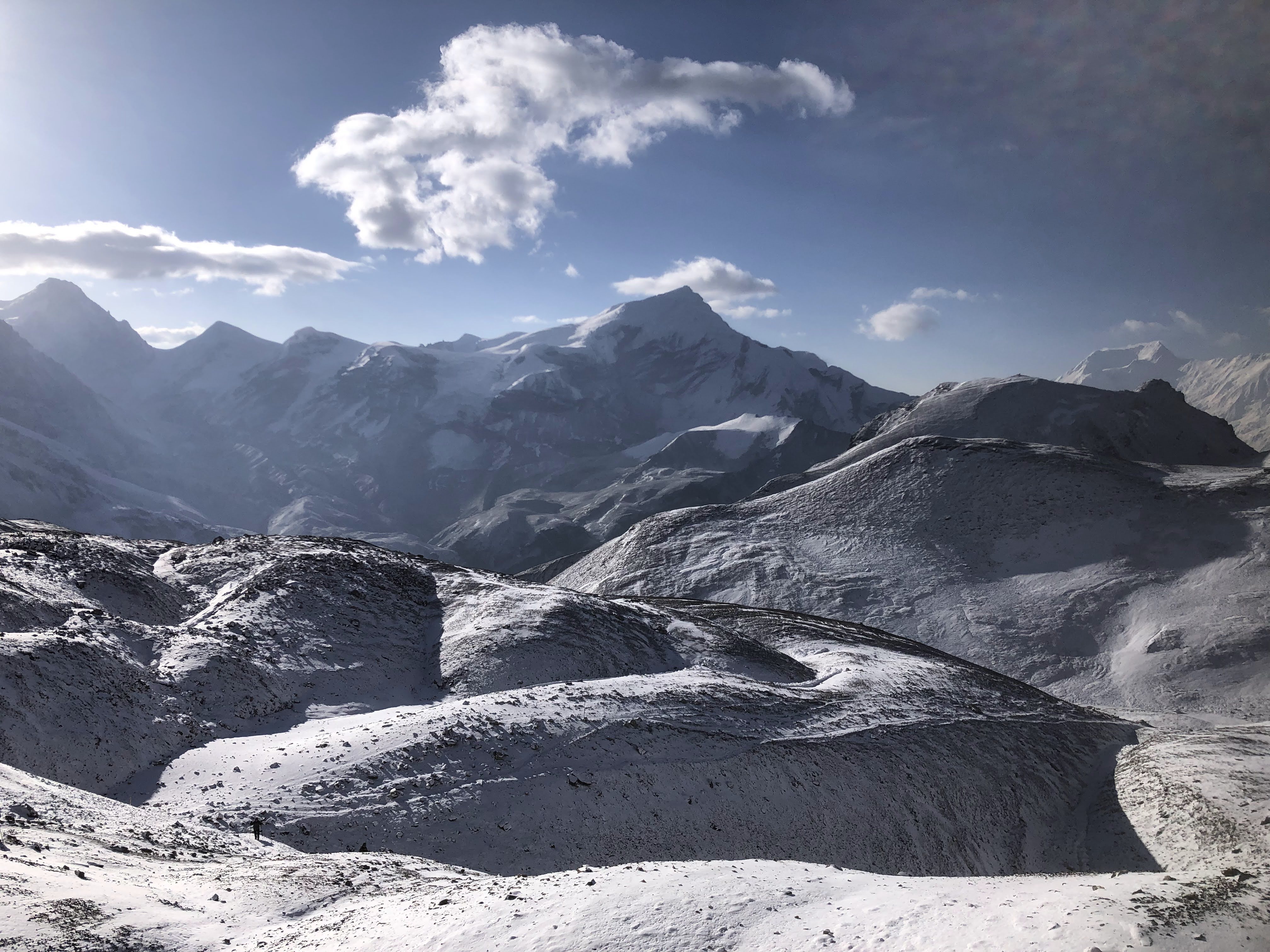
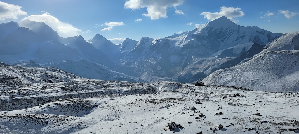
Annapurna range in the distance
Look carefully. This landslide area has been fortified by creating a wall of rocks
That little cave mouth is made by a glacier!
We arrived at our destination (Hotel New Tilicho and Restaurant) at 11:30am.
Our original plan was to go to Lake Tilicho tomorrow morning. However, the weather was splendid and Arun and I were in a really fine fettle. The guides told us that if we are up for it, we should go to the lake now because the weather tomorrow can be uncertain. So we decided to make a run to Tilicho Lake after lunch. We thought we could do it again with the rest of the group tomorrow morning if the weather holds up. So off we went while the rest of the group decided to rest. Two guides (Nabhraj and Beer) decided to come with us and carried our packs.
It is a really steep climb which just goes up almost 3,000 ft in about 3.5 miles. This is a grueling slope even in the best of circumstances not to mention when you are already at 13,600 ft. But we were determined to give it a go and be back in time for dinner.
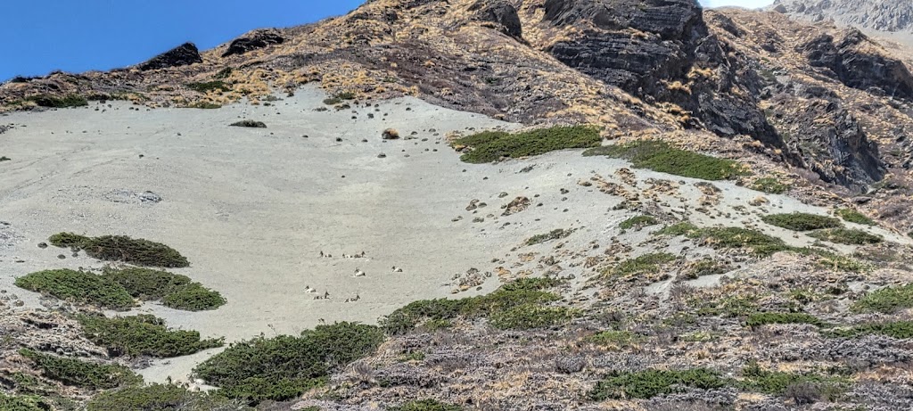
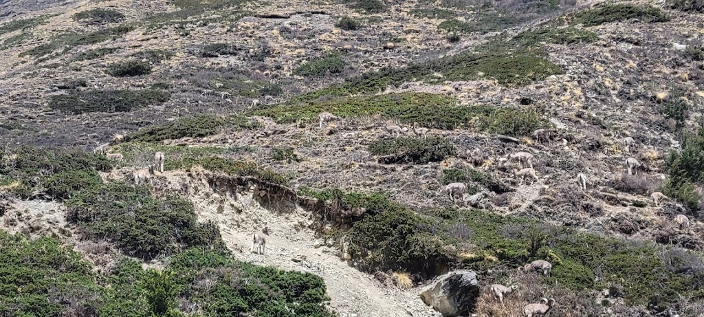
We immediately saw a flock of blue sheep. They were happily grazing around on steep slopes. However, these sheep are not blue at all. Not sure why they are called blue sheep
As we gained height we felt we were seeing eye-to-eye with the mountains but of course this was just an illusion
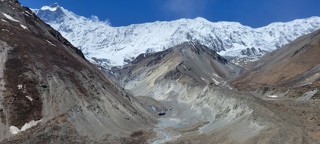
Now we are close enough that we can almost touch these glaciers
Last part of the trail was completely in the snow. It was slow going as we had to walk through narrow passages flaked by snow walls on either side
Tilicho Lake. At 4,919 m (16,148 ft), it is the highest lake in the world. It will be another month of so before it unfreezes
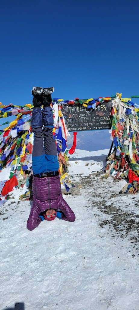
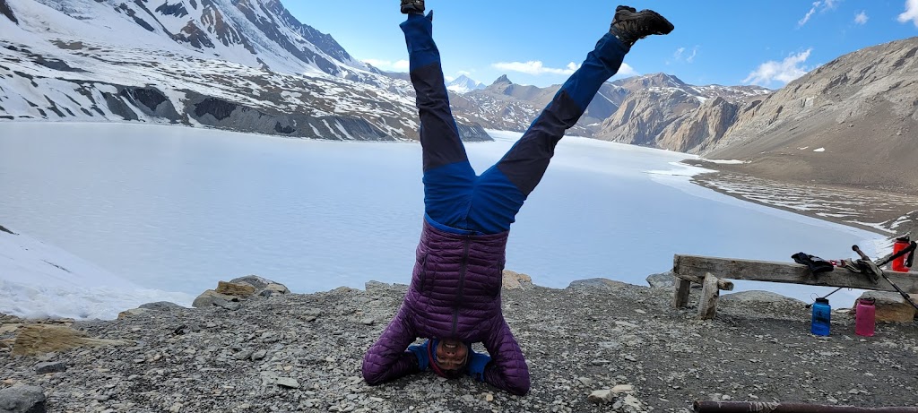
This was definitely worthy of a head-standing ovation !
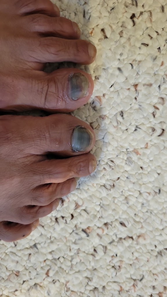
Prakash (our guide) had told us that it takes a minimum of 3 hours to go up and two hours to come down. We reached the lake in 2:50 hrs including stoppages. On the way down my trail running instincts took over and I decided to jog down in my ankle high boots and made it back in an hour. Overall it took me exactly 4:30 hrs including the photo shoot at the top. However, in the process I bumped my right toe on a rock and injured it. I therefore decided to skip the repeat hike with the group the next morning. It was really sad because it would’ve been fun to be at this key milestone with the group. My loss.
Arun was quite tired and also decided to skip the repeat hike.
Rest of the group did a short acclimatization trek while we were away.
Day 7 (April 24): Tilicho Base Camp to Shree Kharka
Start / End Elevation: 13,600 ft / 13,300
Distance Covered: 4 miles
Ascent/Descent: 1,080 ft / 1,270 ft
Max / Min Elevation: 14,032 ft / 13,300 ft
Start Time / End Time / Duration: 1:20 pm / 4:30 pm / 3:10 hrs
Arun and I had a lazy morning while the rest of the group woke up at 4am and went off to Tilicho Lake. They had a great time and spent nearly 1:30hrs at the lake. They got back 7:30hrs later at 11:30am. In the meantime Arun and I wandered about, scrambled up a couple of slopes and took pictures.
I still regretted not being able to join the group but I had to protect my injured toe to make it last the rest of the trek.
Vibhakar, Awadhesh, Samir, Meenal and Anu got really creative at the lake and took dozens of pictures in all different poses
In the meantime Arun and I walked around to nearby area and enjoyed the view
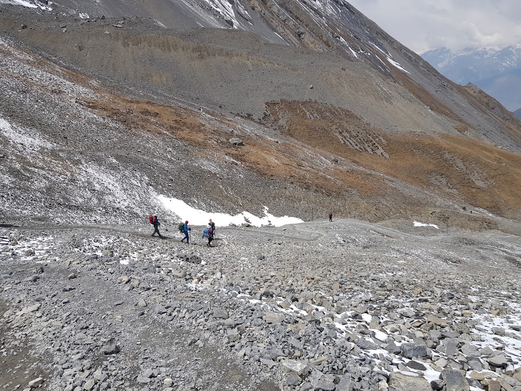
As the group was heading back, winds picked up and kicked up a dust storm. We had lunch and then headed out for Shree Kharka at about 1:20pm in heavy winds. We crossed a few landslide areas successfully but then came across an area where a 20 ft section was practically wiped out and there were small stones falling from above. We hurriedly made our way across somehow while being pelted. It was a scary experience.
Five of us, our guide and three porters made it through. Vibhakar, Awadhesh and Nabhraj (porter) couldn’t cross because the trail deteriorated further and larger stones started falling. The wind showed no signs of letting up and it even started snowing. We were forced to make a decision to continue on to Shree Kharka with the hope that the rest of the group would be able to cross at some point (or may have to head back to Tilicho Base Camp in the worst case).
The other group told us that a major traffic jam got created with nearly 200 people stuck on either side of that washed out section. Finally some local hikers created a path and they were able to cross. It was an unnerving experience. Fortunately the rest of the landslide areas were either fortified or didn’t show signs of active slides.
You can see how a thin trail has been created through some landslide sections
Of course today was another classic “Nepali flat’ day where we lost 300 ft but climbed over 1,000 ft nevertheless.
Day 8 (April 25): Shree Kharka to Yak Kharka
Start / End Elevation: 13,300 ft / 13,216
Distance Covered: 6.5 miles
Ascent/Descent: 1,605 ft / 1,939 ft
Max / Min Elevation: 13,569 ft / 12,587 ft
Start Time / End Time / Duration: 7:30 am / 1:00 pm / 5:30 hrs
Look at the Start and End elevation. Easy, flat day – right? I wish. There was 1,600 ft of climbing up and down with no gain to show at the end 😢
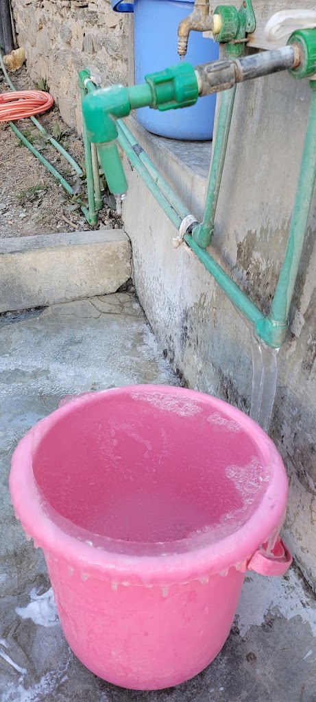
Water is usually running 24 hours in these places with the faucet always running. However the extreme cold sometimes freezes the pipelines
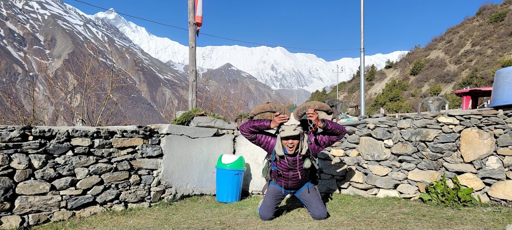
What a welcome 🙂 I found a pair of horns and decided to charge..
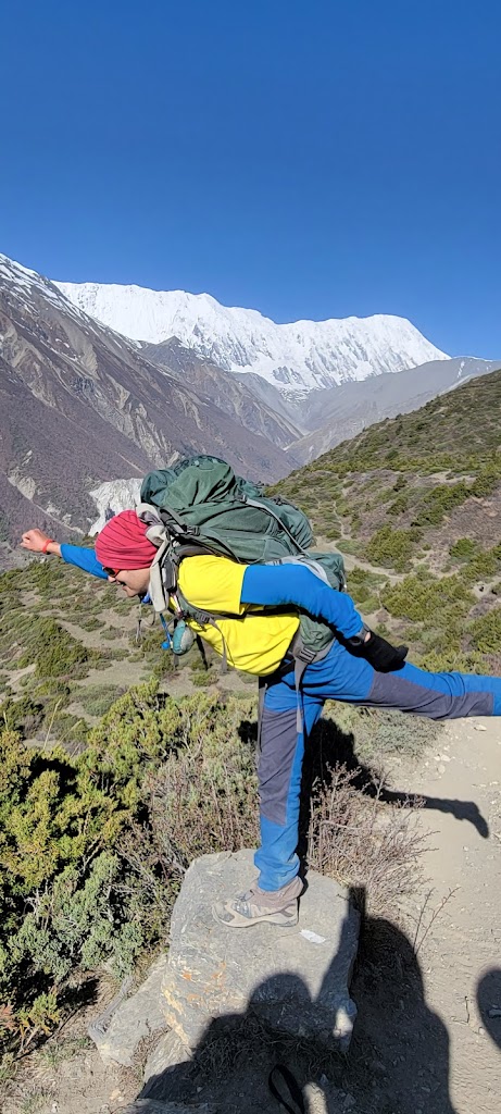
Ready for a flying start…
We climbed up to upper Khangsar and saw incredible views of Khangsar, Gangapurna, and Annapurna II, III and IV mountains
Channeling my inner Shahrukh Khan..
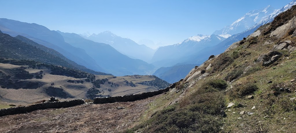
Beautiful views along the way. Truly it is the journey and not the destination that matters
We saw a lot of Yaks and blue sheep
We came up and down on the trail to the right. The trail on the left is coming from Manang. The two will eventually meet
“Peak” performance?
Blue sheep which are not really blue
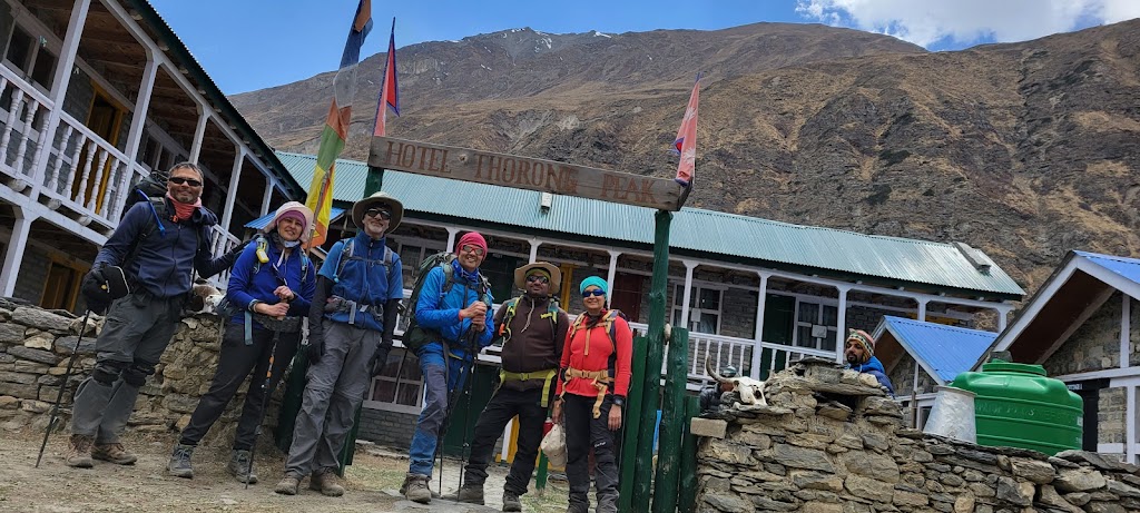
Finally reached Hotel Throung Peak at about 1pm
Overall it was a relatively easy day again. We played Antakshri, dumb charades and cards. Samir accidentally caught my left toe under his chair so now both my toes got injured and my limp balanced out 😊 The toes eventually turned black and blue. However, it wasn’t too bad and I didn’t have much trouble completing the trek.
Going toe to toe for injury…
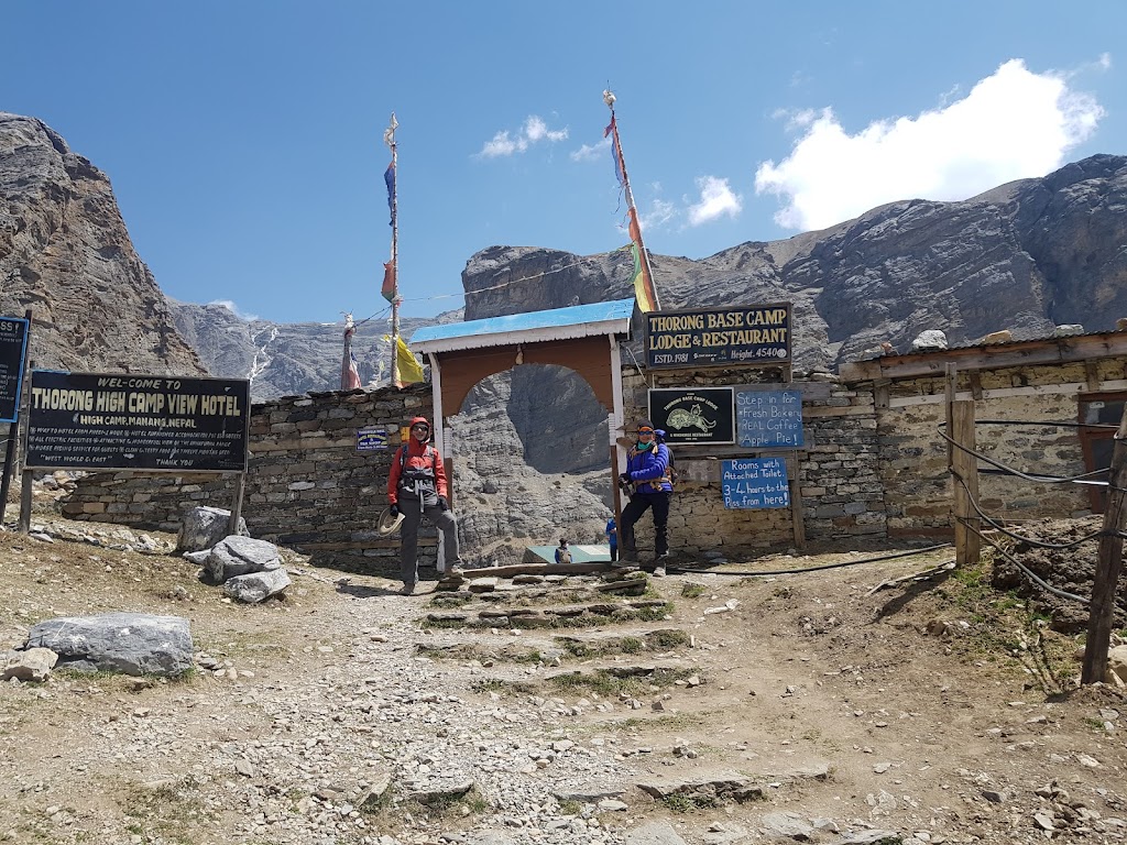
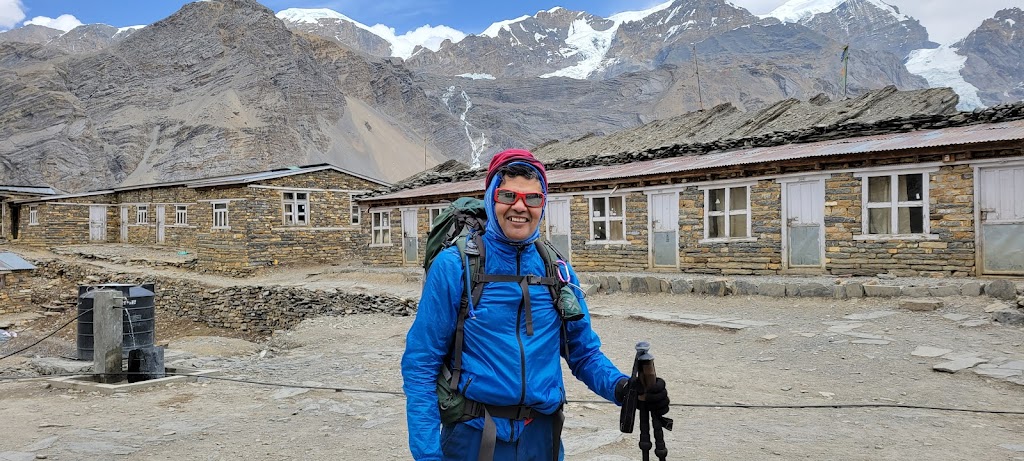
Day 9 (April 26): Yak Kharka to Thorong High Camp
Start / End Elevation: 13,200 ft / 15,816
Distance Covered: 5 miles
Ascent/Descent: 2,907 ft / 292 ft
Max / Min Elevation: 15,816 ft / 13,197 ft
Start Time / End Time / Duration: 7:00 am / 12:00 pm / 5:00 hrs
Today was another big climbing day – nearly 3,000 ft. The last section from Thorong Phedi to Thorong High Camp is especially steep. You climb 400 meters (1,300+ ft) in just 0.6 miles (1km). We added an acclimatization hike on top.
Beautiful sunrise – spectacular as always
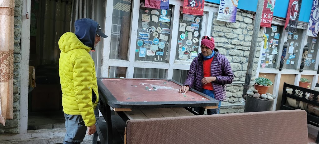
They had a carrom board! Samir and I played a bit while waiting for our breakfast
To infinity and beyond!
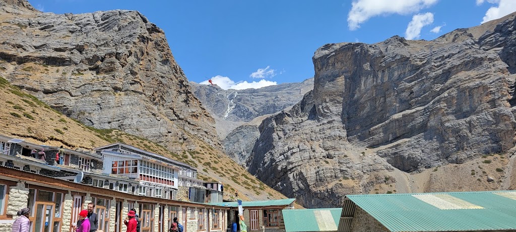
We reached Throng Phedi at around 10:30am. This is where the last hard climb begins
We spotted a rescue helicopter. It landed at a small guest house up the hill and then took off in a few minutes. Not sure if it was rescuing someone or dropping off a VIP
The infamous climb begins
Steep slopes
I was pacing Arun and Vibhakar and we made it in just 55 minutes. We were quite surprised when the climb ended because we were expecting it to take two hours. I guess we underestimated ourselves 🙂
There is only one guest house here. Fortunately we had reservations but we still had to share one triple room. Some people have to sleep in the dining area.
Samir and Anu arrived shortly thereafter. Awadhesh and Meenal took another 10-15 minutes
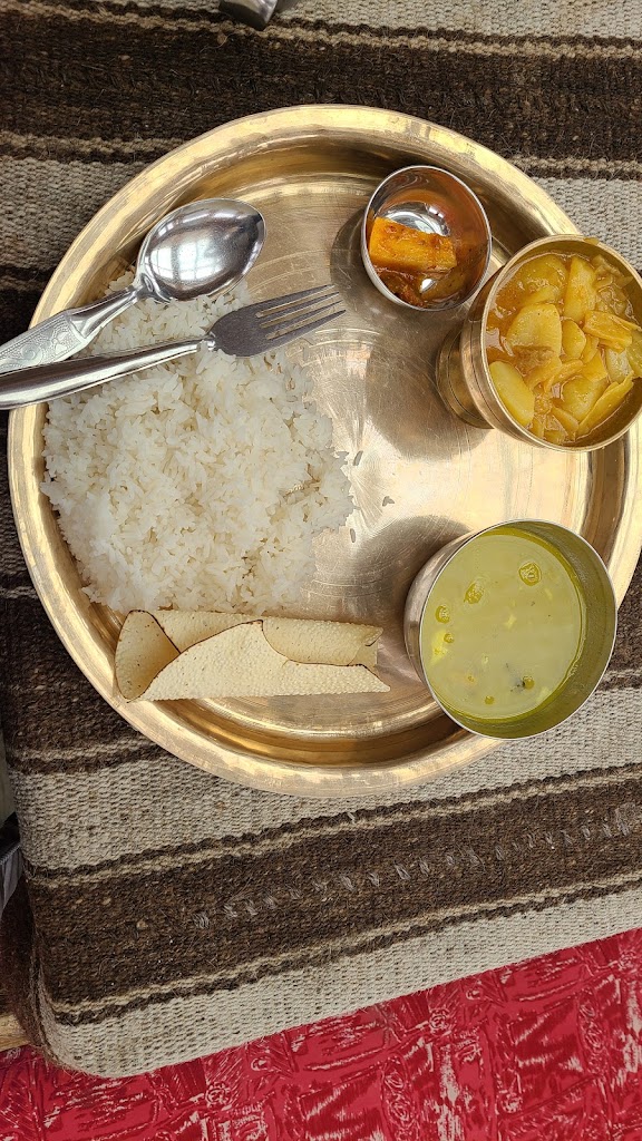
Standard dal-bhat plate we at everyday
Our guide suggested that we should do another acclimatization hike today. Everyone was tired and wanted to take it easy. Besides, it started snowing. Finally Arun, Vibhakar, Awadhesh and I decided to do it.
It was a very steep slope. At one point Prakash challenged me to run up and we both got out of breath in just a few seconds
Breath taking climbs are rewarded with breathtaking views!
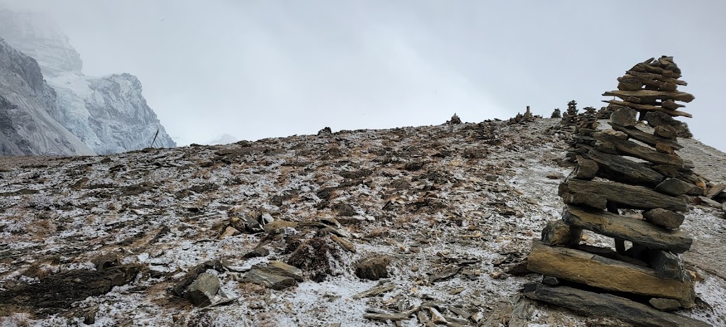
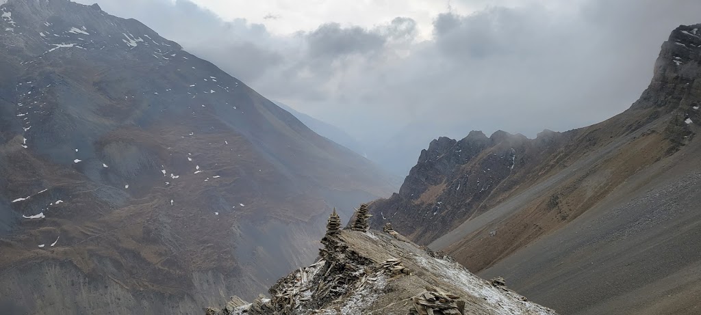
Cairns (tower of rocks) are used commonly to mark trails
Nowhere else on earth can you find such majestic mountains
Well above the treeline, nature’s canvas now only has grays, browns and whites
It snowed quite heavily and we were worried about tomorrow’s Throung La pass climb
We called it a night at 7:15pm to be ready for a bright dark and early start tomorrow at 4am
Day 10 (April 27): Thorong High Camp to Muktinath via Thorong La Pass
Start / End Elevation: 16,000 ft / 12,530
Distance Covered: 8 miles
Ascent/Descent: 1,700 ft / 5,240 ft
Max / Min Elevation: 17,769 ft / 12,397 ft
Start Time / End Time / Duration: 4:00 am / 12:45 pm / 8:45 hrs
This is it! Today was the final day and final test. Having conquered Tilicho lake and climb to Thorong High Camp, we all felt confident about this final, highly anticipated climb.
We started at 4am in the dark with our headlamps on. It had snowed heavily the day before so the entire trail was covered in snow. It was also really really cold. Multiple layers of clothing and the use of hand and foot warmers was still not enough to make us fully comfortable.
Prakash decided that Meenal will be the pace setter and everyone will follow her and stay together at all times. Slow and steady is the way to go at these altitudes and Meenal was the perfect lead for that.
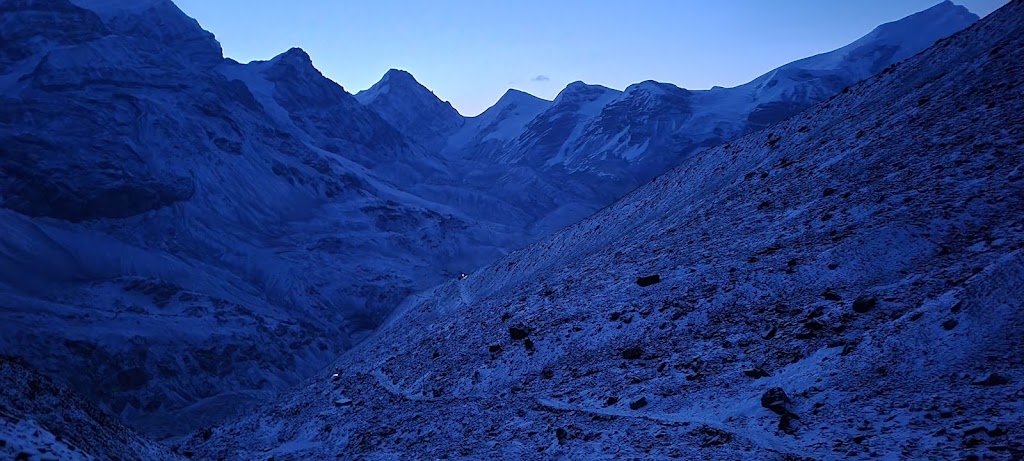
4am was a popular start time. You can see other headlights in the distance
Mountains look really eerie in the dark
Now white is the only color to be seen for miles
Almost an alien landscape
There was barely any trail visible. The poles (seen on the left) acted as our guide
Can you feel the ruthless, unforgiving vibe by looking at the picture?
That’s Thorong Peak behind me. Deceptively close and short.
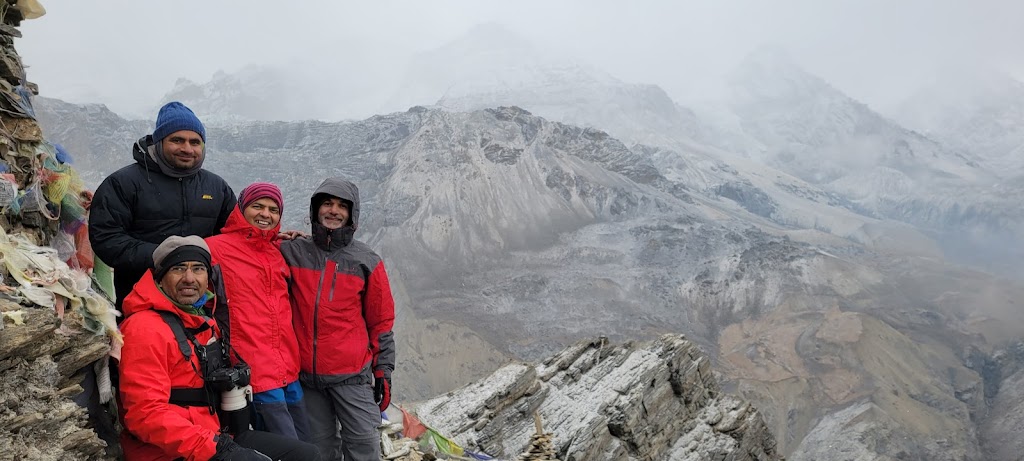
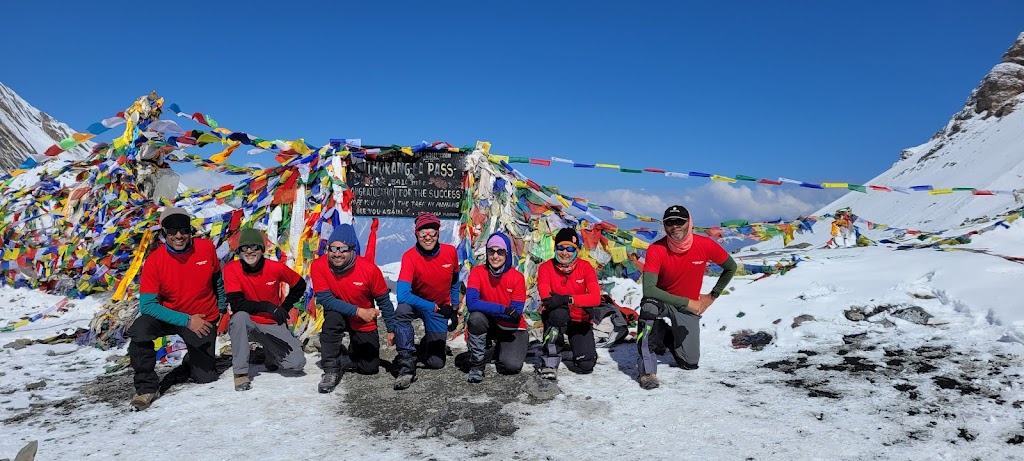
We finally reached the top of the pass at 8:07am. It took us nearly four hours.
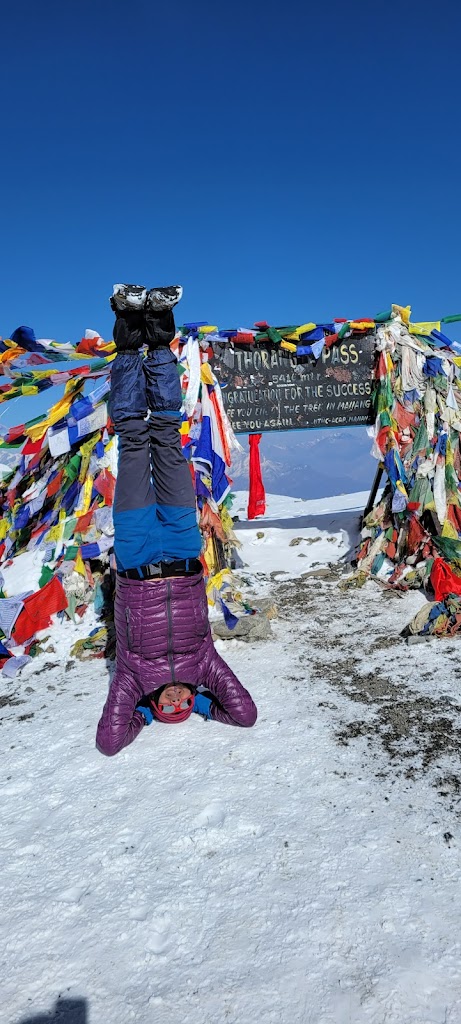
I saw, I climbed, I headstanded
“Peak”-a-boo 🙂
Believe it or not, there is a tea shop at the top of the pass. Talk about High-Tea!
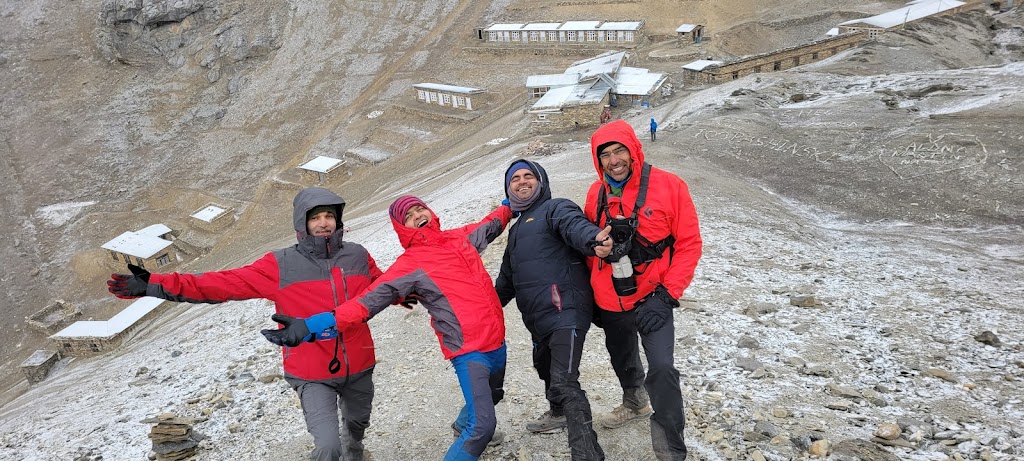
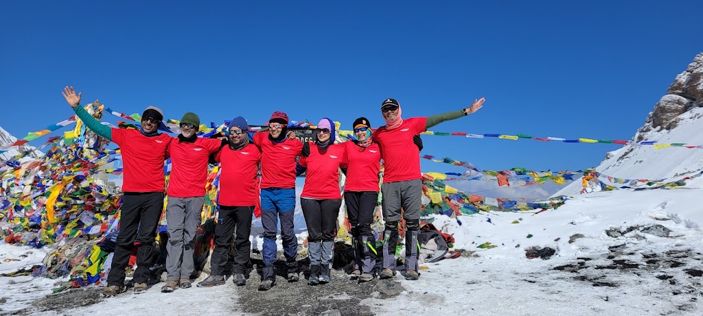
Cheers to the team
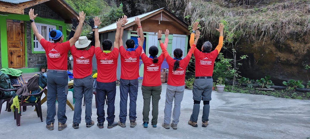
We braved the cold to take off our jackets and show off the T-Shirts. It was meticulously planned.
After spending well over an hour at the top, it was time to leave. It was literally and figuratively all downhill from here. 5,250 ft of downhill to be exact.
Long, never-ending descent. For some reason everyone was quiet the entire time. I guess we were all reflecting on the trek
Despite my bad toes I got bored at times and sprinted down only to stop and wait for the rest of the group
End of the trek! We visited the famous Muktinath Temple and decided to call that the end point.
Coincidentally we saw a “Finish” banner on the road. It was for a trail run but still it was very apt for us
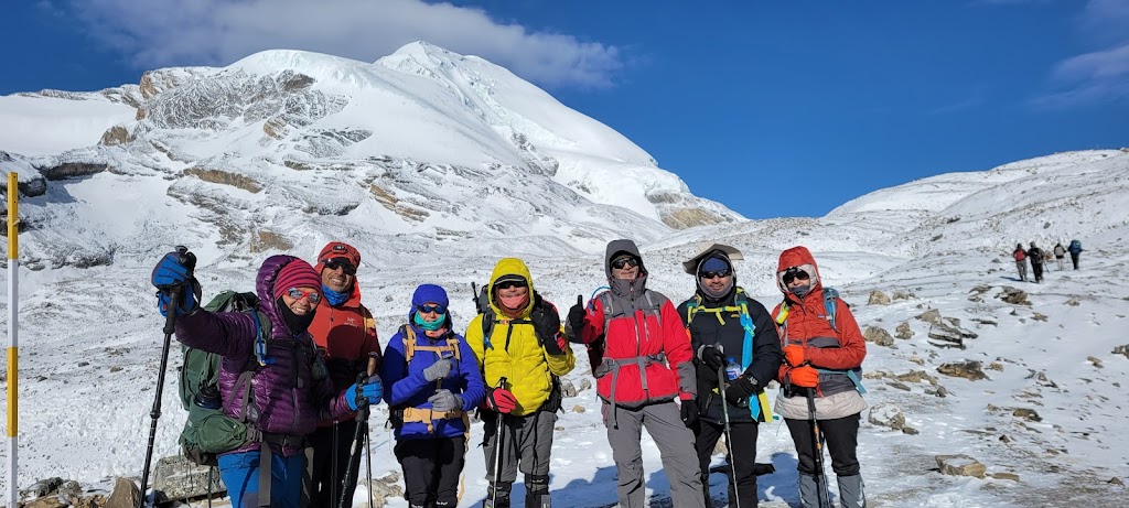
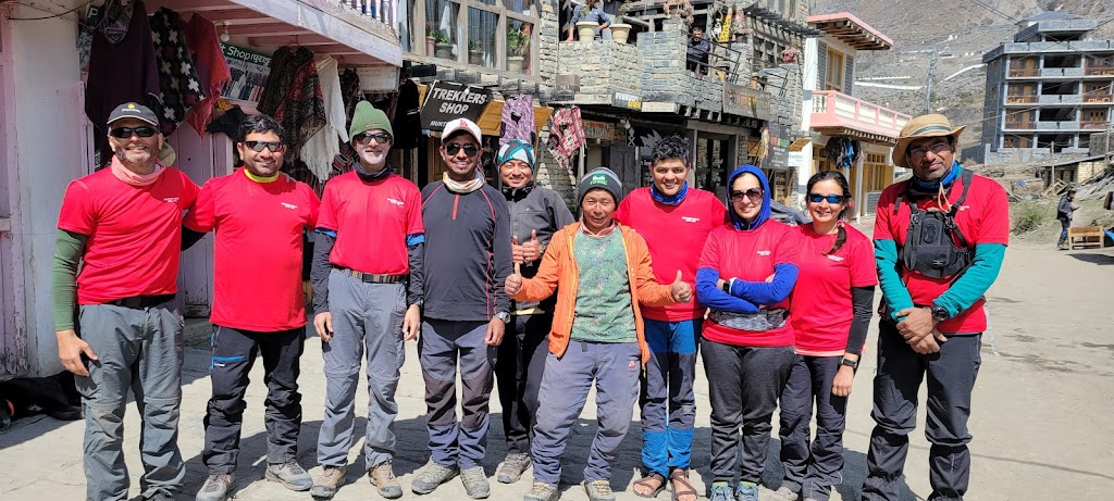
The entire team. Pramod got AMS at Thorong High Camp and had to head back, accompanied by Nabhraj. They are missing from the picture
Day 11 and 12 (April 27, 28): Muktinath to Jomsom; Jomsom to Pokhra
The trek being over, we had a hearty lunch at Muktinath then drove to Jomsom in a jeep. The first half of the road was well paved but the second half was again a boulder-fest. We spent the night at Jomsom and enjoyed a hot shower for the first time in 10 days!
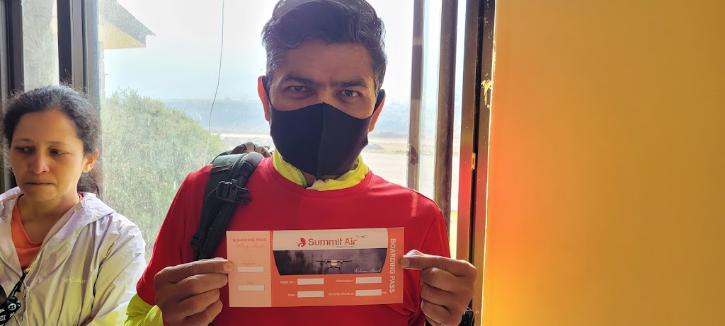
In the morning we had a sumptuous breakfast of poori-aloo and then caught a flight to Pokhra.
Jomsom is a really small airport. This is the boarding pass we received. It is completely blank!
Dhaulagiri – another member of the elite ’14 peaks’ group of 8,000+ meters
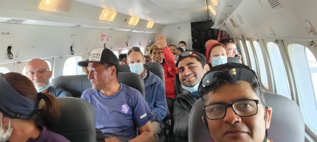
This is the entire plane! I am in the front seat.
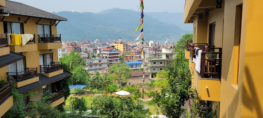
We stayed at Bar Peeple in Pokhra. It was a nice resort
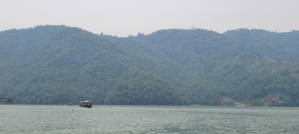
Boat ride in Lake Phewa
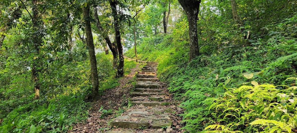
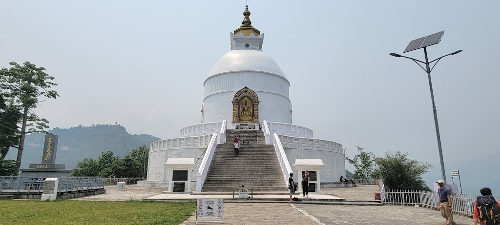
Climbing up to the Peace Stupa. It was a good 1,000 ft+ climb but was really really pretty
We felt we were in a rainforest
Peace Stupa
It was an amazing experience. Disconnection with the external world forced us to be in the present and enjoy every moment. Being able to do this trek with a great group of friends was a blessing.
Currently Founder of Zinrelo - a loyalty rewards & referral marketing platform.
I live in Sunnyvale, California with my wife and three amazing kids. Having worked hard for 28 years of which the last 22 have been as an entrepreneur, I am now trying to find some work-life balance and learning to love outdoors. I have taken up running, biking and trekking and have done a few marathons, ultra-marathons and treks including Everest Base Camp (17,600 ft), Stok Kangri (20,187 ft), Grand Canyon Rim-to-Rim, Mount Shasta (14,200 ft), Mount Whitney (14,500 ft), Chadar Trek and bike ride from SF to LA. This has given me a different type of challenge that requires both mental and physical toughness and a high degree of discipline and commitment.


")


")
 – Summary : Aug 11-30, 2021")

Jai, I relived many moments as I read through this. Very nicely captured and lovely photos too.
Well written, while reading feel like doing it again! Awesome pics 👌
[…] Annapurna Circuit Trek April 17-28, 2022 […]