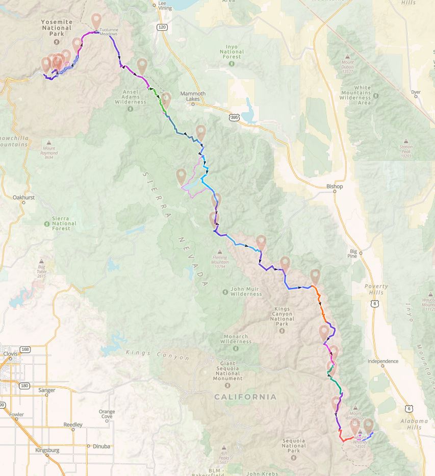
I have created many different ways to consume this content. You can read the summary, view a PowerPoint presentation with or without narration, see a 3D overview of the route or read the day by day detail with interactive maps showing the daily route.
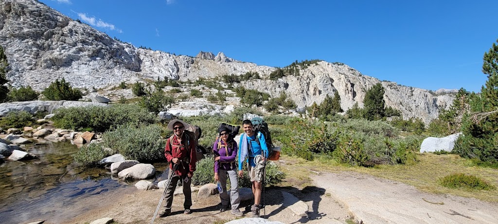
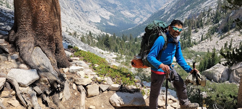
This blog post goes into the details of how we prepared for our JMT trek, food plan, gear and the daily itinerary including some interesting incidents. It will be a useful and fun read for those who want to know how the trek unfolded and also for those who potentially want to plan for a through backpacking trip of their own. It may also be a nostalgic recollection for those who have already done JMT or JMT sections.
If you just want to read a short summary of our JMT trek, I recommend reading this post instead:
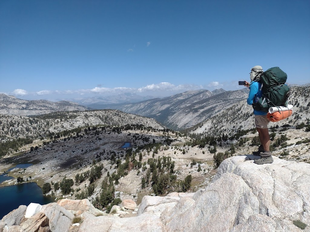
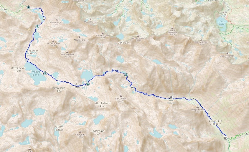
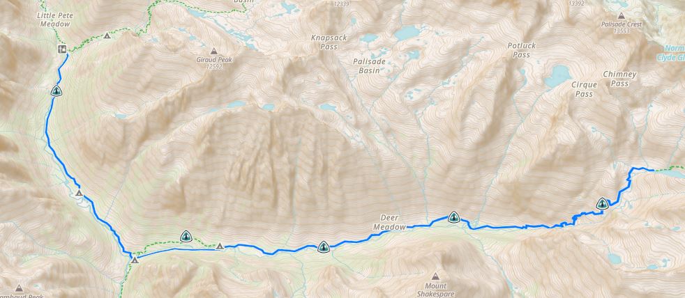
I was truly fascinated by the John Muir Trail and really wanted to get a better understanding of how we were navigating all the mountains and valleys. Could the mountain passes be made more efficient? Were we going on top of the mountains or around them? I managed to combine our daily routes into a single file and use Google Earth to get a birds eye view of the entire trail. I can share the file and instructions with you if you want to play around with it. Just leave a comment at the end of the blog.
We had roughly five months to plan for the trek and train for it. Everything had to be meticulously planned.
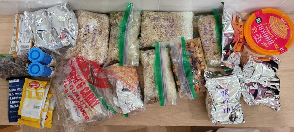
Food
This was really hard to plan because we were both weight and space constrained.
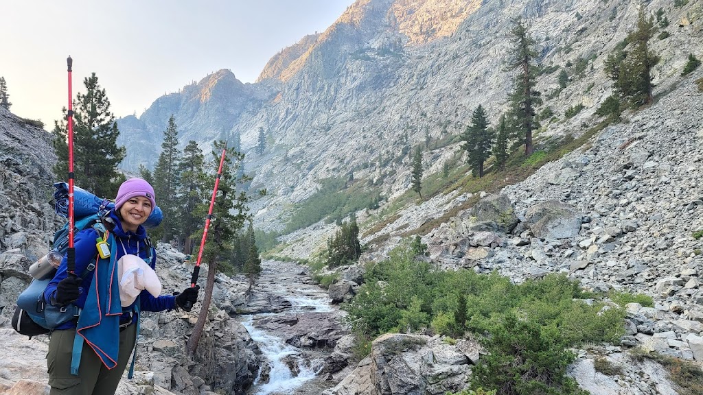
Space: All food had to be stored in a bear proof canister. My canister was 650 cubic inch in volume which can carry 5-6 days worth of food.
Weight: We wanted to minimize the weight and therefore focused on calorie dense options and tried to be very precise about the overall quantity. I planned to consume between 2,600 and 3,000 calories every day. After careful planning, this translated to about 1.5lb (680g) per day.
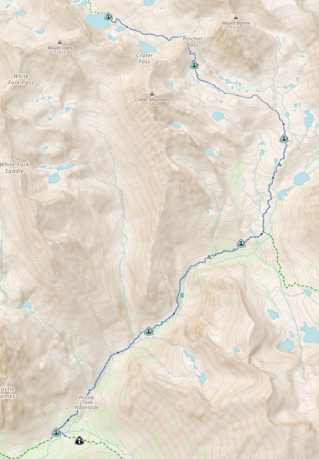
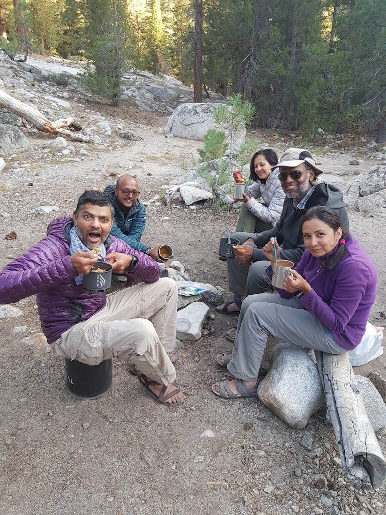
Resupply: We planned to complete the trek in 21 days and it is impossible to carry that much food. Therefore we had to find places where we could get a food resupply. We packaged up our food and shipped it ahead of time to four different locations along the trail. Our resupply points were Tuolumne Meadows (Day 3), Reds Meadow (Day 6), MTR (Day 10) and Woods Creek (Day 15). The last one was via mules! There are a couple of organizations who can bring your resupplies on mules and meet you on the trail. It is quite expensive but since there were seven of us, we were able to share the costs. Here’s a link to my food plan
Anu, Meenal and Samir shared their food plan and got different food options for each day. They worked directly with a packer in India. We called their kitchen the ‘gourmet kitchen’. The rest of us bought Backpackers Pantry and Haldiram packets and repeated the same food every 2-3 days.
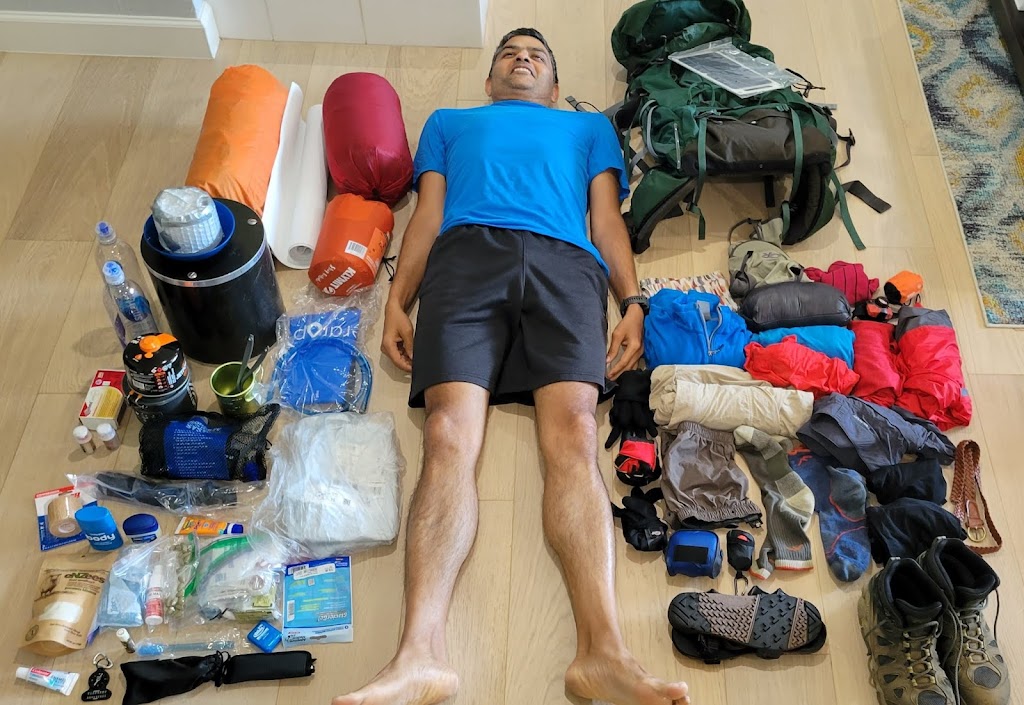
Gear
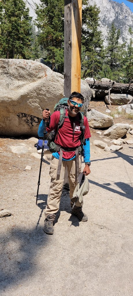
Similar to food, we had to be meticulous about carrying everything and only the things we would need. Every gram of weight had to be justified. Some of us did a short, 3 day backpacking trip to get a better understanding of the gear we would need. It was really helpful. Here’s a link to my final gear list which I carried.
Training
Given that this was my first through backpacking trip, I didn’t really know what training regimen I should follow. I created a routine which included strength training, trail running, hiking with an increasingly heavy backpack, biking and yoga/stretching. I took note of the muscles that felt strained during steep inclines and descents and focused on strengthening them via weight training. I was feeling pretty confident but then just 2.5 months before the start date I had a bad fall from my bike and was really bruised up including ribs, shoulder, elbow and hips area. Fortunately there were no fractures but I was practically on bed rest for a month. I could not even walk properly, let alone lift weights or train. I didn’t have enough time to fully recover and train but did the best I could and hoped for the best.
Plan
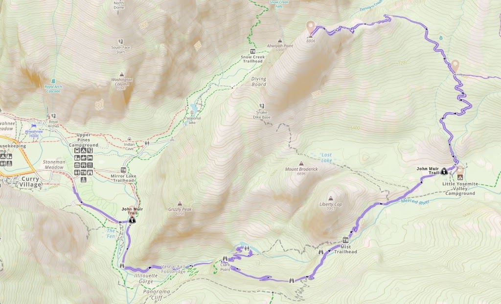
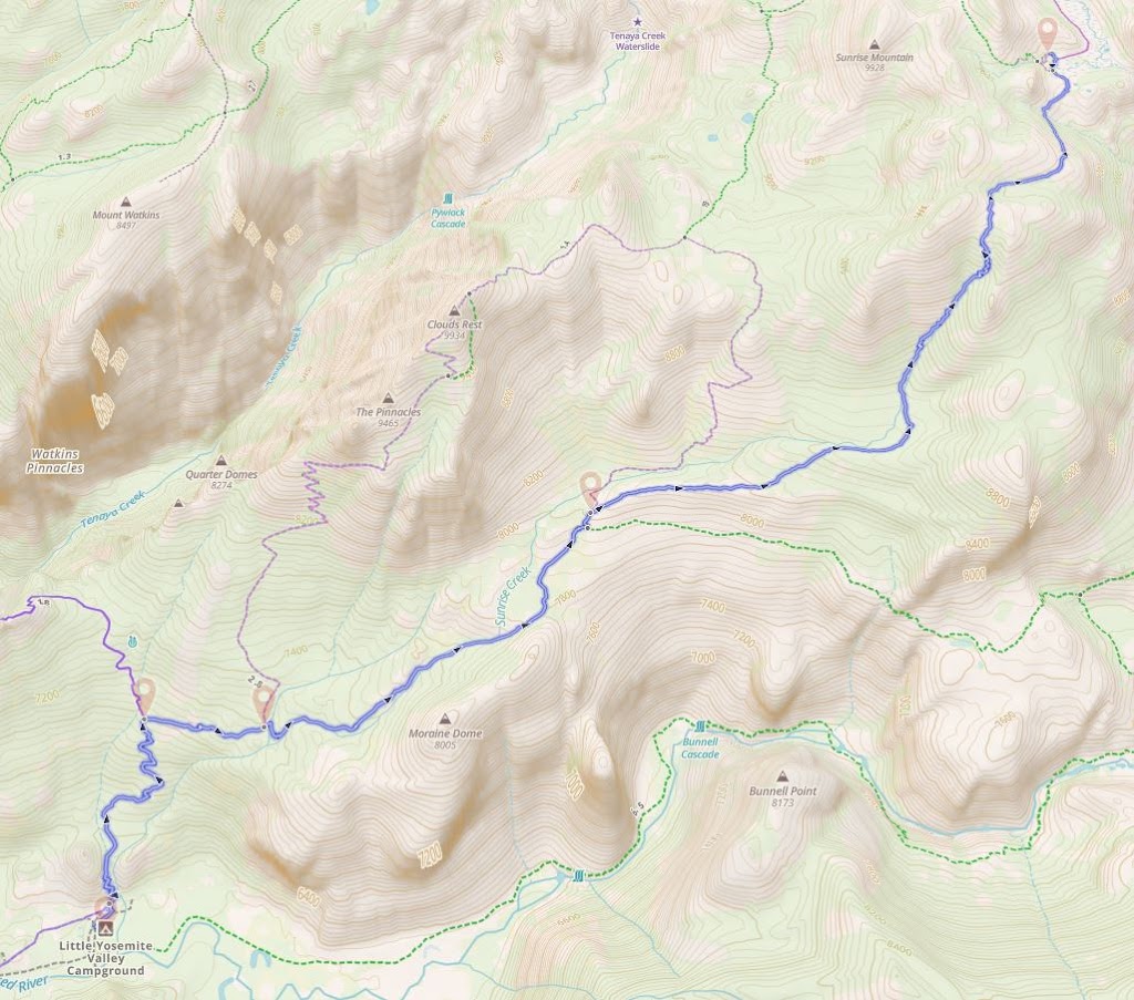
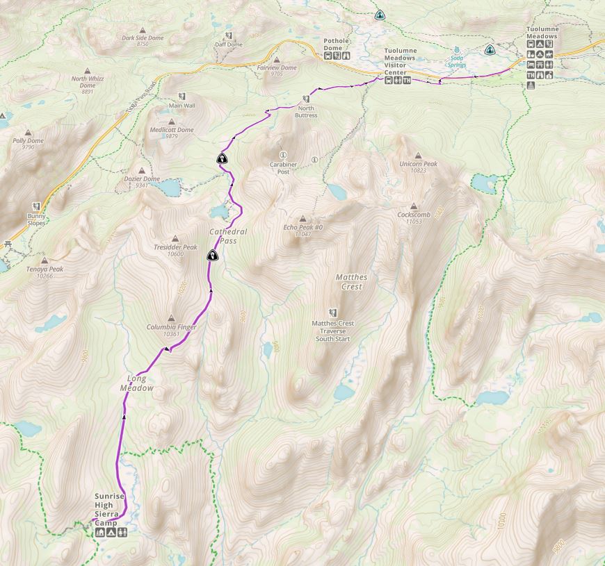
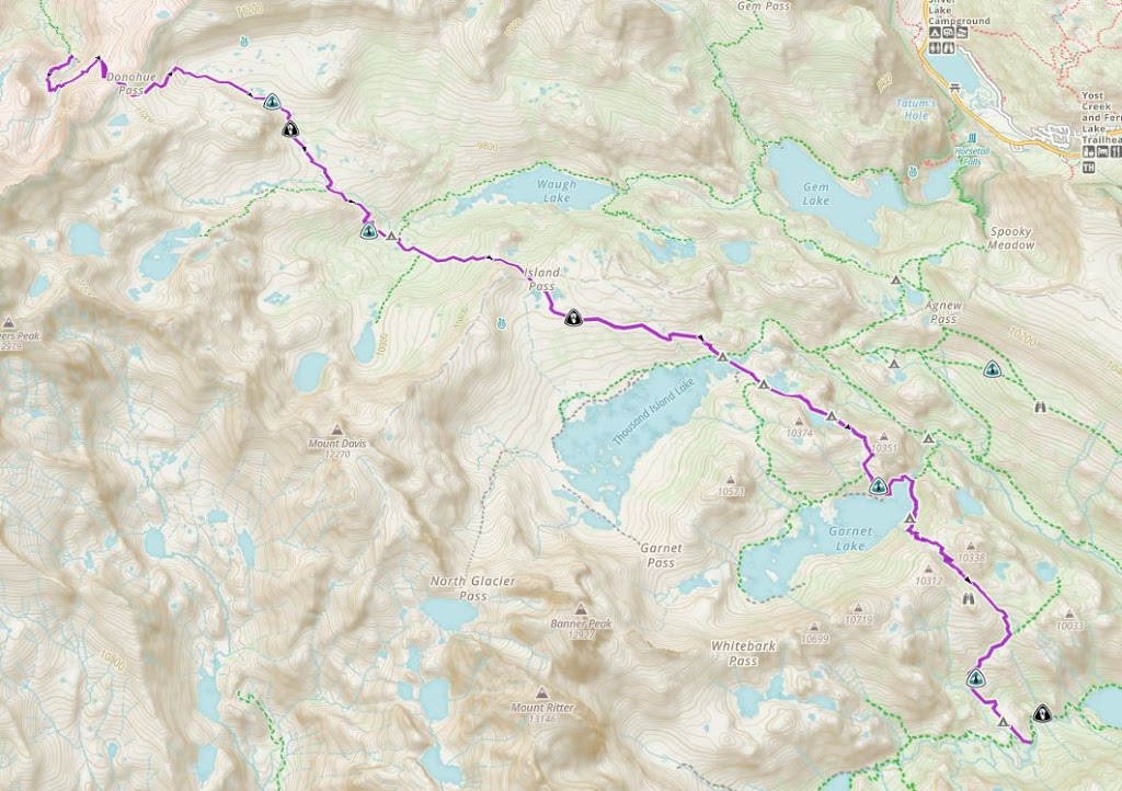
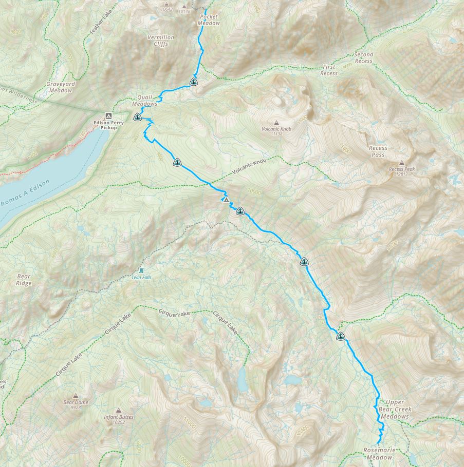
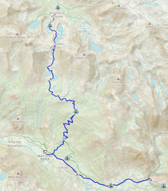
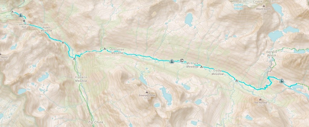
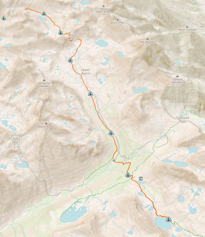
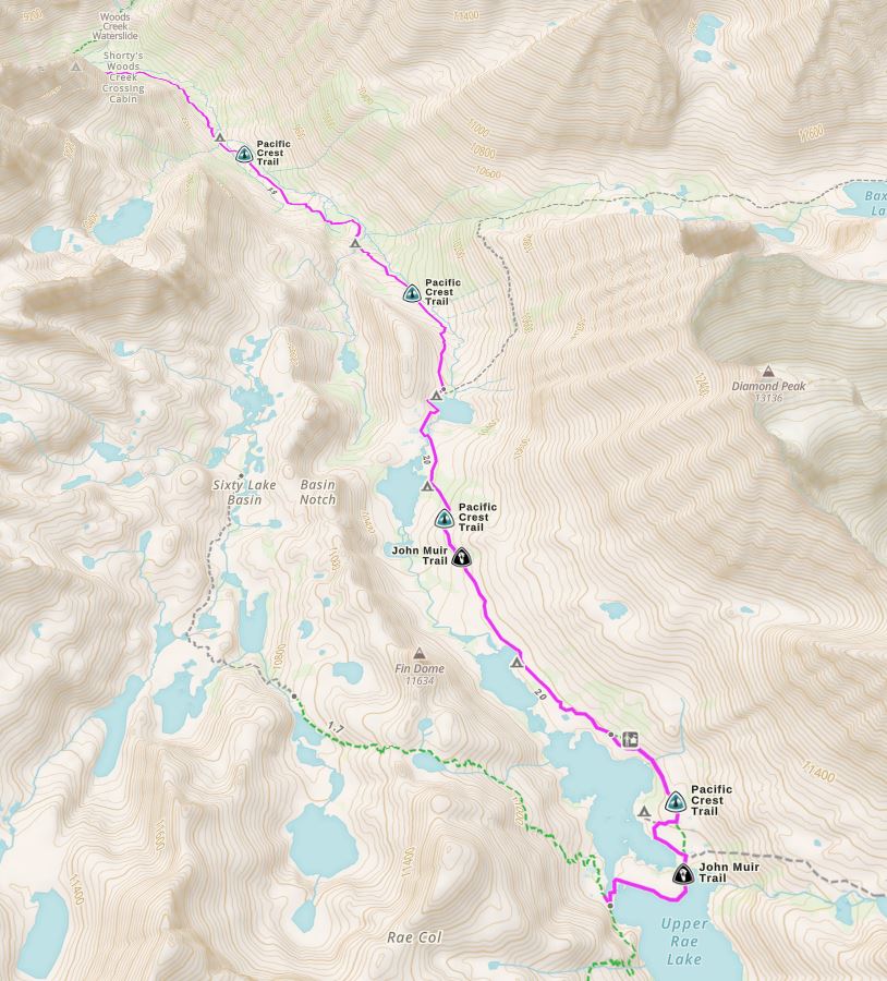
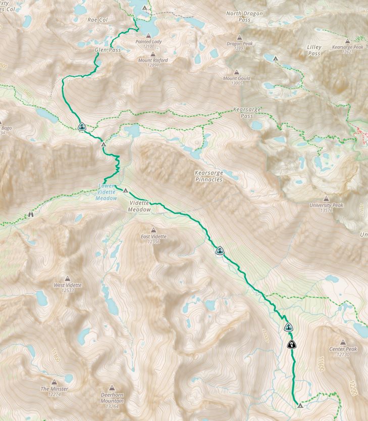
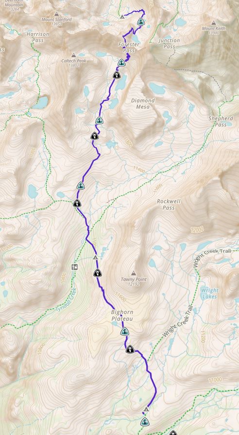
Ankur took the lead on creating our 21 day itinerary. He planned the daily route taking into account the distance, amount of climbing, campsite location and water sources. However, once we started our trek we realized that the route needed to be readjusted on a daily basis. We made significant changes including skipping a side trip to climb Clouds Rest, getting rid of a short detour to stay in a resort (VVR) for two days and shaving off a day to complete the trek in 20 days instead. Ankur diligently planned the route every evening. Here’s a log of our day by day travel.
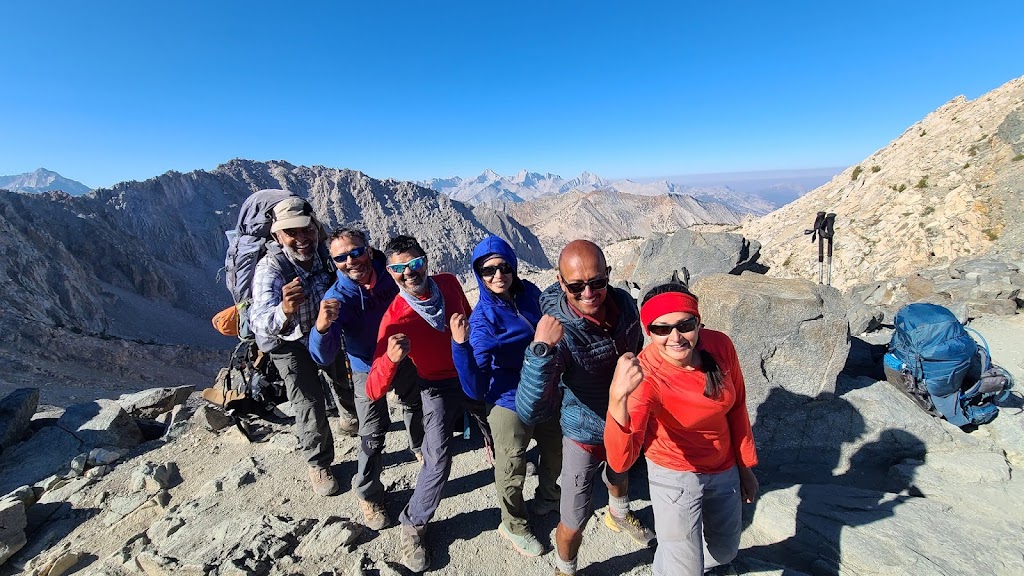
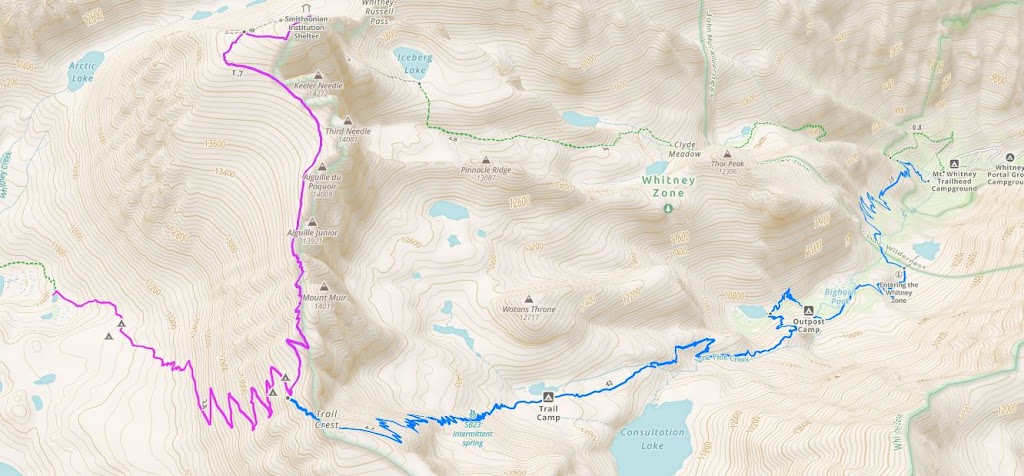
Day 20: Guitar Lake to Mount Whitney to Whitney Portal (16 miles)
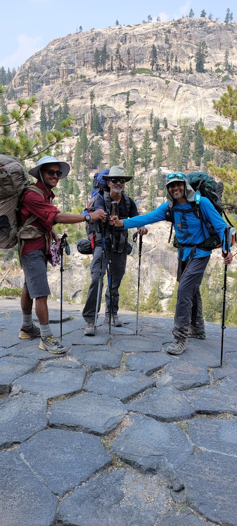
Day 0 (Aug 10): Bay Area to Yosemite
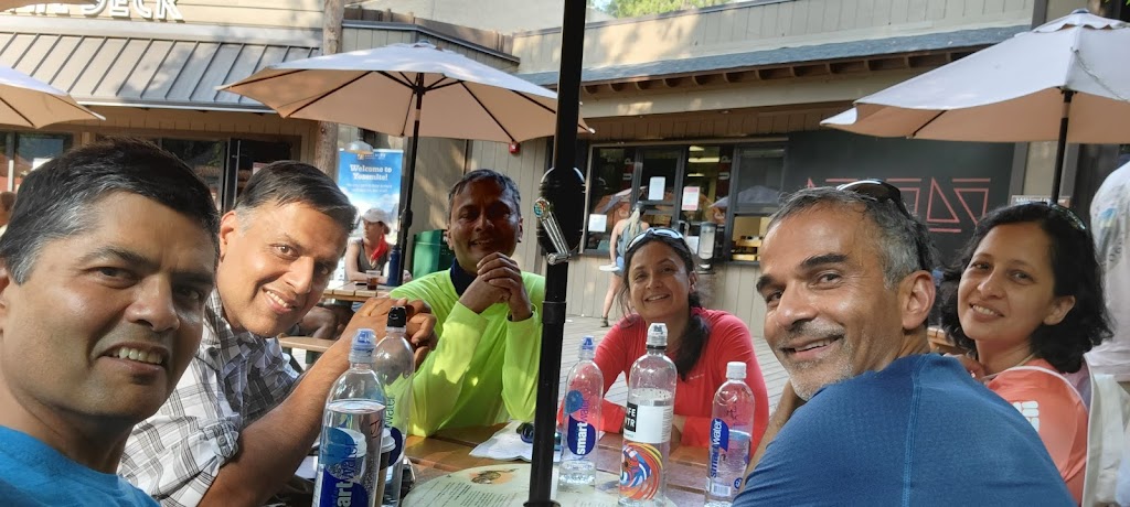
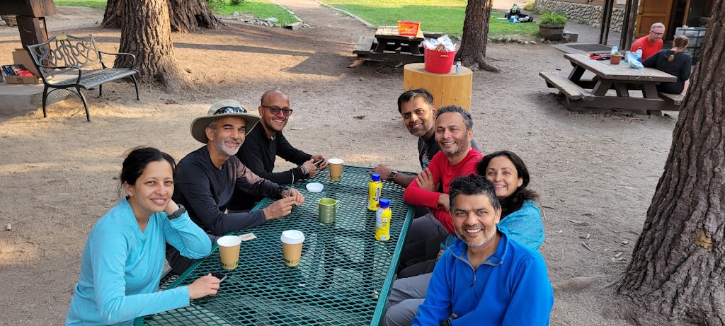
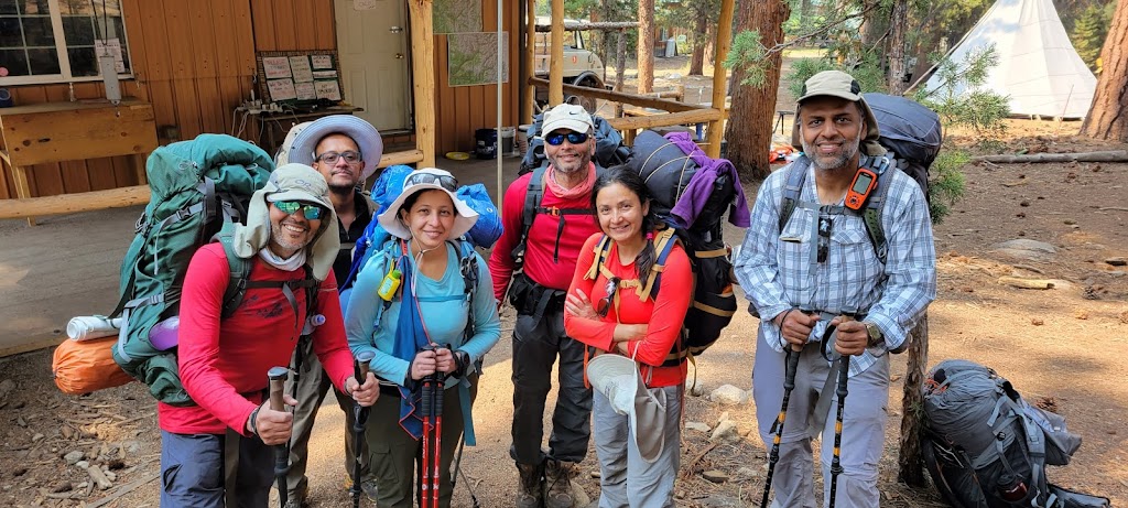
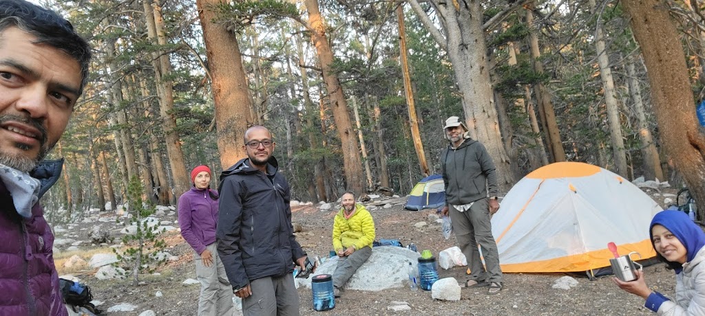
We left the Bay Area in a rental car and drove to Merced. At Merced we returned the car and boarded YARTS to reach Yosemite. We had made reservations in Curry Village for tonight. Last bit of comfort before embarking on our trek.
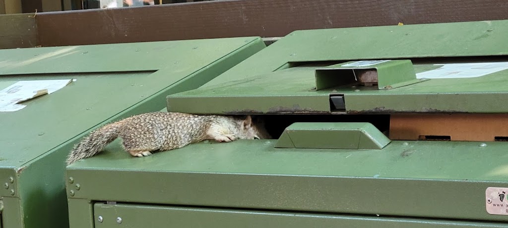
Squirrel trying to scavenge food from a partially open garbage binLast good meal at Curry Village before starting our trek……and last comfortable accommodation
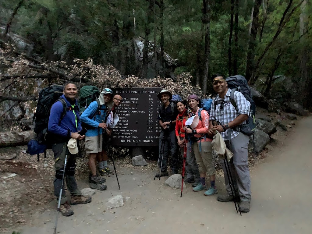
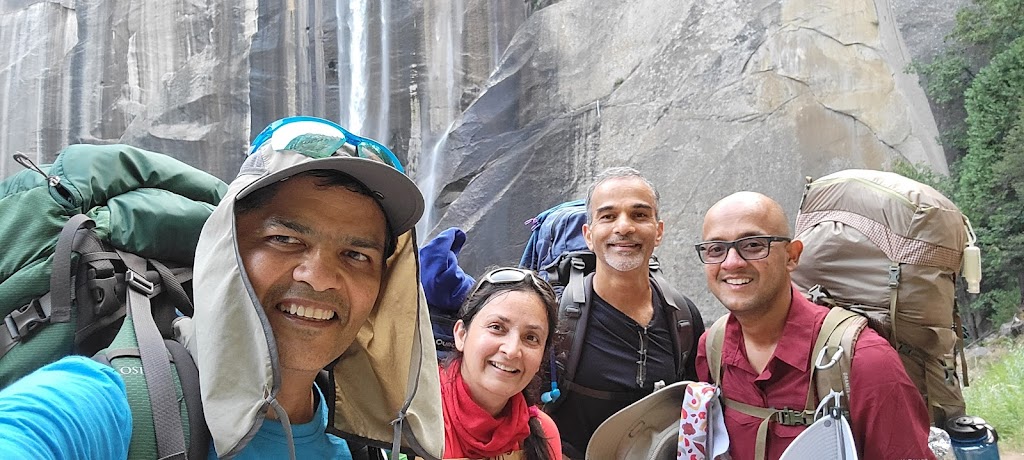
We started from Curry Village at 5:30am in the morning.
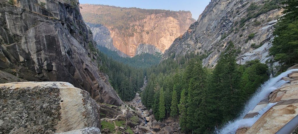
Some of us took the steeper mist trail to Vernal Falls and joined the other group at Clark Point. It was sad to see that Vernal Falls was down to a mere trickle. Usually one gets soaked on mist trail by the water vapors but the water levels are really low now due to the ongoing drought. You can barely make out the falls in the picture below.
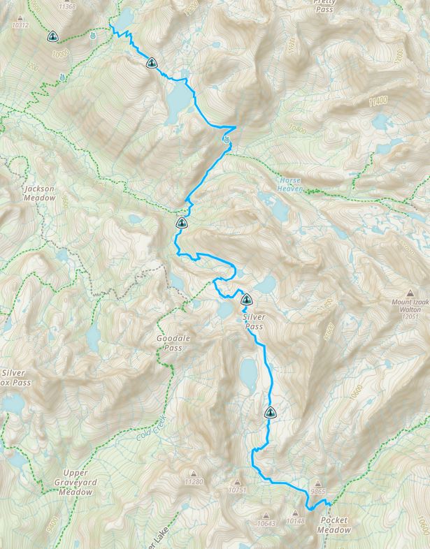
It was a grueling climb out of the valley to reach the Little Yosemite Valley campground. Within 30 minutes of starting the hike, Meenal felt weak and had to stop for a while to regain her strength. Most likely it was due to the excessive heat and her trying to keep pace with the faster group. It shook her confidence but soon she found her natural rhythm. She was the least experienced person in the group but showed tremendous mental and physical toughness to complete the entire JMT trek.
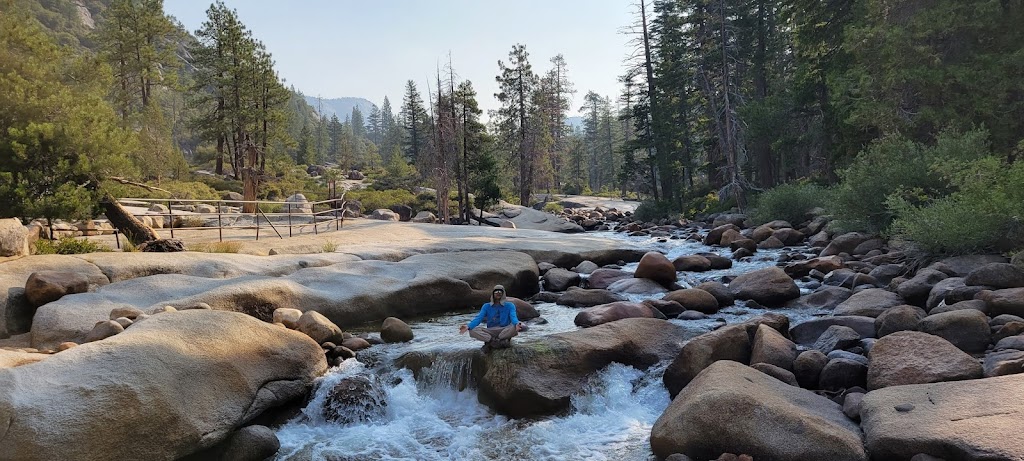
Meditative moment at Nevada Falls 🙂
After reaching Little Yosemite Valley, we pitched our tents there and continued on with smaller packs to climb the Half Dome.
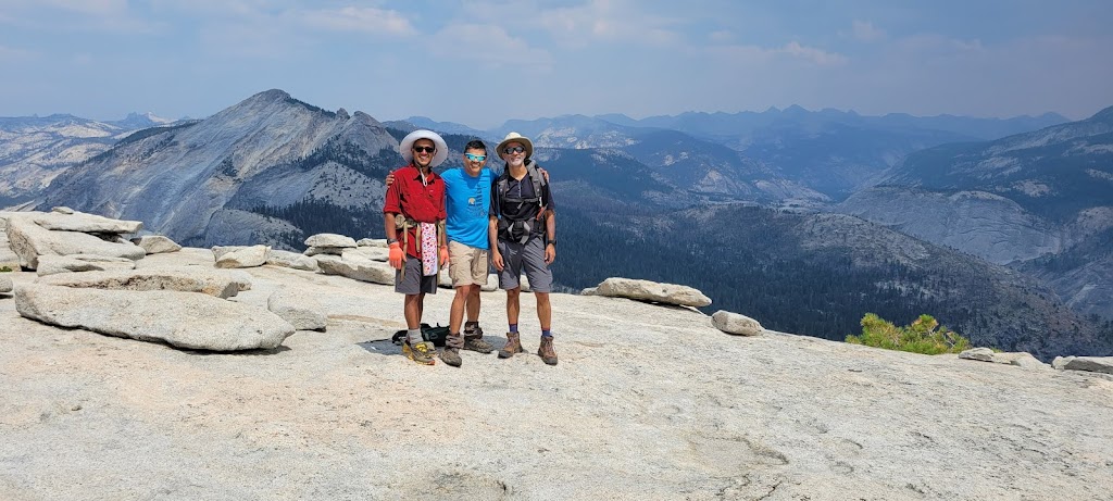
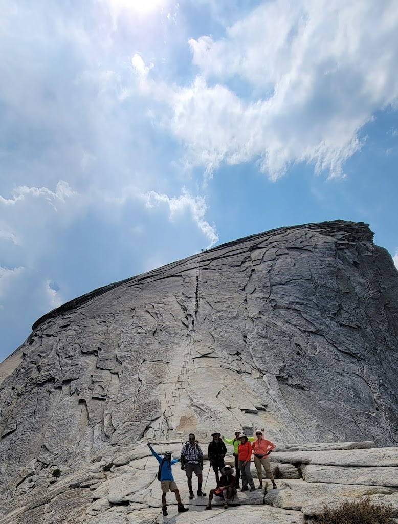
We met a ranger along the way who cautioned about a potential storm moving in. Half Dome is the last place you want to be stuck on in a thunderstorm. It is a lightning magnet. You cannot get down either because there are metal cables which attract lightning and the granite gets extremely slippery when wet. Arun, Ashutosh and I were in the front and hurried up so we could reach the top before any storms. It was a hard climb and it was also a very hot day with temperatures touching 100 degrees and I was running out of water. I started getting some cramps but made it to the top nevertheless. The last part of Half Dome climb is at a 45 to 60 degree incline which is too steep to climb without any support. Therefore the park has installed a set of metal cables and nailed some wooden boards to provide periodic footholds. It looks really scary and there are many hikers who simply freeze and are not able to complete the cable section. The cables today were jammed with panicked hikers ascending/descending at a slow pace. We scrambled up outside the cables. I had done the Half Dome climb three times in the past so I was fairly comfortable although the last climb was 19 years ago. On the way down my cramps got really bad. I felt I couldn’t move and had to sit down but it didn’t help. I figured that the cramps won’t go away anytime soon and I just have to keep going. I somehow got up and practically jogged down outside the cables.
Top of Half Dome (Left to Right): Ashutosh, Jai and Arun
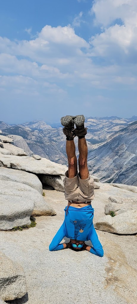
Headstand to celebrate completion of Half Dome 🙂
We made it to the top easily, took a couple of quick pictures and decided to head down. My cramps got really bad but I powered through them to get down quickly because there were ominous black clouds gathering up in the sky. Once we descended the cables, the rest of the group was just arriving at the base. We all decided that it was too risky for them to climb the cables and everyone decided to turn back. As it turned out, the clouds dissipated eventually without any storm. However, turning back was the right decision at the time.
Half Dome cables. You can see the dark clouds in the sky.
We arrived back at the campsite at nearly 5pm, cooked our dinner and retired to our tents.
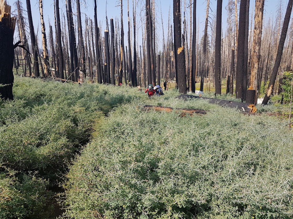
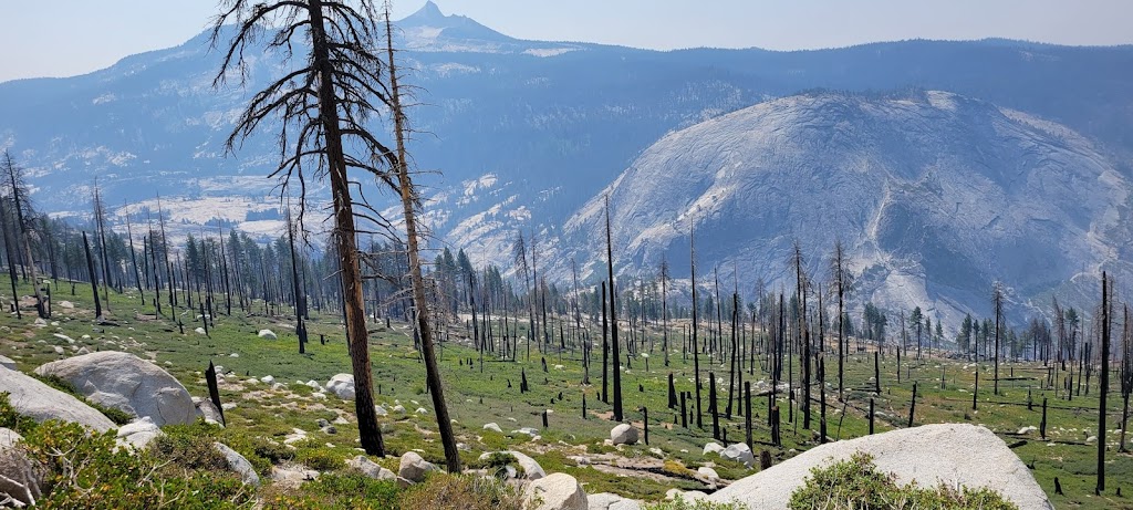
We had originally planned to take a longer route via Clouds Rest today but most of the group was tired from yesterday’s long hike so we decided to take the regular JMT trail. We woke up at 4:30am but it took us almost 3 hours to get packed up and get going! Over the next few days we eventually got it down to 1.5hrs which is pretty decent for a large group considering that we cooked breakfast/lunch, packed up tents, went through the morning rituals etc. Soon after crossing the Clouds Rest junction we passed through an area full of burnt trees and thorny bushes. These bushes were very low and rubbed against our legs – thankfully I was wearing full pants. It was quite annoying and it lasted for many miles. The Clouds Rest detour may have been a better option!
Arun and I are navigating thorny bushes on a narrow trail
Burnt forest area – it was eerily beautiful
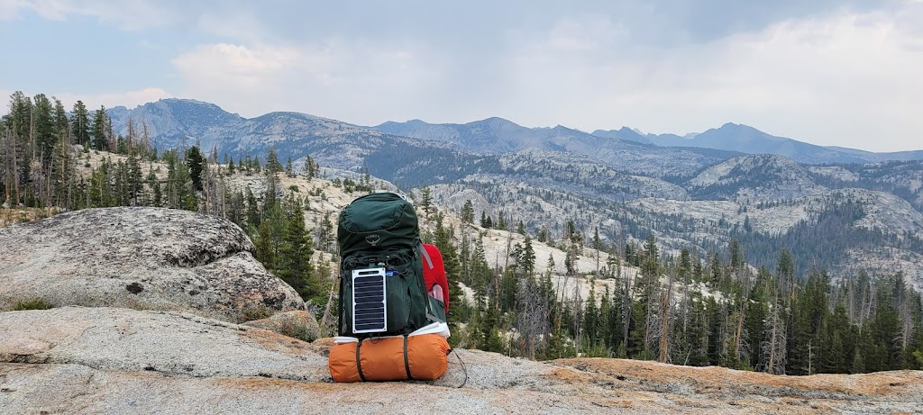
This was all about the journey, not the destination. Taking time to recharge my soul (and the battery pack)
Our plan was to camp at the Sunrise Meadows but we found from other hikers that there was no water there. Ashutosh, Arun and I were in the lead group and decided to wait at the last stream crossing before Sunrise Meadows to sync up with the rest. We waited for over an hour and began to get worried. I started hiking back to see what was wrong. I saw Samir after about 0.5 miles. He told us that they had stopped to refill their water bottles which took them over an hour and there was no way for them to inform us. We were all still learning to do things more efficiently!
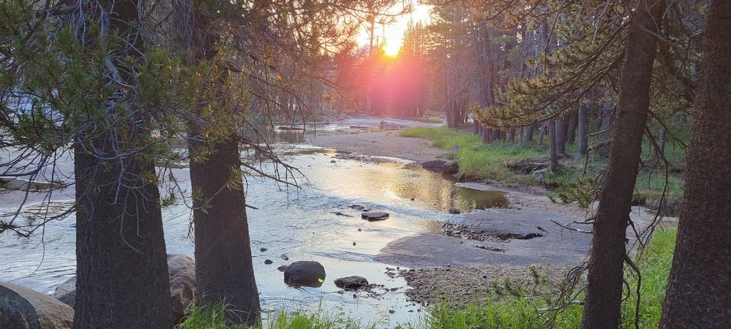
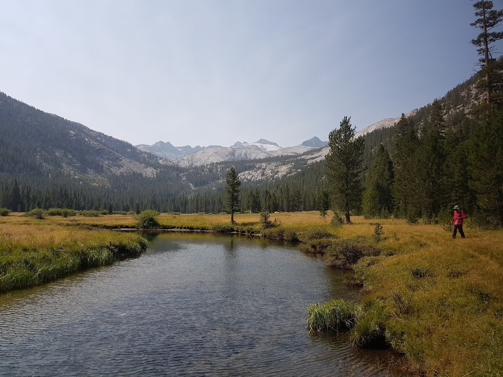
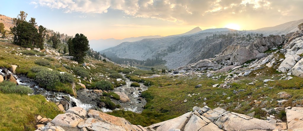
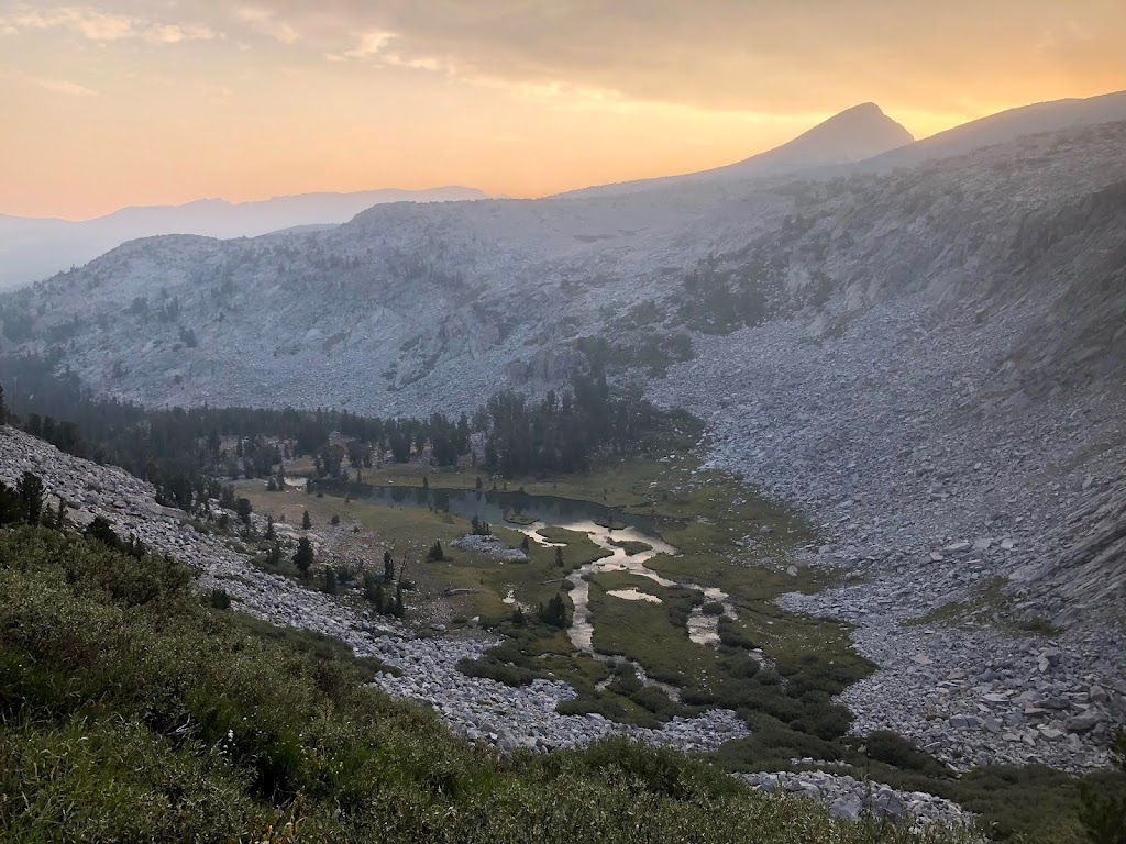
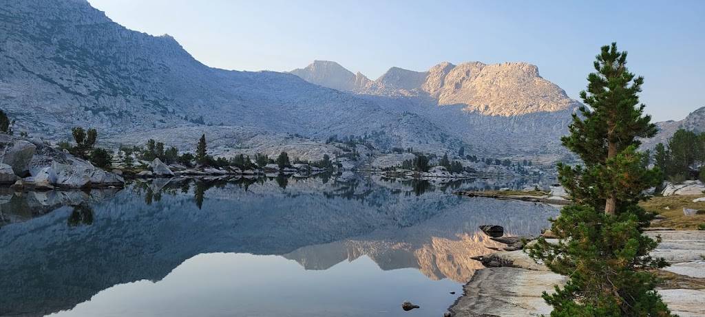
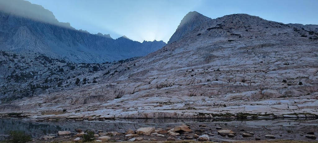
We now had a decision to make. We could either camp next to the stream but that would mean a much longer and tougher day tomorrow. Or we could fill up a lot of water (4+ liters) and carry it for the last few miles to Sunrise Meadows. We opted for the latter which meant climbing over 1,000 ft with an extra 10lb of water weight. This was not easy. However the effort was well worth it. Sunrise Meadows was incredibly beautiful.
We had the entire site to ourselves because everyone had heard that there was not water there.
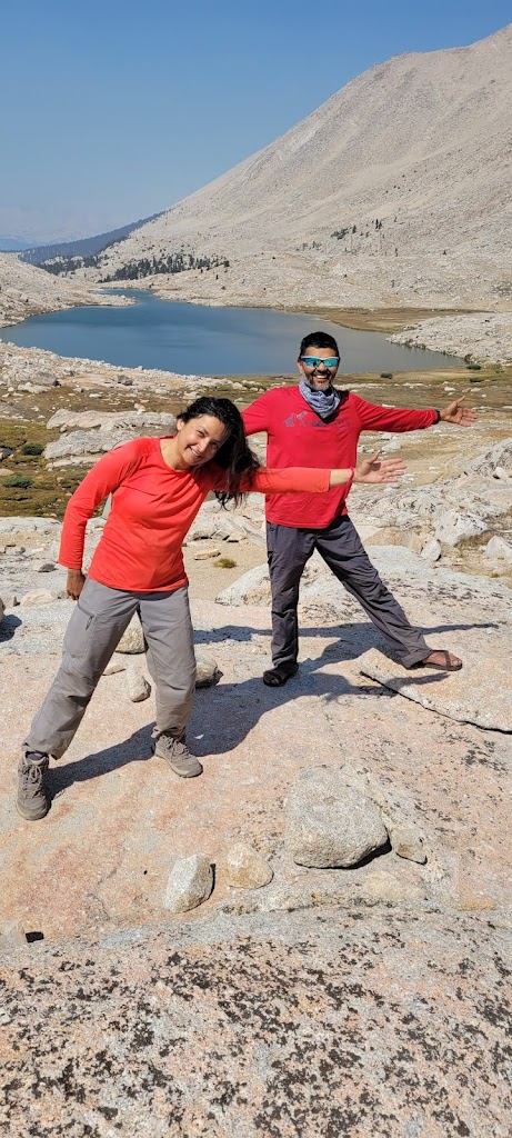
We started at 6:30am. Anu joined Arun, Ashutosh and I in the lead group today. She is a really strong and fast hiker but has altitude issues and therefore prefers to go slower at high altitudes. Therefore she shuttled back and forth between the lead and the trailing group during the entire trek.
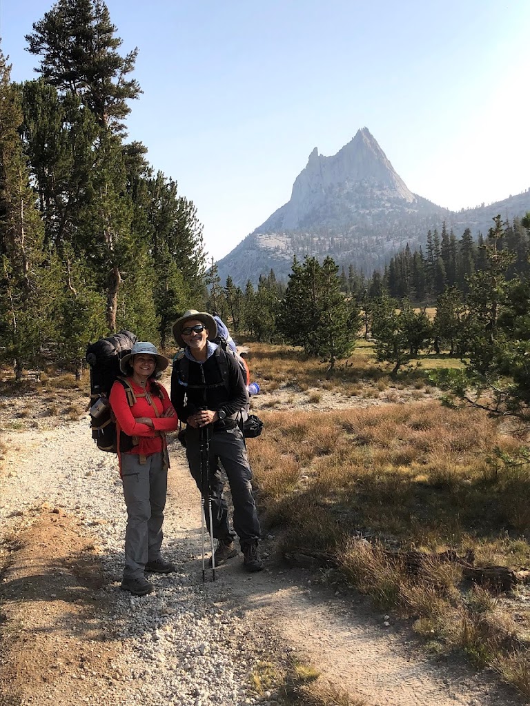
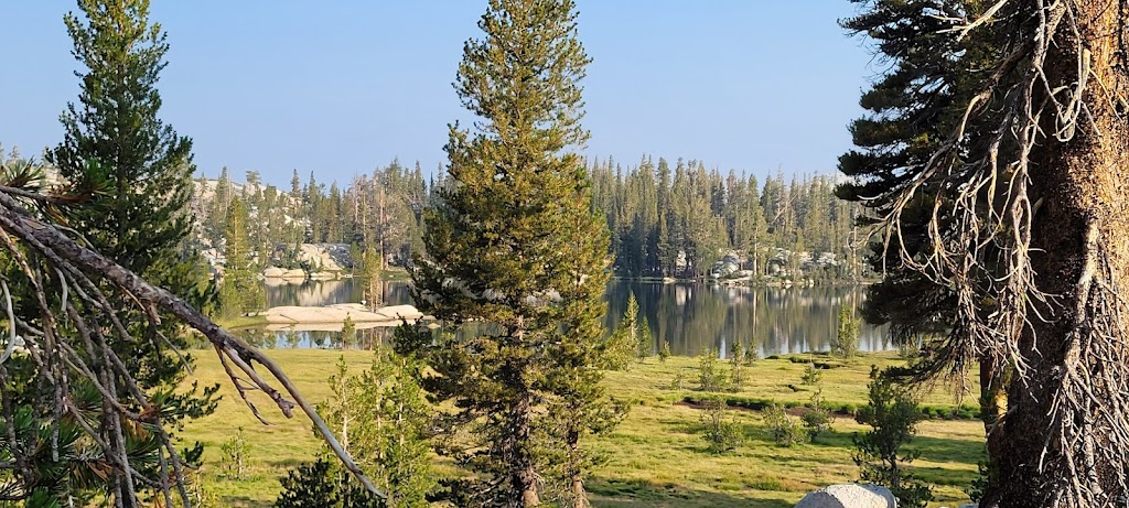
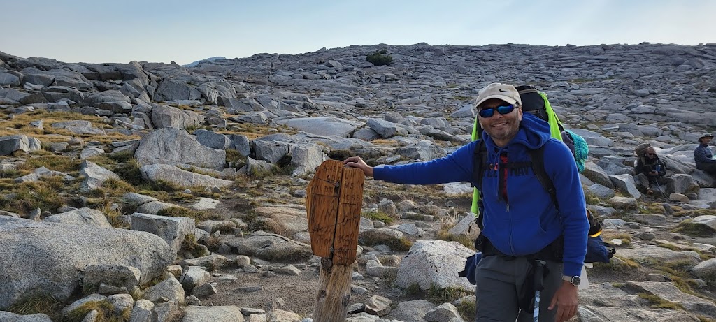
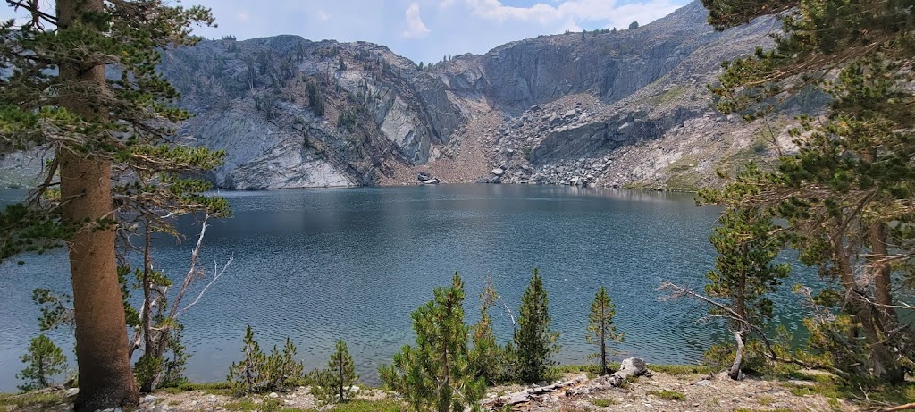
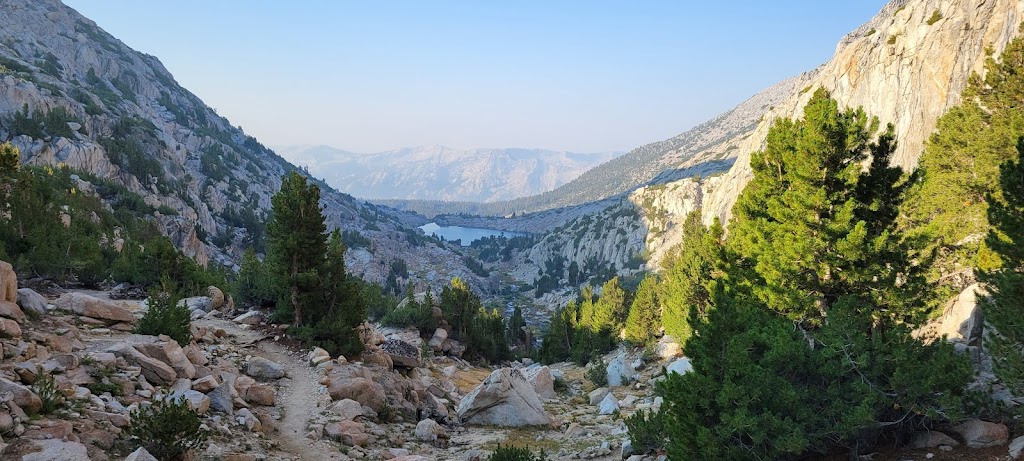
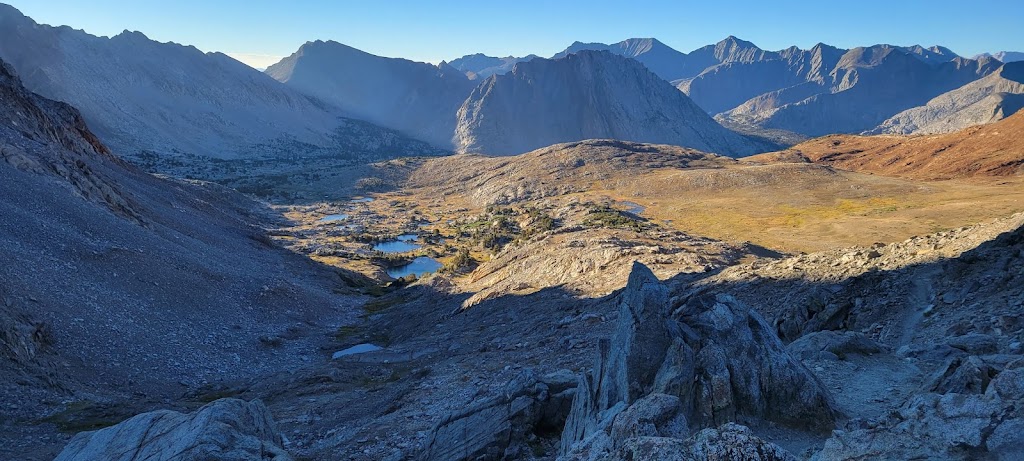
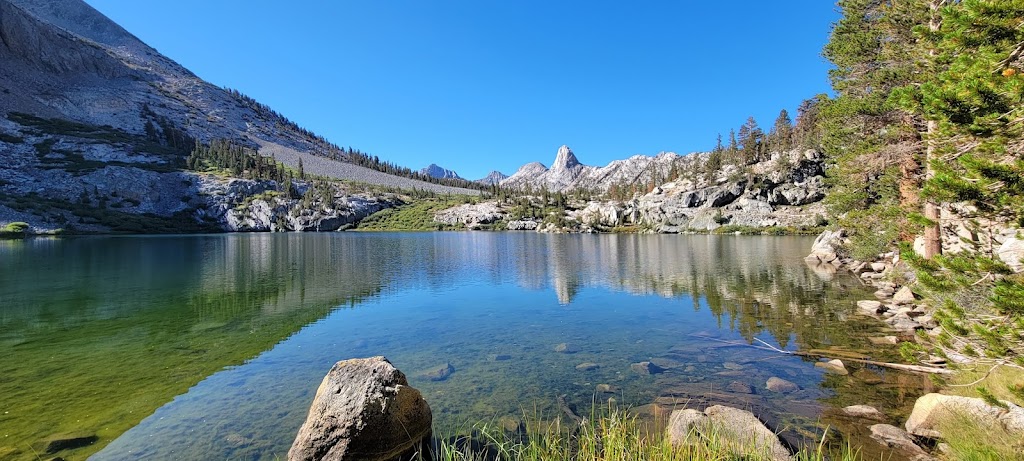
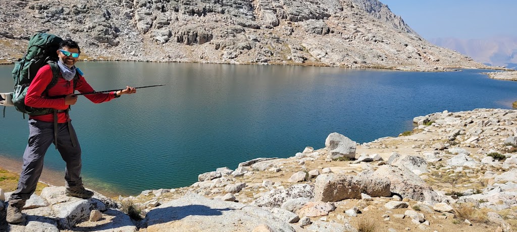
After going through the meadow area, started climbing for our first of the 11 passes we would be climbing during this trek. At 9,700 ft, Cathedral Pass is the lowest and easiest of them. We passed the imposing Cathedral Peak and beautiful Cathedral Lake.
Cathedral Peak
Cathedral Lake
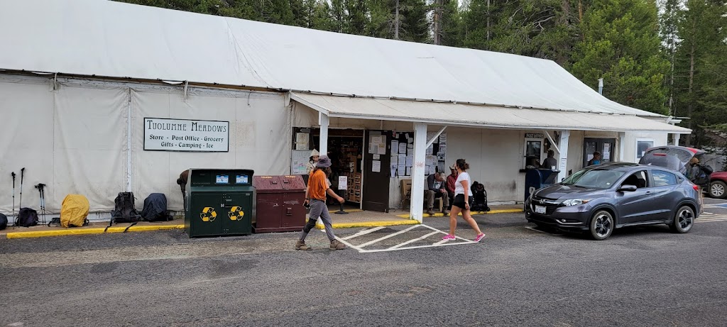
We also met many day hikers along the way and finally arrived at Tuolumne Meadows. We got our food resupply from the post office, rummaged through the hiker bins and contributed a lot of food back into the bin. We were gradually getting a better handle on the amount of food we needed on a daily basis. We were also looking forward to eating fresh, hot meal here but unfortunately the grill was closed due to Covid.
While sitting at the tables outside the Tuolumne Meadows store, I told Ankur that I was craving for fresh fruit and was going to buy a banana from the store. Just as I finished my sentence, a banana appeared in front of me! Another hiker sitting on the adjacent table had heard me and gave me her banana. Her name was Crystal Gail Welcome. We met her a few more times during the trek and found out that she was doing a 6,000 mile trek! One of her motivations was to encourage more black people to take up long distance hiking. What an amazing woman.
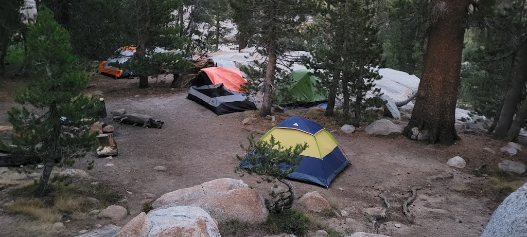
The backpackers campsite at Tuolumne Meadows seemed full. A fellow JMT hiker (Scott) offered to share his space with us. We had heard about hikers being helpful to each other and I had seen two instances of that in just a few hours. We had access to proper toilets and running water at Tuolumne. Luxuries we will soon miss dearly.
Backpackers campsite at Tuolumne Meadows
One funny incident happened here. There was a sign at the campground about potable water. As I was filling up my water bottle, a couple saw me and said that this is only potable water and the drinking water was further down, near the restrooms! I explained to them that potable means drinkable but they insisted that potable means the water is suitable for pots and irrigation but not drinking. I decided not to argue but it was an amusing exchange.
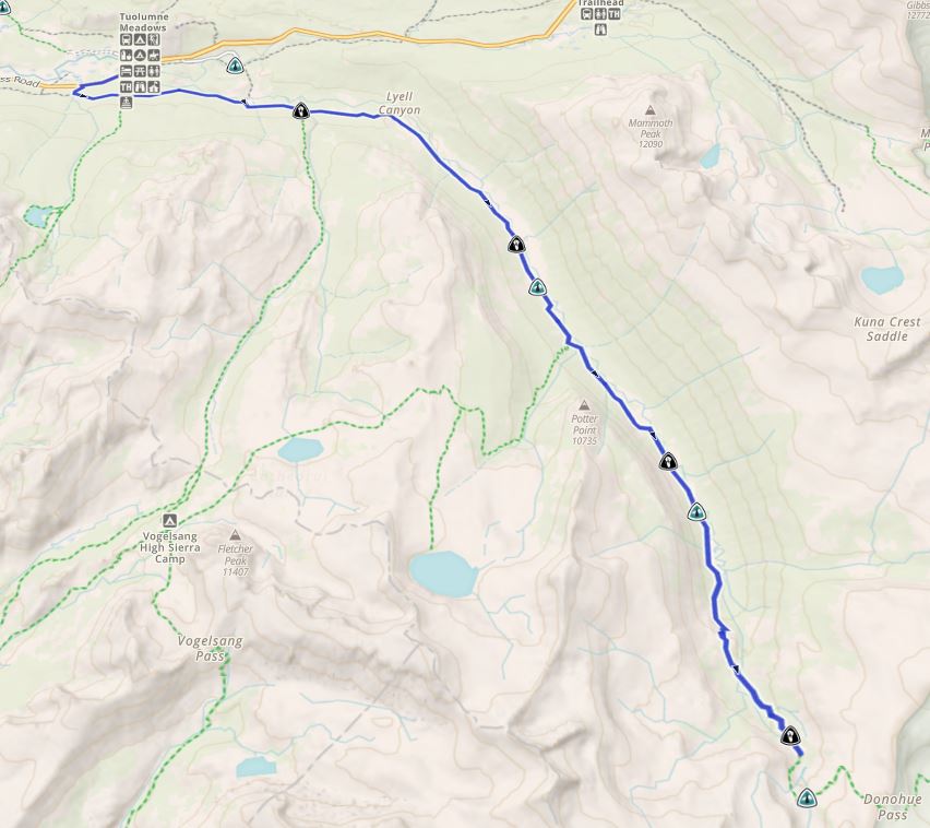
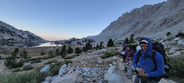
We started at 6:30am from Tuolumne Meadows and saw a beautiful sunrise.
Single ray of the Sun filtering through, making the grass look like it was on fire
The first 9.5 miles were relatively flat and we made quick progress.
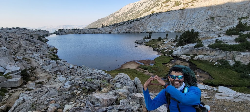
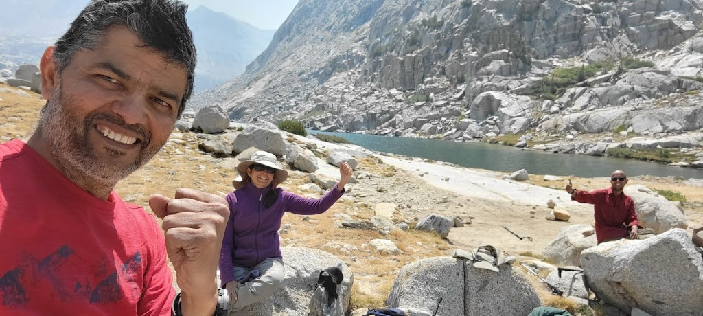
All the climbing was concentrated in the last couple of miles in 90+ degree heat. Once again our hard work was rewarded handsomely. We found a really beautiful campsite right next to the Lyell Fork and a small lake. The views were simply stunning. Between the seven of us, there was a camera clicking every few minutes 🙂
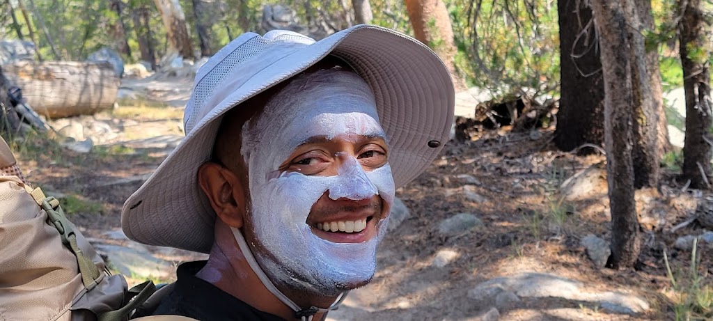
Fighting the sunscreen monster!
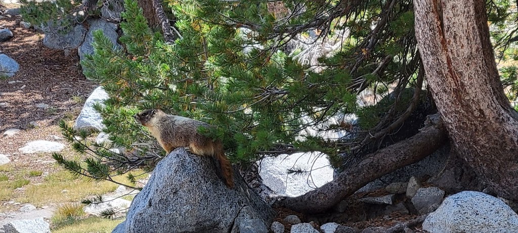
We also saw fat marmots running around the area and had to be extra careful with our food.
Mormot perched at a vantage point waiting for us to get distracted to steal our food!
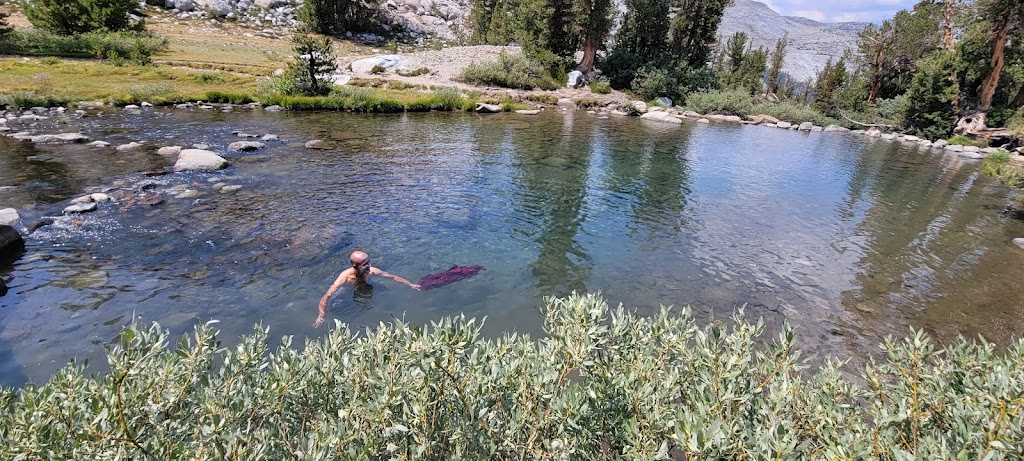
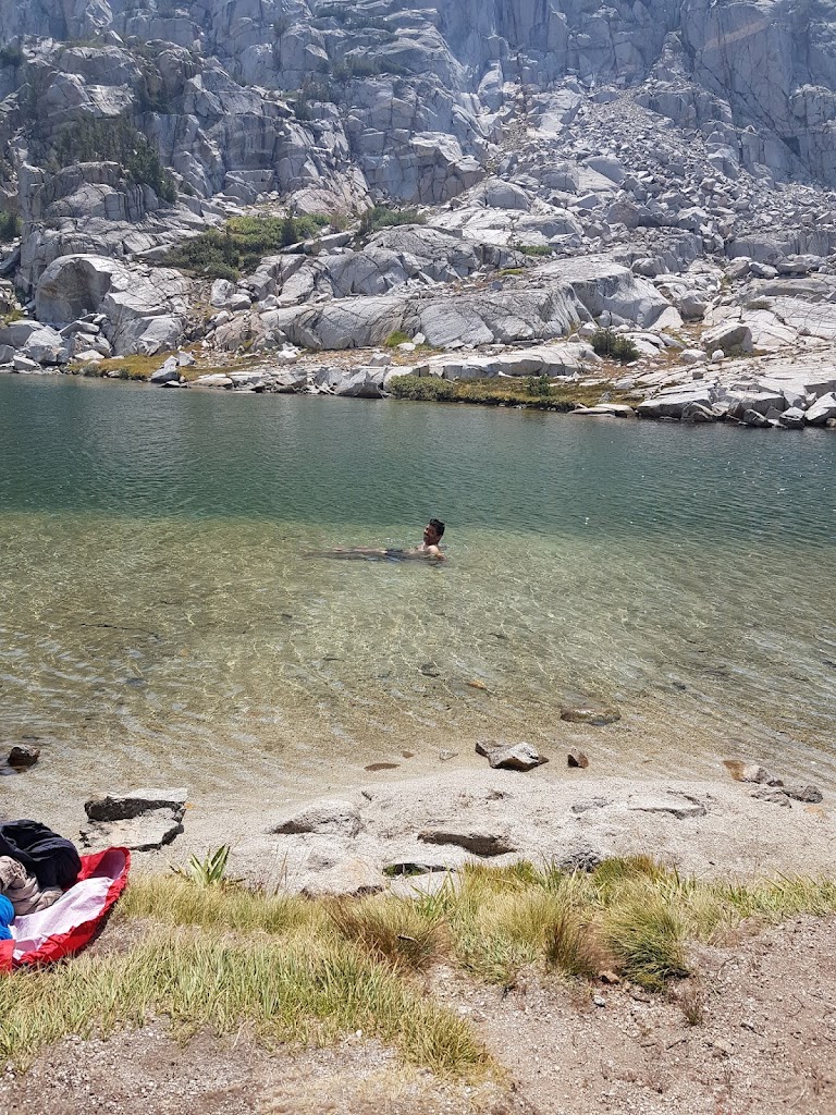
The lake was really cold but we decided to take a dip nonetheless. It was really refreshing. We also rinsed our clothes.
It was a really pretty campsite.
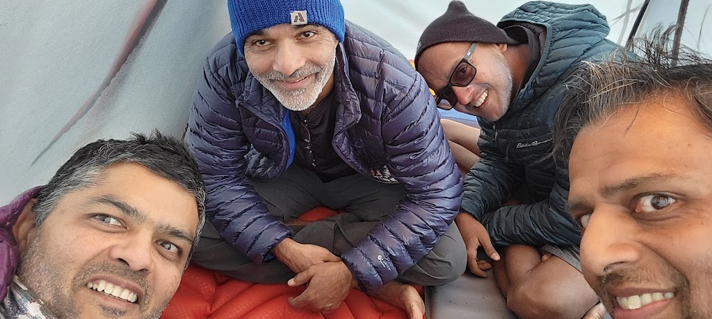
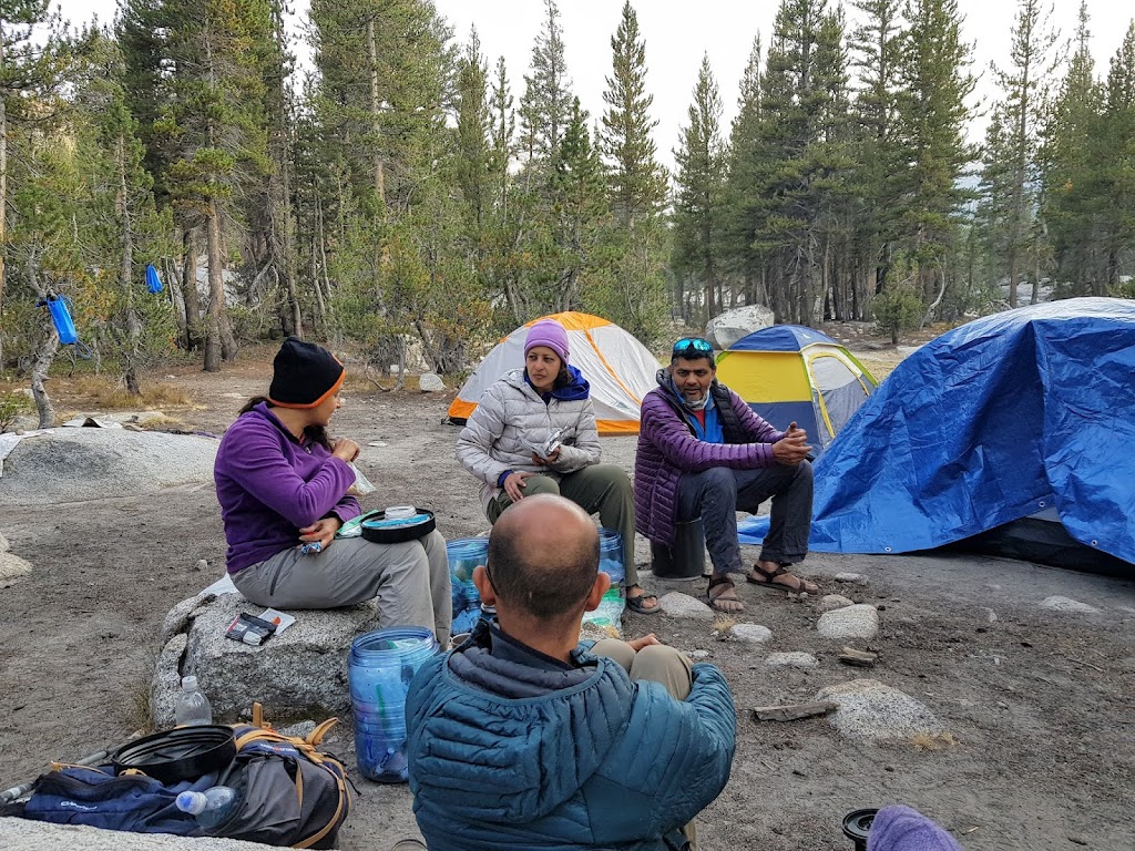
It was too cold outside so the four of us huddled up inside a tent and played cards
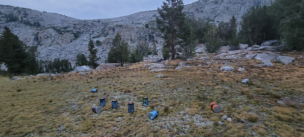
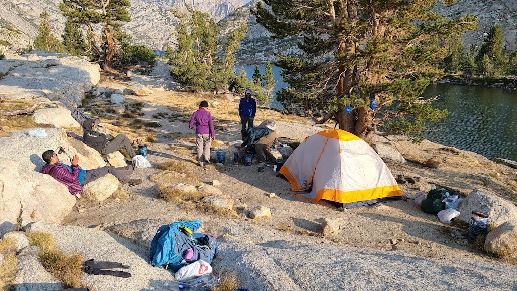
Bear canisters kept a safe distance away from the tents
At night I tried to scare Anu and Meenal by making some grunting noises outside their tent after they had retired but didn’t get any reaction. I thought they were asleep. Later they told me that they had half expected me to do these things and figured out my prank easily. Damn. I need to up my game, I am becoming too predictable.
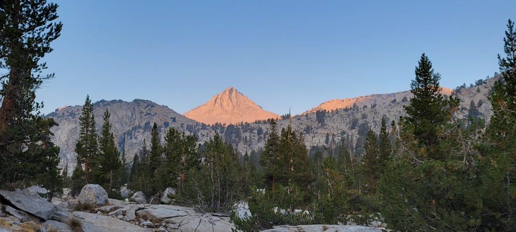
This turned out to be a really long day. We started at 6:30am and again saw some incredible sunrise views.
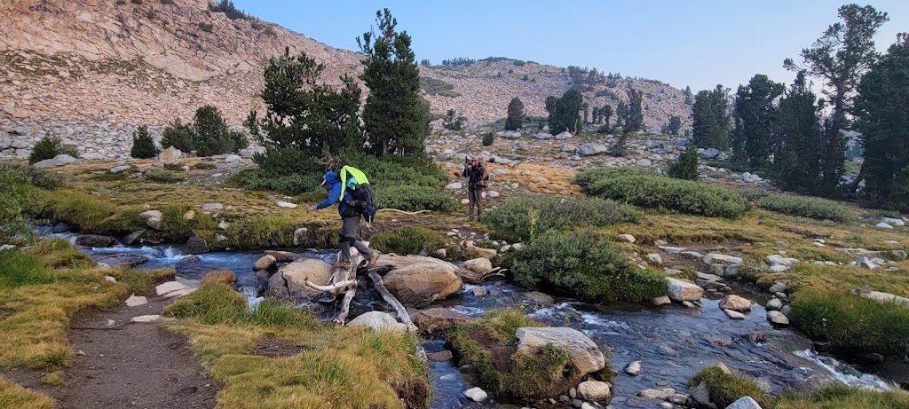
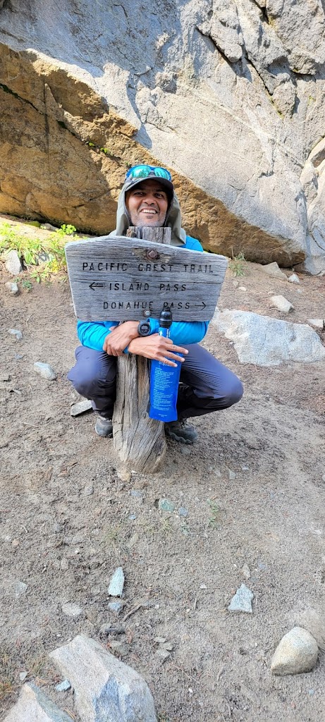
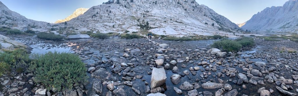
We crossed two passes today. The first one was the famous Donohue Pass. We boulder hopped across numerous little streams along the route.
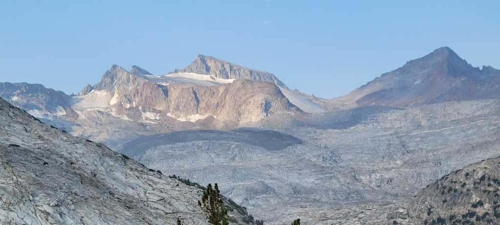
Mount Lyell was visible in the background.
At the top of the pass you enter the Inyo Forest and Ansel Adams Wilderness area.
After descending 1,500 ft from Donohue Pass, we climbed another 750-1,000ft to cross the Island Pass.
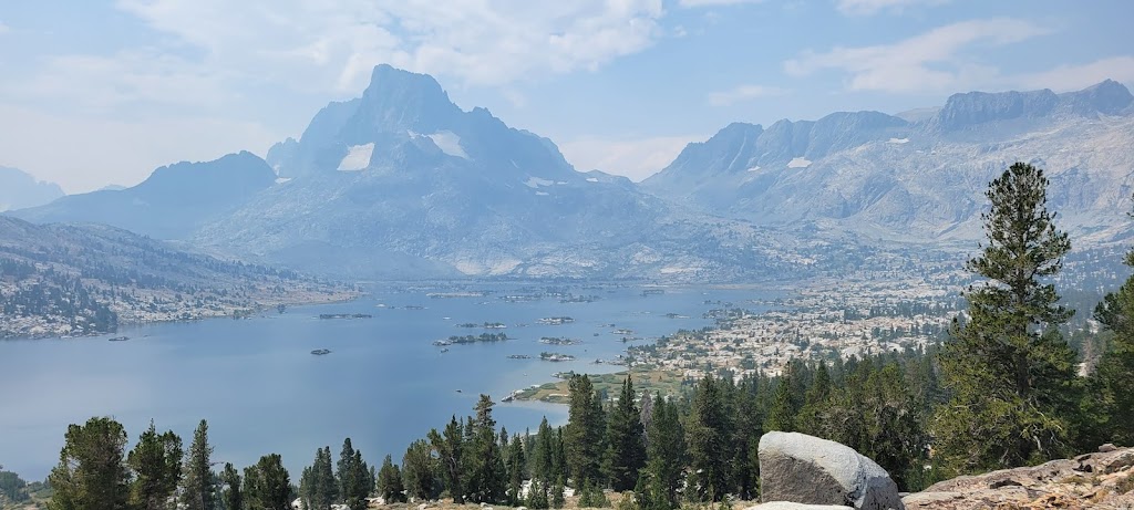
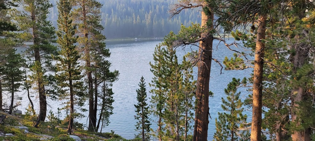
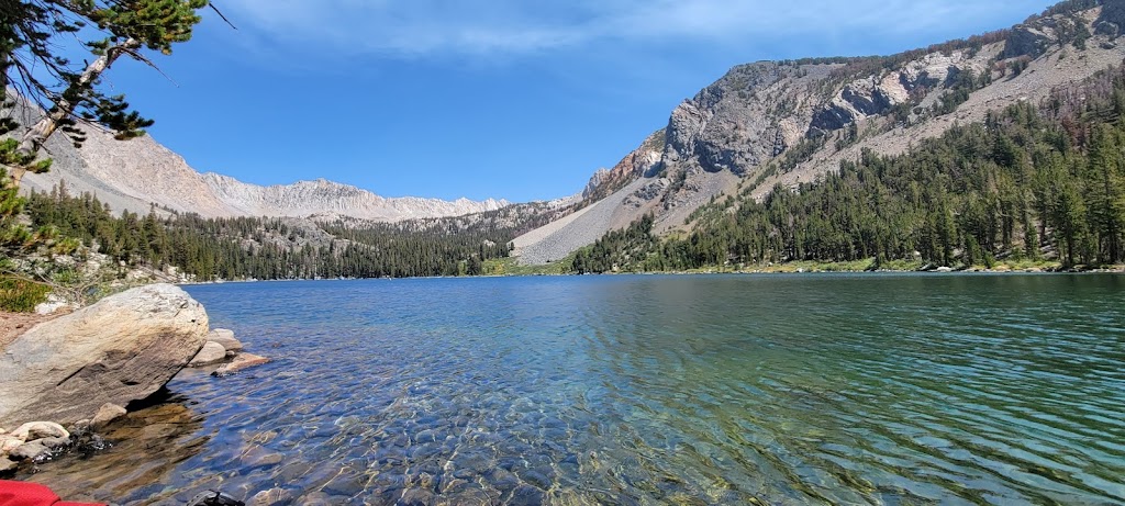
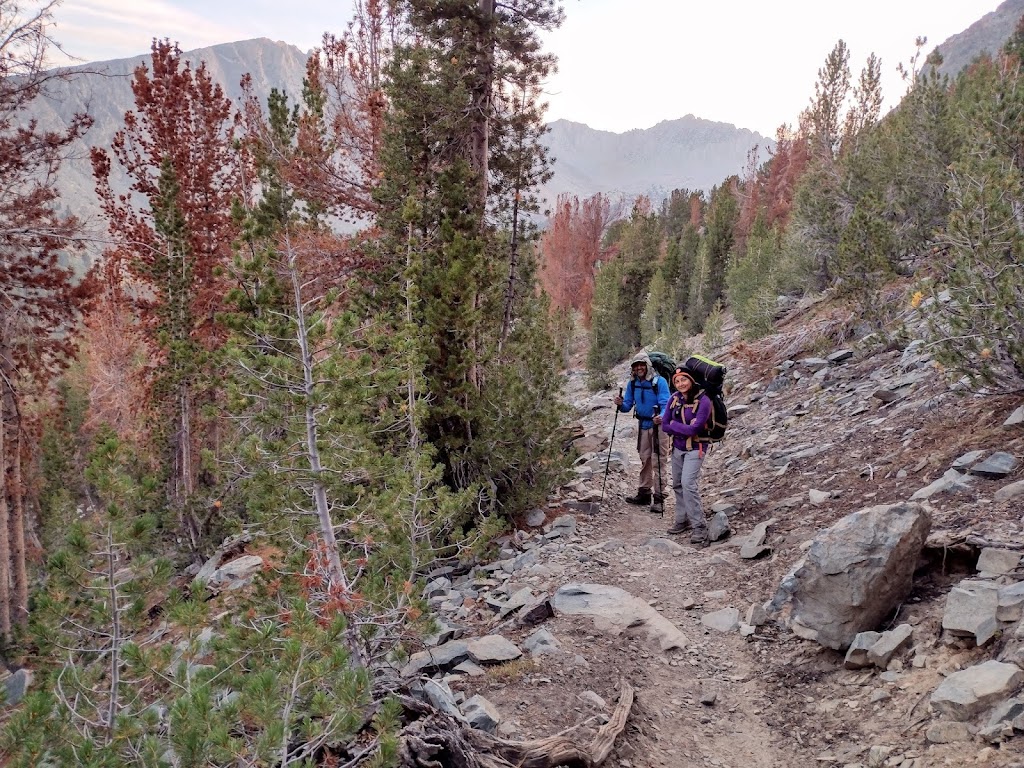
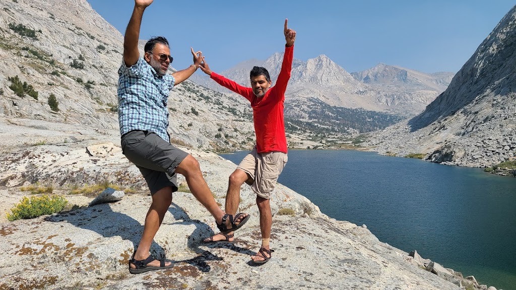
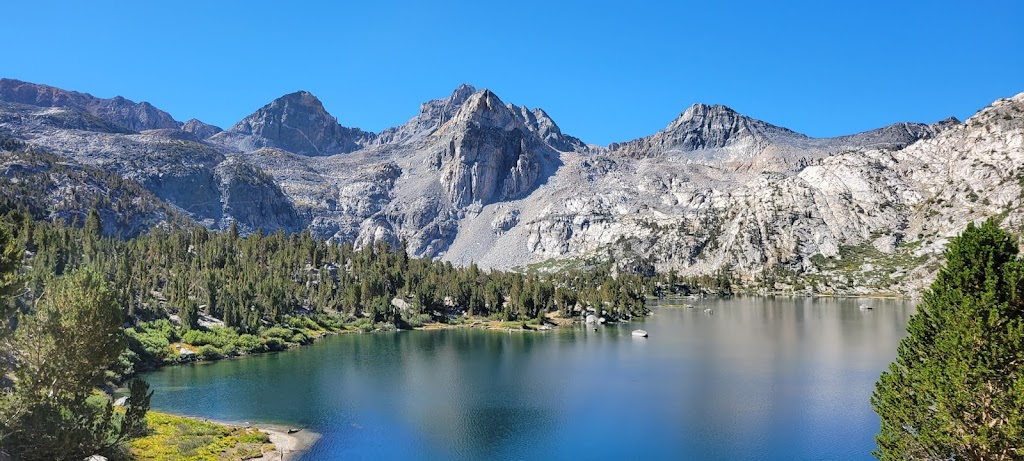
All this hard work paid off spectacularly because we saw a number of beautiful lakes – Thousand Island Lake, Emerald Lake, Ruby Lake and Garnet Lake.
Thousand Island Lake with Mount Banner in the background
Ruby Lake
Garnet Lake
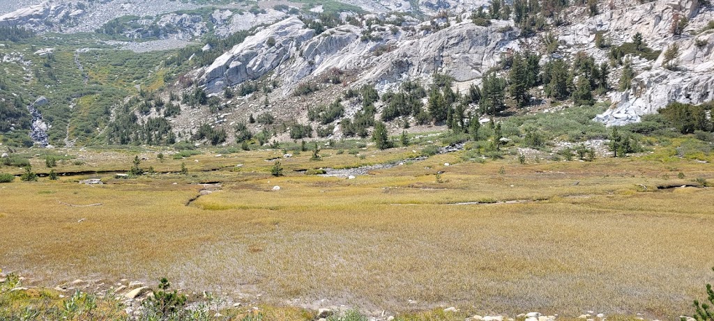
Notice the contrast – steep, hostile rocky terrain is ending in a beautiful, serene green meadow. Views on JMT changed constantly.
We reached the campsite after 4pm. The second group arrived closer to 6pm – they barely made it to the campsite before it got dark.
Soon after everyone arrived at the campsite, we heard a rescue helicopter overhead. We couldn’t figure out exactly what it was announcing but the helicopter left after a few minutes saying something along the lines of ‘everything is fine, have a good day’. Turned out that one of our nearby campers had accidentally triggered an SOS message via their sat device at Garnet Lake. The rescue team tracked down their location to the final campsite and had sent a rescue helicopter! I guess the hikers were finally able to send a message out that they were ok and the helicopter left after that. It was a little unnerving because initially we thought that they may be asking us to evacuate due to fire or some other situation. It didn’t help the matter that the setting Sun looked like this…
However, it was also somewhat comforting to see that help is always given at JMT to those who ask for it 🙂 (It is a Harry Potter reference in case you are not a potterhead).
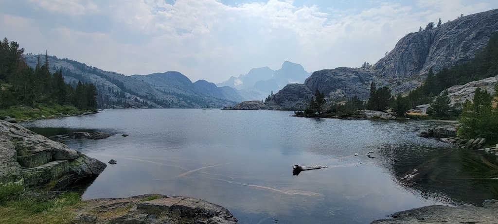
We started the day at 6:40am and again passed some beautiful lakes. Shadow lake created stunning morning reflections.
Shadow Lake
Rosalie Lake. Fellow hikers mentioned there were leeches in the area. Glad we didn’t camp here!
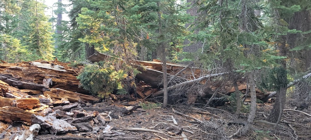
We also saw many other lakes including Gladys Lake and Emily Lake. After Gladys lake we passed an interesting area where we saw a lot of downed trees and gaps in the forest. This area was decimated in Nov 2011 by Devils Windstorm which toppled more than 10,000 trees! The tree roots were well buttressed to withstand the usual southerly winds but this storm brought 125-150 mph north-northeast winds which the trees were not prepared to handle. It was sad to see this destruction but it was also a fascinating sight.
Downed trees from Devils Windstorm in 2011
The trail in this area descended gradually and was relatively smooth. I was feeling very energetic and frequently burst out into songs at full volume, occasionally danced down the trail and at one point decided to run with my full backpack. I crossed one hiker coming in the opposite direction who understandably wanted to know why I was running and when I told him that I was just enjoying myself and having fun, he had a really perplexed look on his face 🙂 I think Ashutosh and Arun were a bit confused/amused as well and perhaps a bit nervous about hiking with a nutcase.
Crossing Minaret Creek
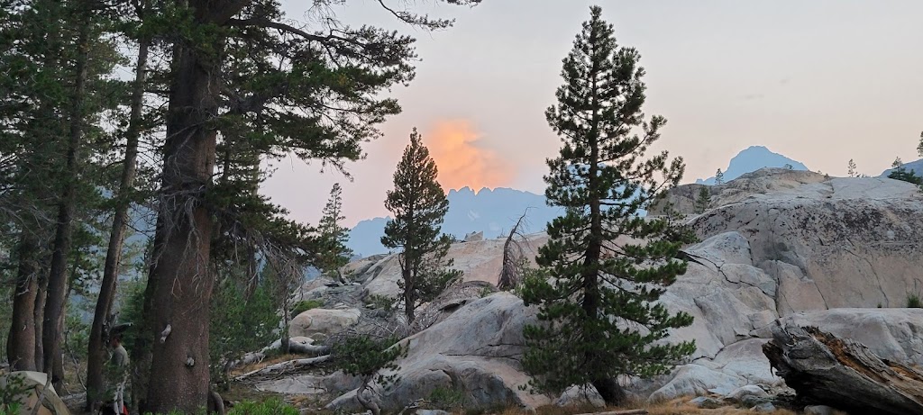
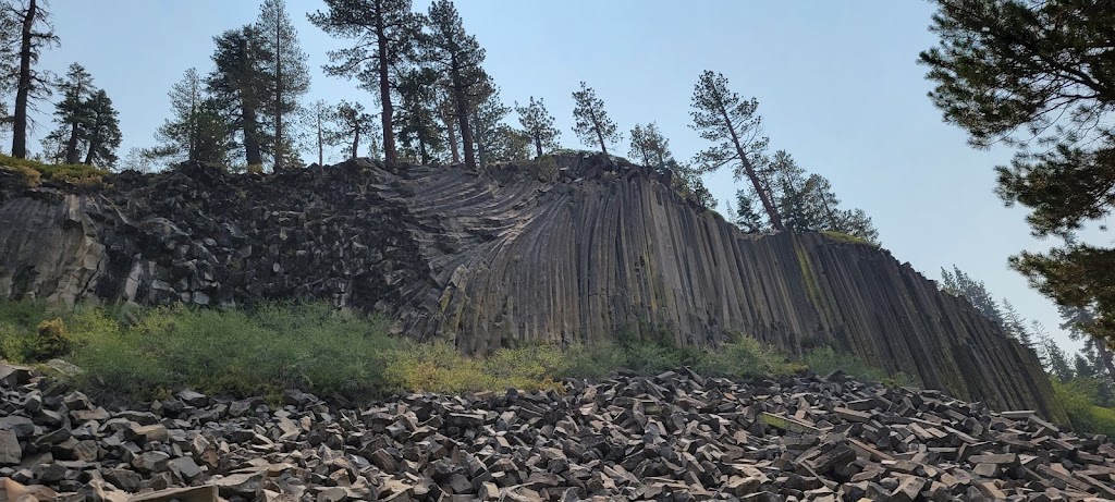
We now passed a lovely meadow and lake (Johnston Meadow and Johnston Lake) and then detoured from JMT to visit the Devils Postpile National Monument. Devils Postpile is a very unusual geological structure that was formed when cooling lava flow cracked into multi-sided columns. It created nearly perfect hexagonal shaped columns! It was a short, steep climb and well worth the detour.
Devils Postpile
The columns end in near perfect hexagons! Really amazing
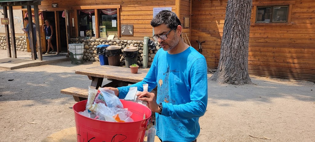
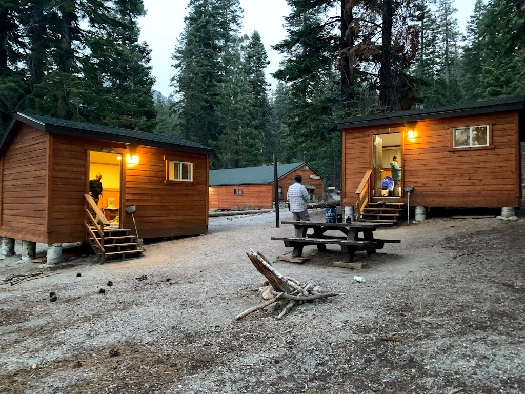
The longer distance on Day 5 paid off because we were able to reach the Reds Meadow by around noon. Reds Meadow has a resort area with a general store, cafe and hiker cabins. We had a hearty garden burger and milkshake for lunch and again for dinner – the first good meal in 6 days and the last one until we finished our trek. We had booked cabins for our stay so this was a day of luxury. We also got our second food resupply here.
Rummaging through the hikers bin to see if we can use any goodies that other hikers have left
Garden burger for lunch and dinner and bagel + grilled cheese for breakfast the next day. What luxury!
Beds, restrooms, shower and laundry. Newfound appreciation for things we took for granted
Arun learned about some family emergency and unfortunately had to head back to Seattle. It was not an easy decision but under the circumstances, this was the best course of action. Meenal was thinking about quitting as well but for a different reason. She was the least experienced in the group and was having the hardest time coping with the rigorous terrain. However, Samir and Anu did a great job in encouraging her to continue. Meenal also overcame her doubts, showed tremendous mental toughness and never looked back.
This was one of the rare mornings where we did not have to pack our tents and therefore could start even earlier. We started at 5:45am.
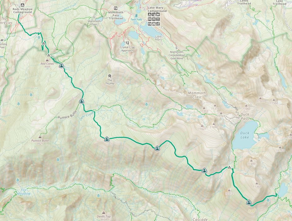
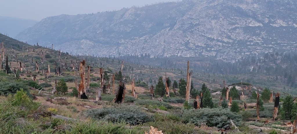
With Arun gone, only Ashutosh and I were in the lead group now. We covered the 14 miles distance very quickly. At the start of the trail we saw a large area of burnt forest – this was destroyed by the Rainbow Fire in 1992 and is still recovering!
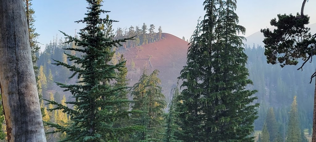
We passed the Red Cones and Duck Creek which were pretty but the scenery after that got to be a bit monotonous. This section is perhaps the only ho-hum section of JMT.
Red Cone
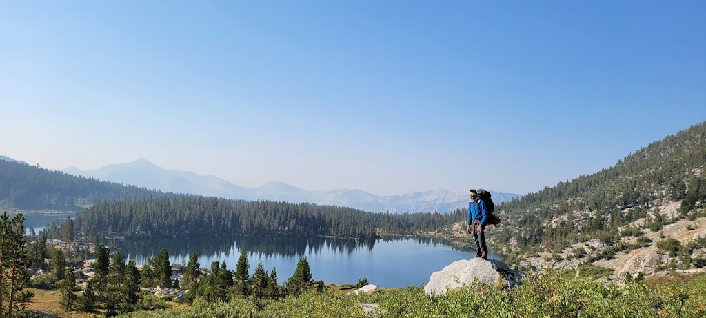
We struck up conversations with many fellow hikers and met someone who had done the entire PCT trail alone. It was fascinating to learn about his experiences. We reached Purple Lake by around 12pm.
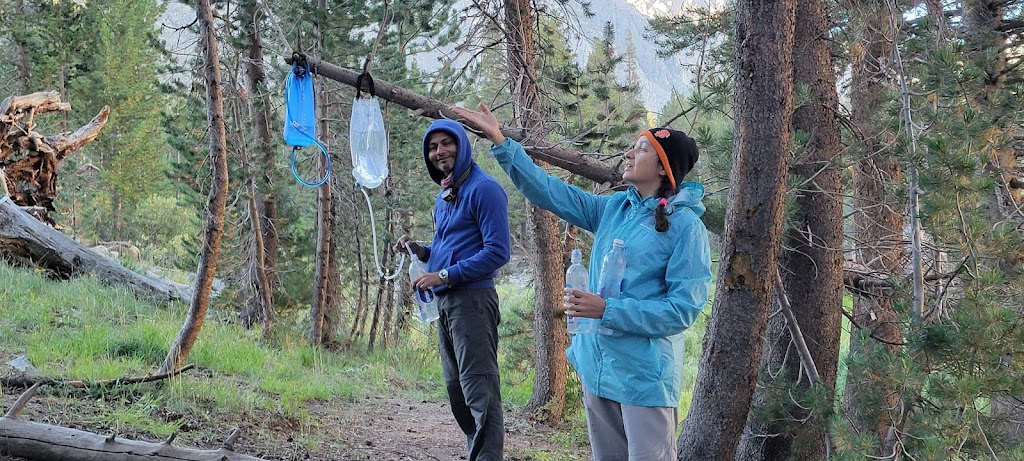
We needed roughly 4 liters of water per person after reaching the campsite. This included water needed for cooking (tea/coffee, dinner, breakfast), cleaning, morning rituals and to start the hike the following morning. Ankur and Ashutosh had gravity filters but they were not easy to use on the fly. I had the portable Sawyer Squeeze but was able to convert it into a gravity filter using a water bag. This combination really worked well.
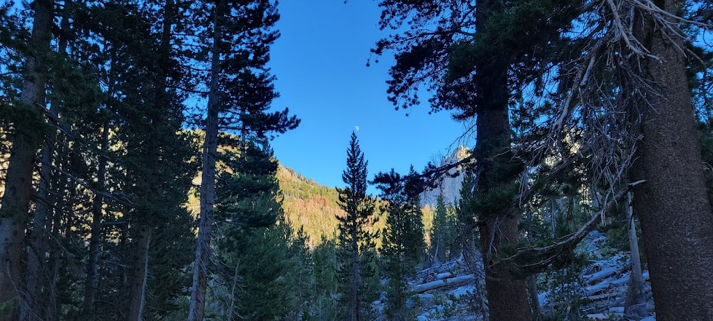
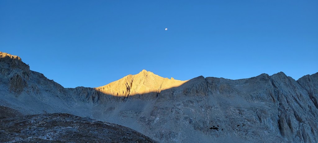
Moon taking over the reins from the Sun
Most hikers prefer to camp at Lake Virginia which is just a couple of miles beyond Purple Lake. It is a bigger and prettier lake but most people in our group didn’t want to go the extra distance. As it turned out, Purple Lake was also very pretty and it was also uncrowded. We were in a bowl surrounded by mountains on all sides. It was surreal. The only downside was the it was really windy and therefore got very cold. We had to bundle up in our down jackets and retire to our tents early.
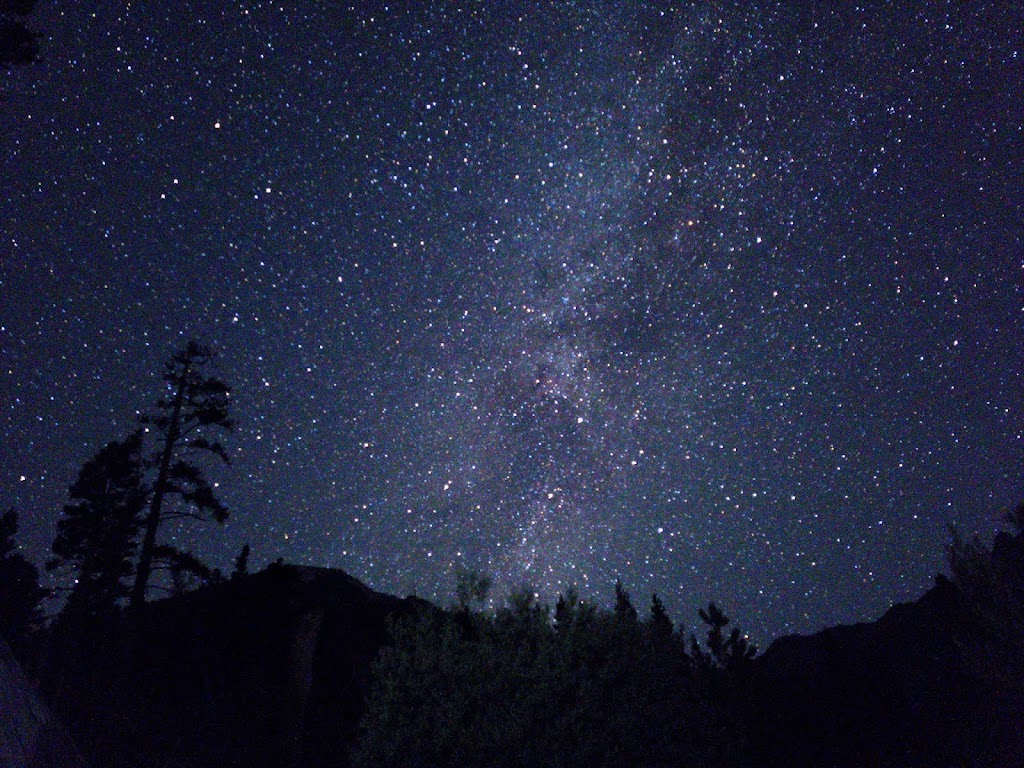
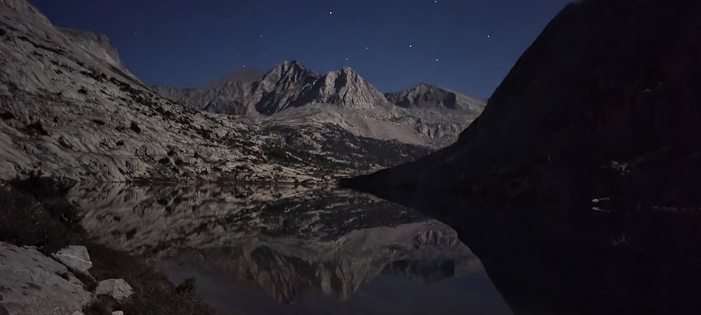
We saw amazing night skies and since we woke up so early, we saw starry skies in the morning as well..
Milky Way! I took this picture in the early morning with my Samsung S21 phone
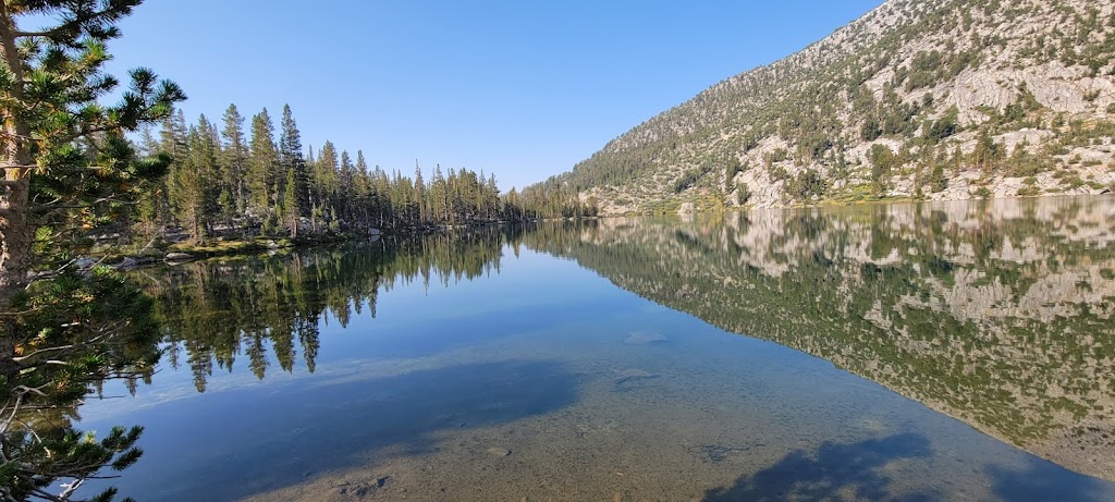
It was really cold but we still managed an early start. After a short climb we reached Lake Virginia, one of the largest alpine lakes and waited for the rest of the group to sync up here.
Lake Virginia
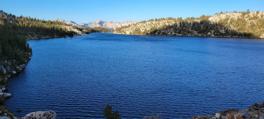
From here we descended towards the Tully Hole and Cascade Valley. I met two kids – 10 and 12 years old who were hiking the JMT with their parents! It was both inspiring and humbling.
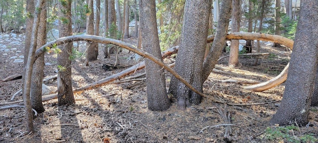
Infinitely interesting tree formation!
Here we started a long and tough 2,000 ft climb to the Silver Pass (10,900 ft). We passed several lakes named after native Americans along the way including Lake of the Lone Indian, Warrior Lake and Chief Lake.
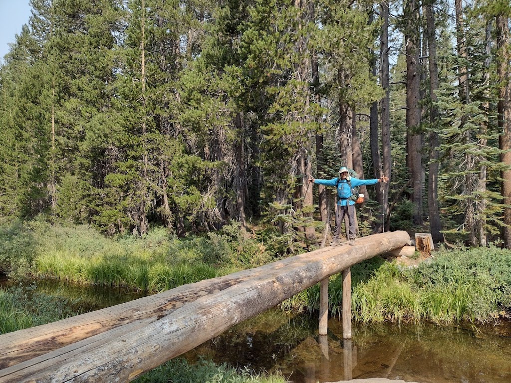
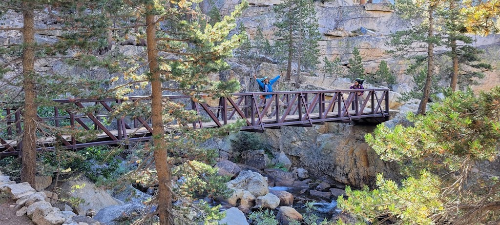
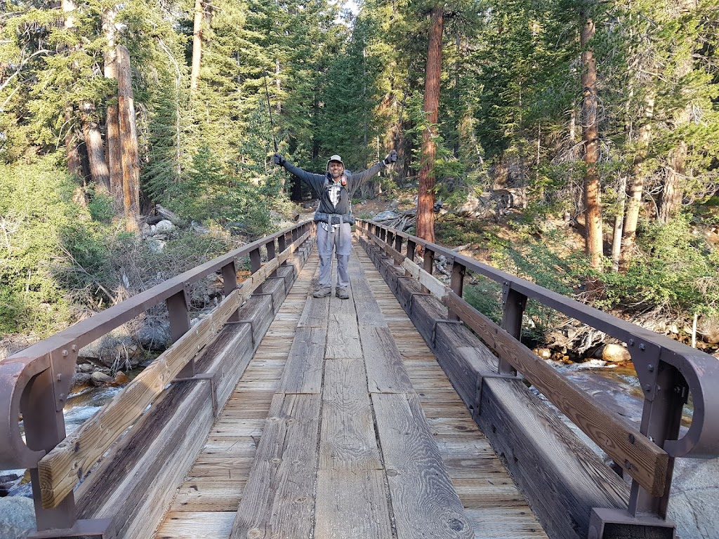
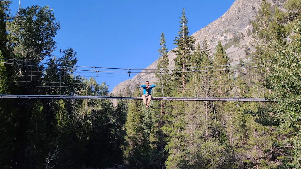
We crossed many foot bridges on JMT
We also crossed the Goodale pass junction to the Vermilion Valley Resort (VVR) which was in our original itinerary. We were supposed to take this detour to enjoy a couple of days at VVR but then the group decided against it because a rest day + detour would’ve meant a few high mileage days and many felt that it would be too much for them. I had heard a lot about VVR and was looking forward to it but in a group the first priority is to make sure that everyone can complete the trek safely. It was too late to cancel our reservations. I gave my reservation details to a hiker who was going to VVR but did not have a reservation. Hopefully he was able to use it.
The views from Silver Pass were really breathtaking. We spent a fair amount of time at the top taking pictures and talking to the fellow hikers.
Views from Silver Pass
We thought we were done with the hard part but then came a long and rocky descent. It was a knee jarring, ankle twisting, joint rattling, never ending descent. I am usually very sure footed and enjoy downhills but this section was the second hardest descent of the JMT for me. The hardest was yet to come!
Silver Pass from a distance
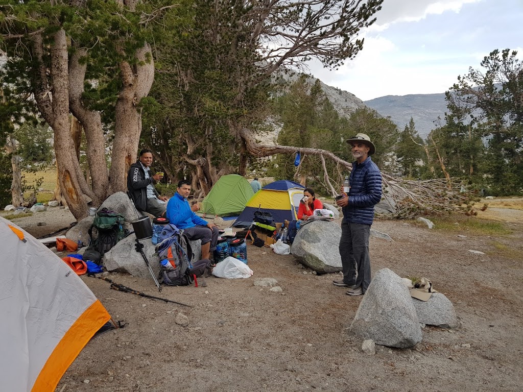
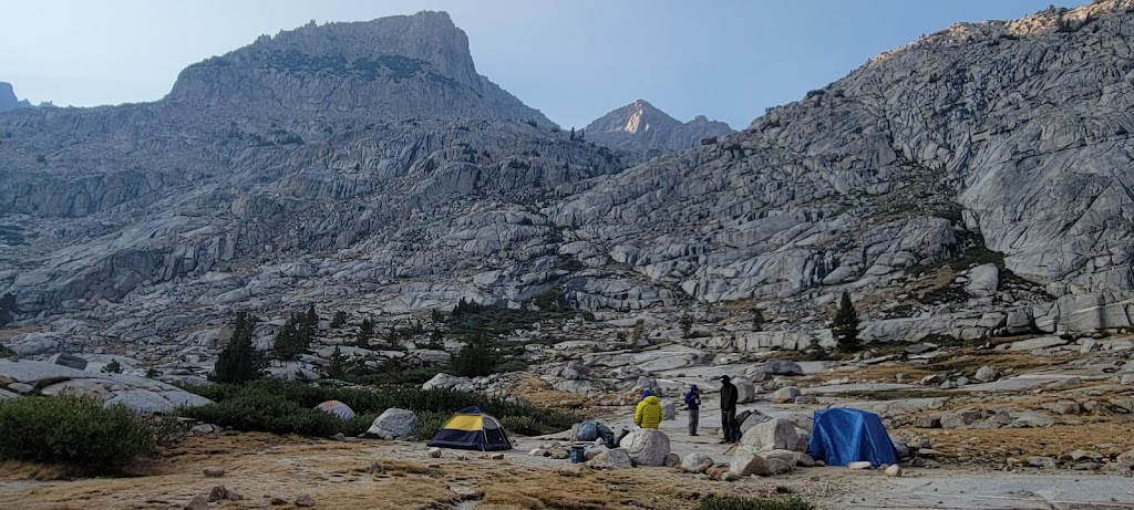
The campsite was functional and not as pretty as the earlier ones. We had a hard time finding level ground for pitching our tents. Some days it was a challenge finding three good nearby sites for our tents but we took that in stride. We knew it wasn’t going to be a four seasons accommodation!
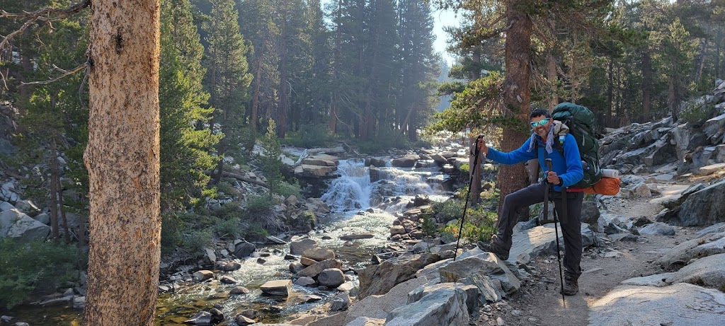
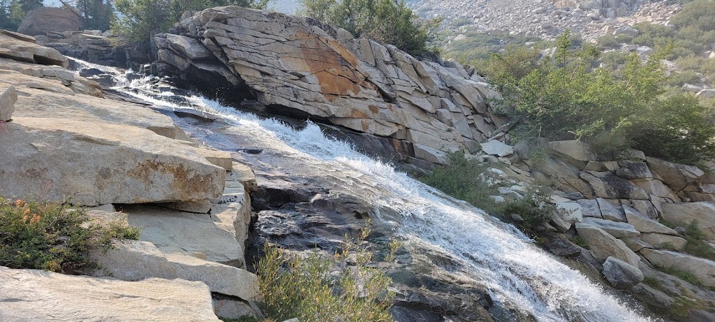
This was another long day with a lot of climbing. We were walking along the Bear Creek for the most part and saw some really lovely waterfalls.
However, the water situation at our destination campsite was suspect so we asked several hikers coming from the opposite direction to confirm that there was indeed some water at the West Fork. Thankfully the creek was flowing well enough.
It was a big campsite with great views.
Celebrating the end of a long day of hiking
At night we heard cowbells and the sound of hooves. It felt as if there were animals running through our campsite! None of us cared/dared to step out to see what was going on but we had all conjured our own wild imaginations involving different wild animals . Next morning we saw a lot of fresh mule dung on the trail – most likely some packers with a mule train had passed through the trail at night! What a let down 🙂
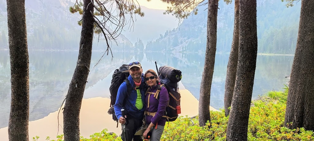
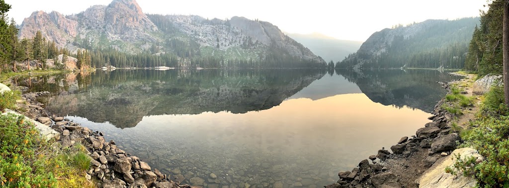
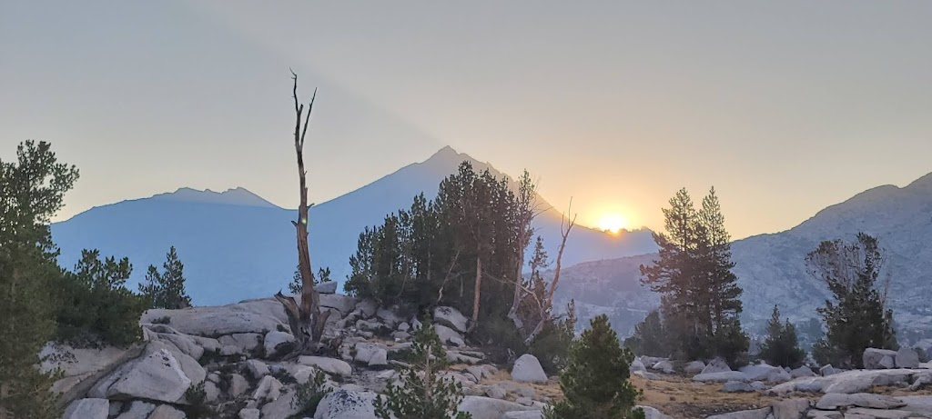
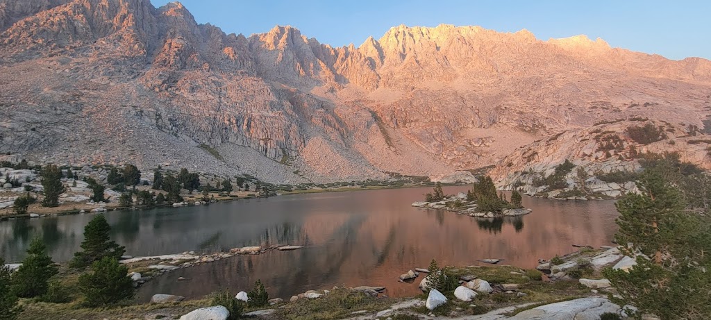
Within the first hour of our hike today we reached Marie Lake. We arrived there just as the sun was rising above the mountains. It was truly a mesmerizing time. We stayed at the lake for nearly an hour and watched as the rising sun magically transformed everything around us.
From here we continued our climb to Seldon Pass (10,870 ft). I accidentally dropped Ashutosh’s phone while taking his picture. It felt like a soft drop but the screen was badly cracked. He had bought the phone only a week ago for JMT. However, to Ashutosh’s immense credit, he did not once show his displeasure. He took it in stride. I wish I could learn to be that equanimous.
Views from Seldon Pass
Climbing down from the pass we passed two more beautiful lakes – Heart Lake and Sally Keyes Lakes. I took time to enjoy the views at both lakes before continuing down to MTR.
It was a long and rocky descent. At some point during the descent I twisted my left ankle. It didn’t feel too bad and I was still able to descend at a fairly good clip. It won’t be until the next hard descent two days later that the ankle will really start troubling me.
Ashutosh and I reached Muir Trail Ranch (MTR) at around 11:30am and quickly found and laid claim to a good campsite for the group. Our original plan was to camp here. MTR was also our (third) food resupply point. After the rest of the group arrived, we retrieved our food buckets and packed our food for the next five days.
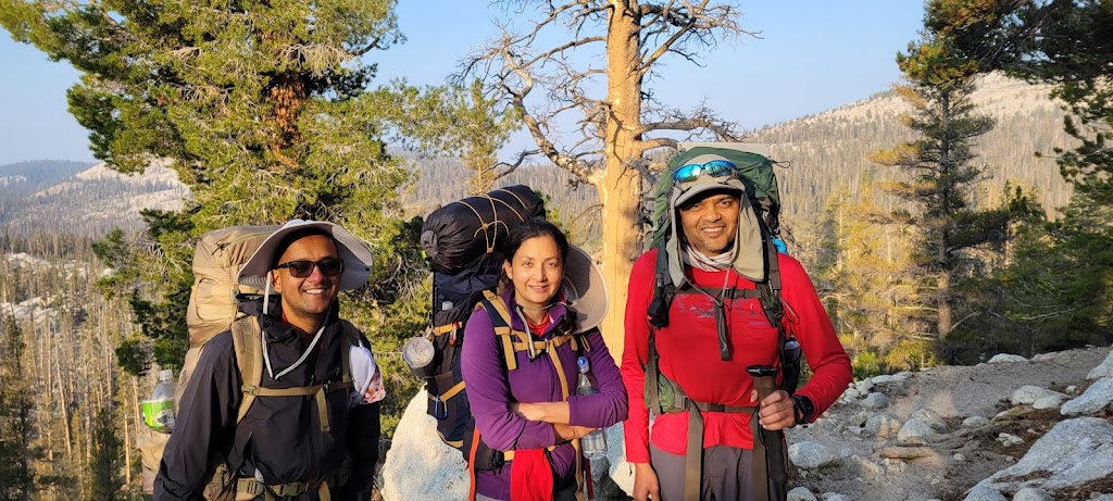
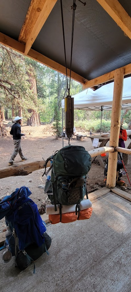
We weighed our packs on the scale. Ankur, Samir and I had the heaviest packs at around 42lb. I had been carrying about 2 extra pounds of weight to help Meenal. Samir was carrying extra weight as well to help Meenal and Anu.
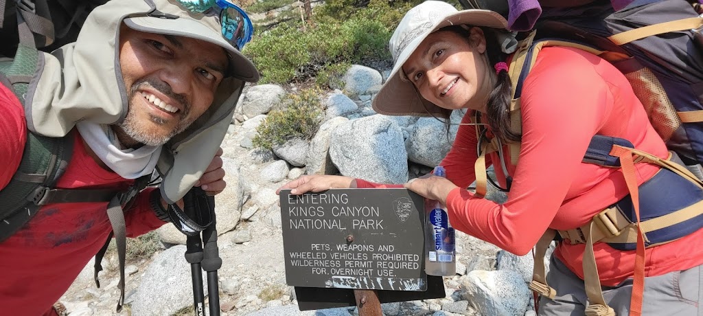
At this point the group decided that it would be a good idea to continue for a few more miles today to cut down on the distance + elevation for tomorrow. Ashutosh was really looking forward to dipping in the hot springs at MTR but gave it up to go with the group decision. We hiked for an additional 3.5 miles to reach Piute Creek. Along the way we entered the Kings Canyon National Park.
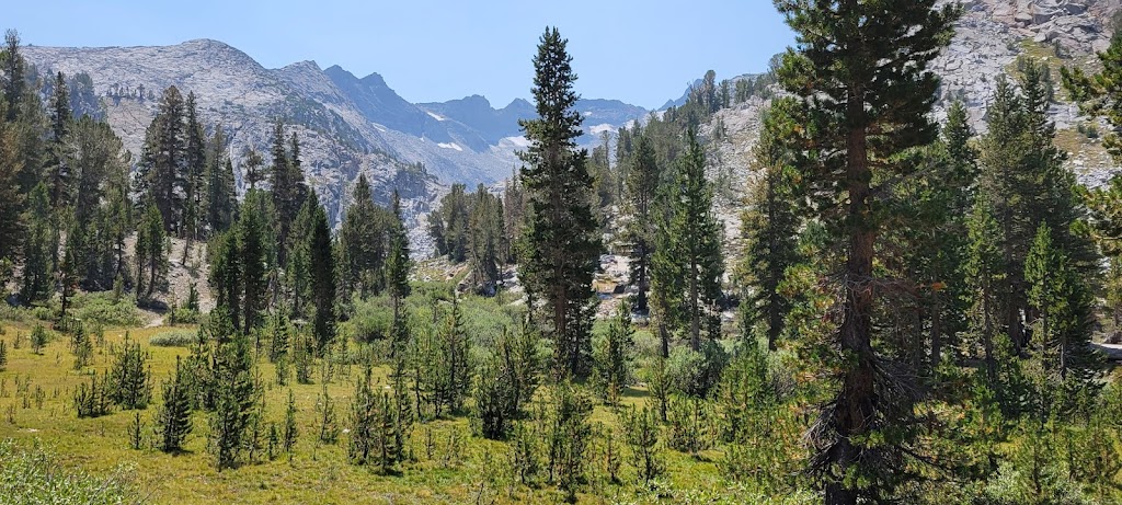
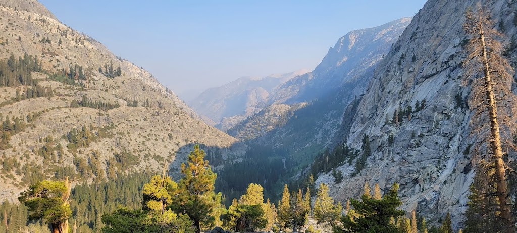
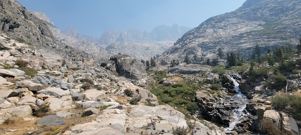
The views in Kings Canyon were really different and more dramatic than what we had seen so far. We initially traveled along the South Fork San Joaquin River.
We then arrived at the Goddard Canyon area followed by Evolution Valley. The views here were simply stunning. Unfortunately the visibility wasn’t as good due to the smoke from wildfires burning in various California parks and forests. Still the cascading waterfalls and deep valleys made us forget about the incessant climb. These were some of the most exquisite views we had seen so far.
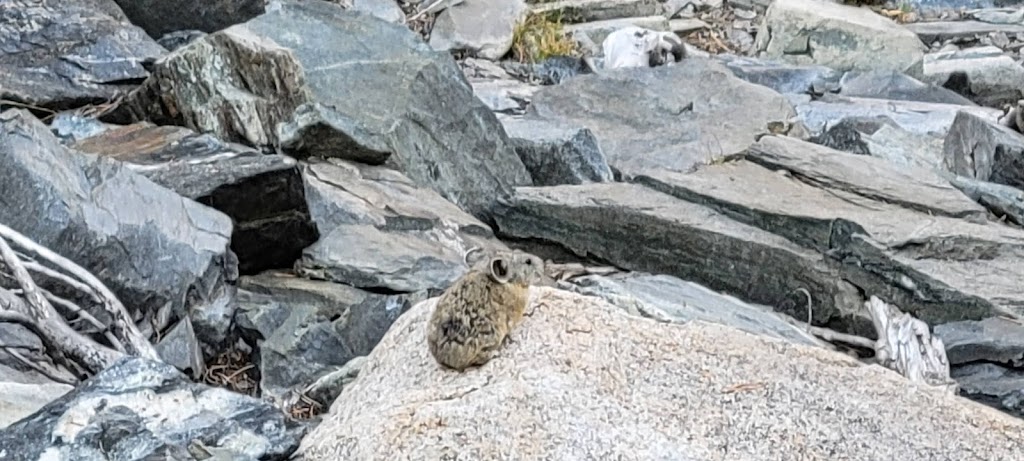
Pika
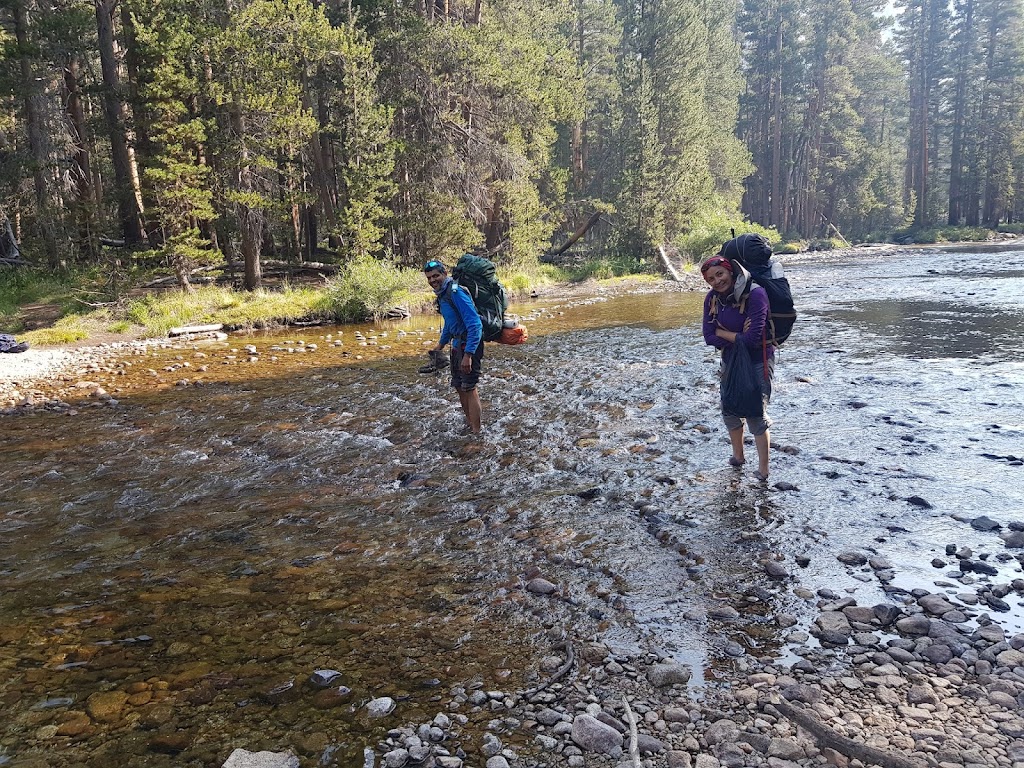
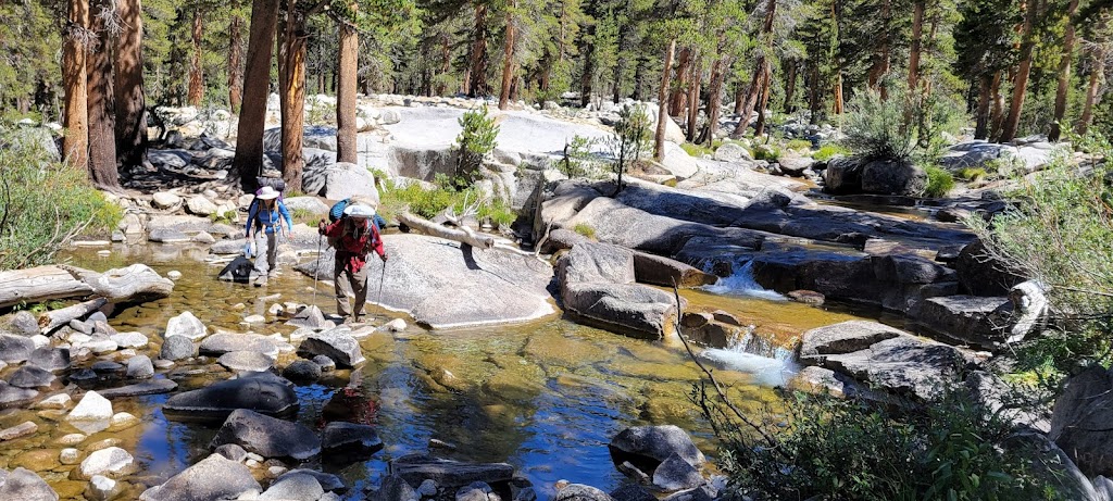
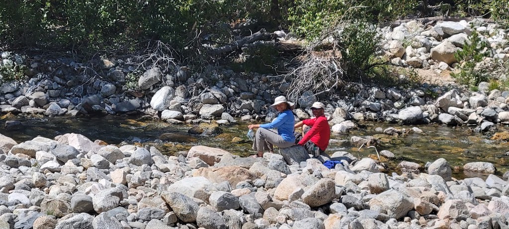
Now the trail continued along Evolution Creek. At one point we had to cross the river and the water level was high enough that we had to take off our shoes. In non-drought years this would’ve been a much more treacherous crossing. While we were tippy-toeing through the stream in our sandals, Ankur showed up and strode through the stream in his high ankle boots with disdain 🙂
The area around here was named after prominent figures in evolutionary biology by Theodore Solomon, the visionary of JMT These names include Mount Darwin, Fiske, Haeckel, Huxley, Spencer and Wallace along with Evolution Valley and Evolution Lake.
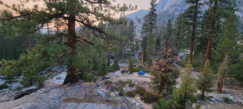
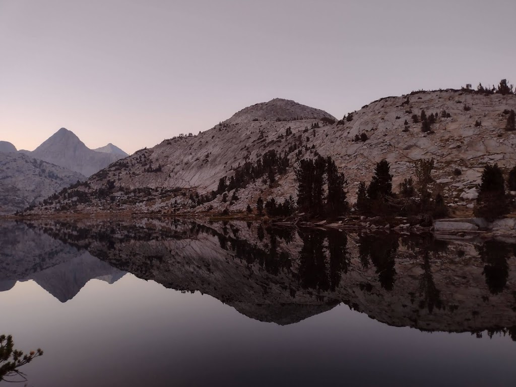
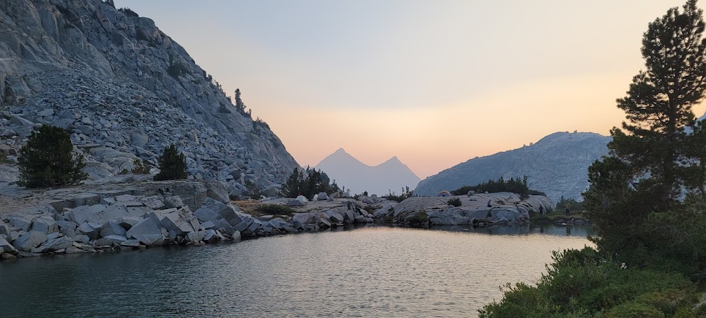
We camped at the north end of Evolution Lake. Thanks to the Guthook app, we were able to find a large enough campsite for our group. The site was hidden from view from the trail.
The sunset was really spectacular here. Mountain peaks turned golden and their reflection in the lake created such magic that we did not want to go back to our tents until it was dark.
Note the change in color although the two lakes are connected!
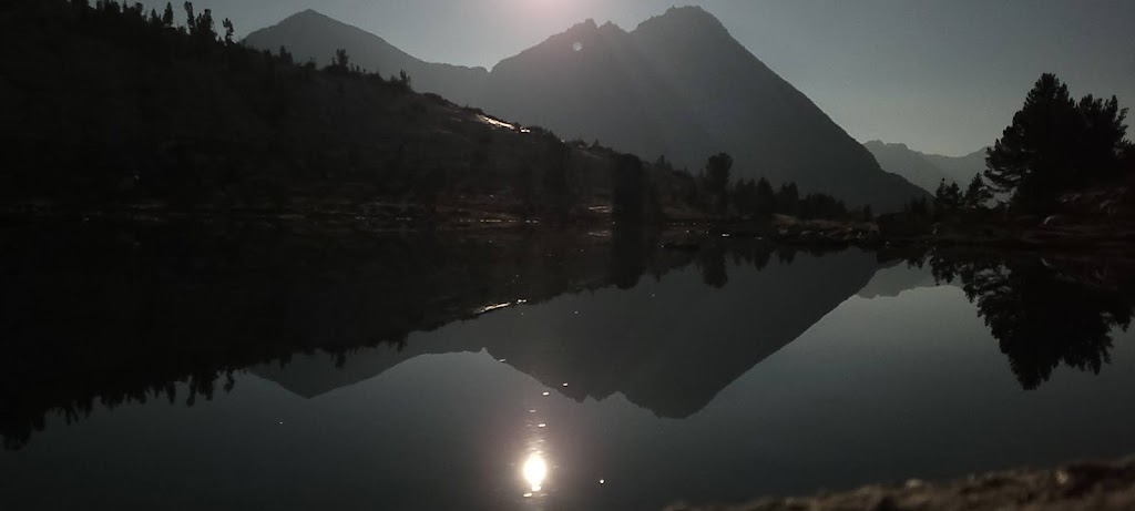
As the Sun went down, the Moon came up and casted its own magical spell.
Once again we started early enough in the morning to see the Moon handing over the reins to the Sun.
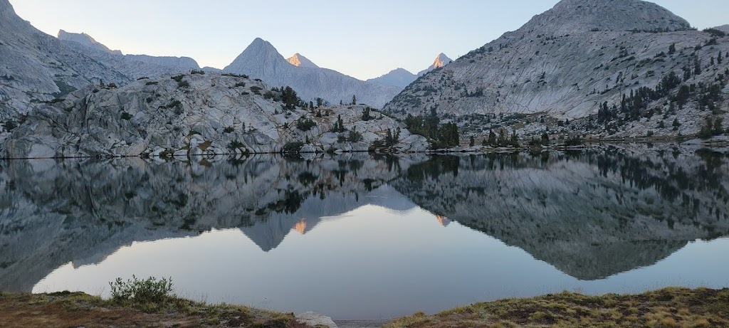
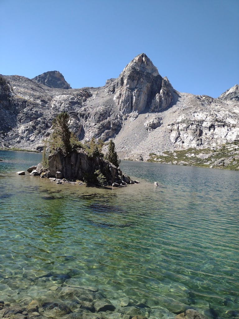
As we continued our climb up the Muir Pass, we walked along one lake after the other. Evolution Lake continued on for over a mile and led to Sapphire Lake. We then crossed an unnamed lake and arrived at Wanda Lake. Wanda Lake is named after one of John Muir’s daughters. Helen Lake, which is on the other side of Muir Pass, is named after his other daughter. Ashutosh and I spent some time enjoying the views at Wanda Lake.
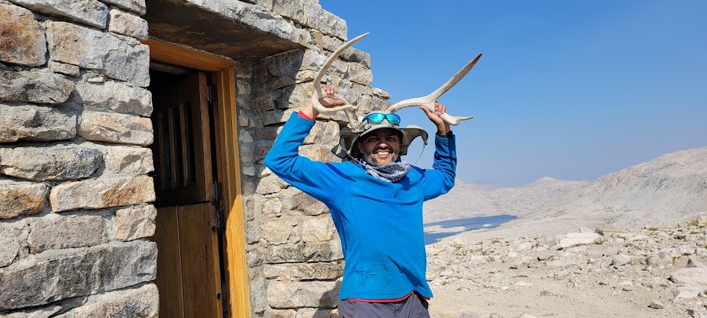
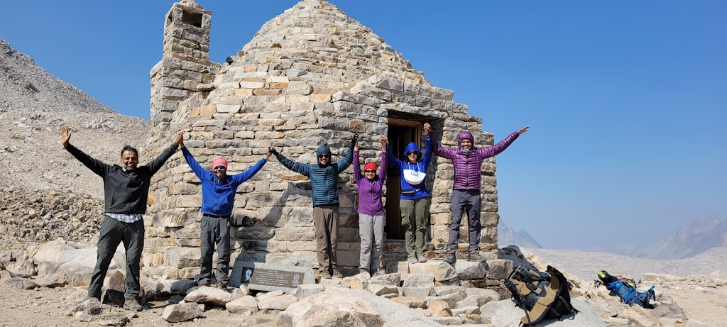
We then climbed the final section to reach Muir Pass and spent over an hour here, first waiting for the rest of the group to arrive and then to take some pictures with the group.
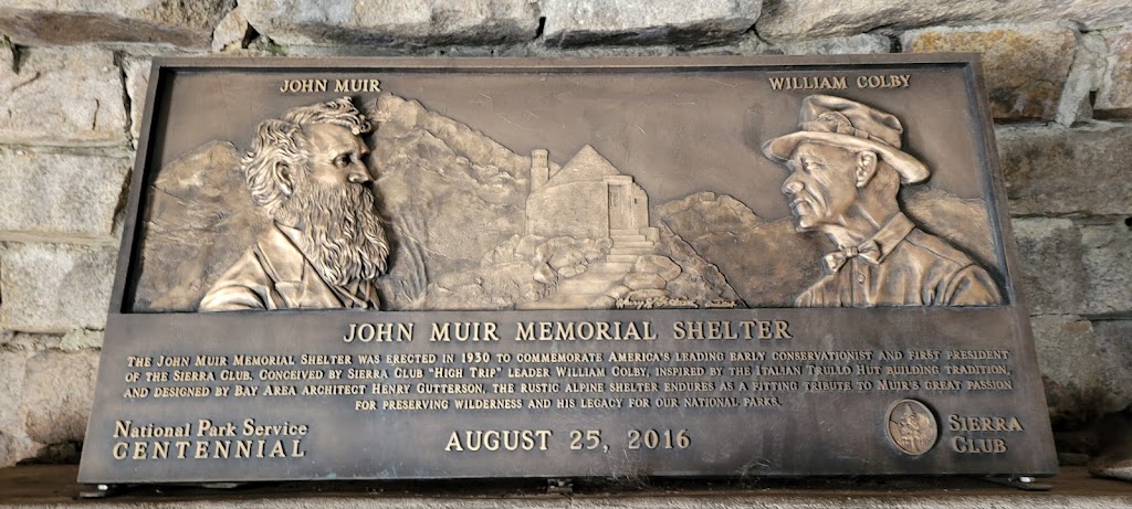
There is a shelter on Muir Pass called Muir Hut. It was quite cold outside so we mostly stayed inside the shelter and talked to fellow hikers. While sitting in the shelter we saw three different hikers in tears for different reasons. The first one was an old lady (in her 70s I think) who had failed her first attempt at JMT and while climbing the Muir Pass, was thinking that she may not be able to make it this time either. The second was a girl (Morgan) who was suffering from toothache. Her pain occasionally flared up and she was trying to figure out how to get to a dentist quickly and come back to complete the trek. Incidentally, we had met Morgan at MTR as well and had given her some of our excess food. Now I gave her most of my Advil and Tylenol so she had enough pain killers with her. Little did I know that I would need these medicines myself very soon and would have to borrow them from others! The third person was Meenal who was exhausted from the climb and had tears of joy in her eyes. It was a very emotional scene at 12,000 ft.
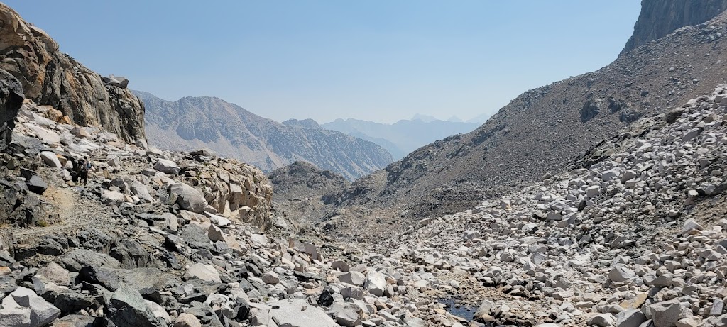
The climb down from Muir Pass was extremely rocky with giant craggy steps and no stable surface to step on. My left ankle (which had twisted two days ago) started hurting a lot and I had a really tough time going down. Usually I was the quicker one going downhill but today Ashutosh was far ahead of me and had to stop frequently to allow me to catch up. I was limping and was trying my best to protect the ankle. We had another 8 miles to cover with a 4,000 ft descent.
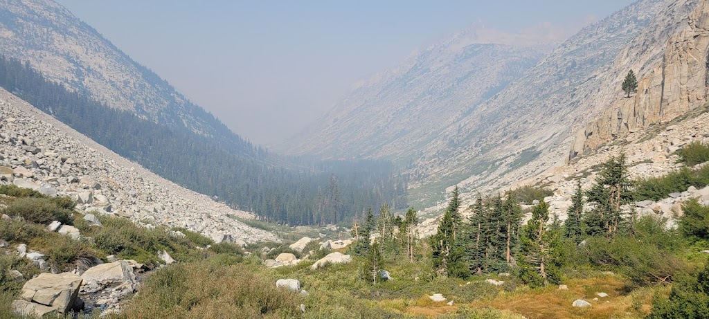
Along the way we saw Helen Lake, Le Conte Canyon and traveled along the Middle Fork Kings River for the most part. The views were again spectacular. Some parts of the trail had been created by blasting off the canyon’s sheer granite wall. We mentally thanked the trail engineers again for their hard work in creating and maintaining this trail.
Le Conte Canyon
Ashutosh suggested camping early to give my foot some rest but that would just mean adding more distance the next day. Half limping and half grimacing, I managed to cover the distance. I wrapped my ankle in a sports bandage and it stayed that way for the rest of the trip. I also took some Advil everyday to keep the inflammation down.
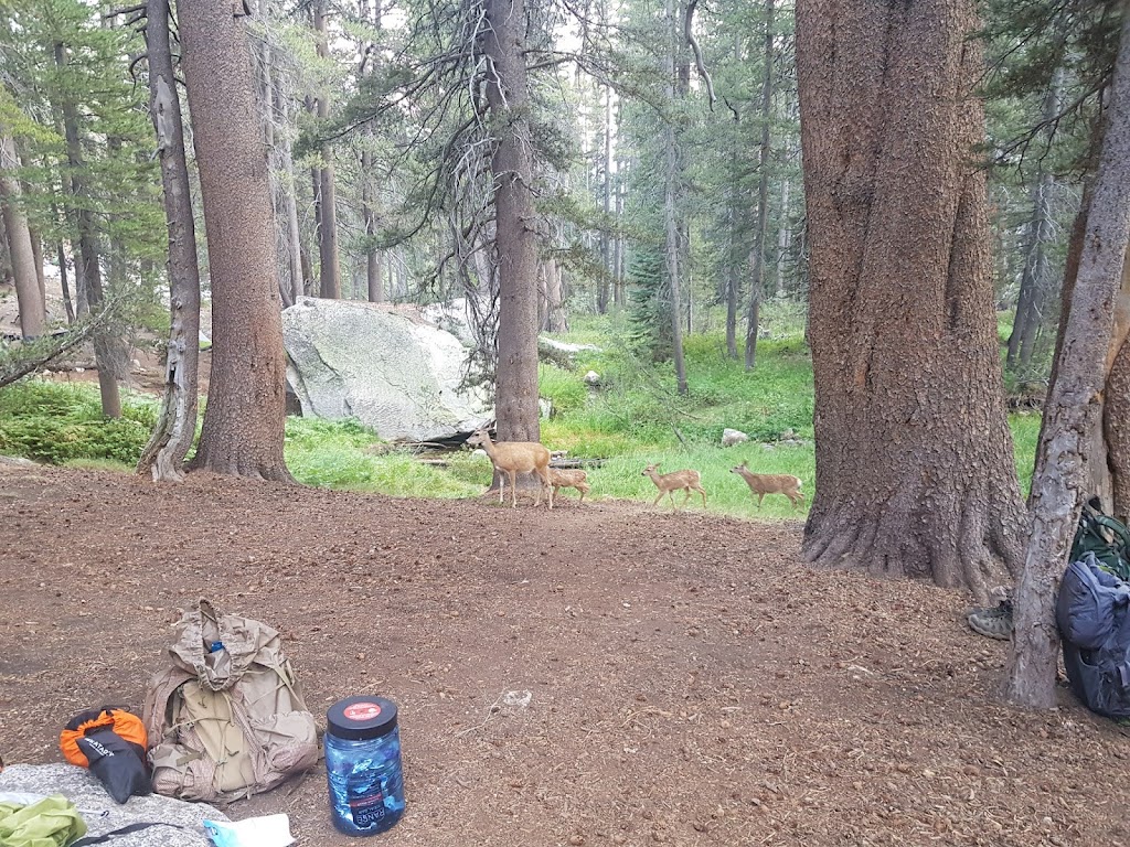
We saw a family of deer at the campsite. They seemed completely unafraid of humans and despite our multiple attempts to shoo them away, they adamantly kept coming back. Reading the notes from other hikers we discovered out that the friendliness of these deer was just a sham. They were notorious for chewing anything they found interesting including the straps of hiking poles! We had to take extra precautions that night and carefully stowed our gear in addition to our food.
We passed Morgan again who had camped ahead of us but was now returning back to take the Bishop Pass exit to get to a dentist. Apparently she had also shared the food we gave her with other campers. We met at least two other campers who asked us if we had given her the Indian food which she had shared with them. We had added a little spice to their trek 🙂
Along the way we crossed Grouse Meadow with outstanding views of Le Conte Canyon and also one of the largest blueberry patches in the Sierra. Unfortunately the berries were not ripe yet. The initial part of the trail continued alongside Middle Fork Kings River until it joined the Palisade Creek and diverged. The rest of the trail paralleled Palisade Creek. We again saw a burned out forest area, this time from the 2002 lightning-started Palisade Fire.
Views from Grouse Meadow
Blueberry patch – at least that’s what the book said 🙂
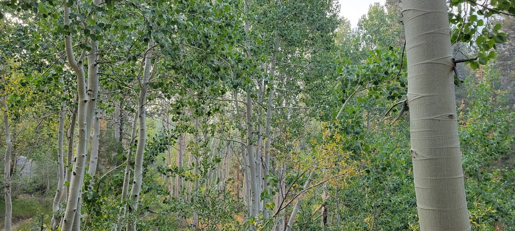
Beautiful Aspen trees
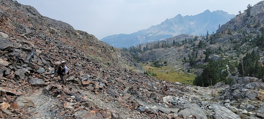
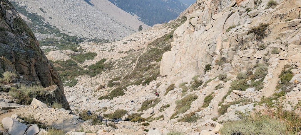
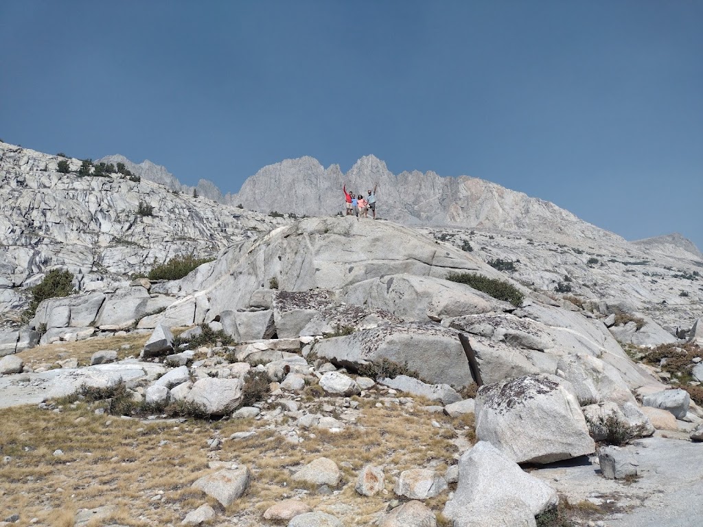
We finally reached the famous “Golden Staircase”. This is an exposed, 1,500-foot climb up steep switchbacks. Time and again during the trek we looked at steep climbs with disbelief. How are we going to climb that?? But the trails have been really well designed.
Golden Staircase was the last constructed section of JMT in 1938. It is a notoriously hard climb but somehow I found it to be quite easy and was able to cover it very quickly. Ashutosh and Anu also made easy work of this section. I did stop frequently to admire the views of the valley and cascading waterfalls. Here are some views from the climb:
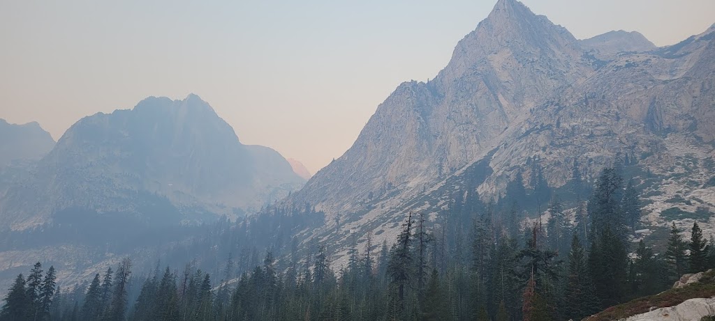
Hazy skies are due to smoke from the wildfires 🙁 Some days it was quite bad
Can you spot Anu coming up the Golden Staircase?
We did it!
After setting up our tents, Ashutosh and I took a dip in the freezing Lower Palisade Lake and also rinsed our clothes.
While I was rinsing my clothes, one of my sandals somehow got swept away in the lake. By the time I noticed it, it was in the middle of the lake. I do not know how to swim. In fact Ankur was the only one in our group who could potentially swim that far. I was trying to convince him to retrieve my sandals but I am sure he was not crazy about jumping into the frigid water. Just then I noticed another hiker who had his shirt off and it seemed he was planning to take a swim. I told him about the situation and amazingly he agreed to help me out. What an extraordinary act of kindness.
Watch the epic swim
It was a really beautiful campsite. We had a photo shoot, played some games and had a lot of fun.
Brrrr. It was really cold – perhaps the coldest morning so far. There was frost on our tents and gear. It was really hard to cook and pack up.
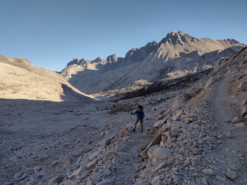
We started the day with an immediate 1,500 ft climb to Mather Pass. We saw a number of tarns along the way.
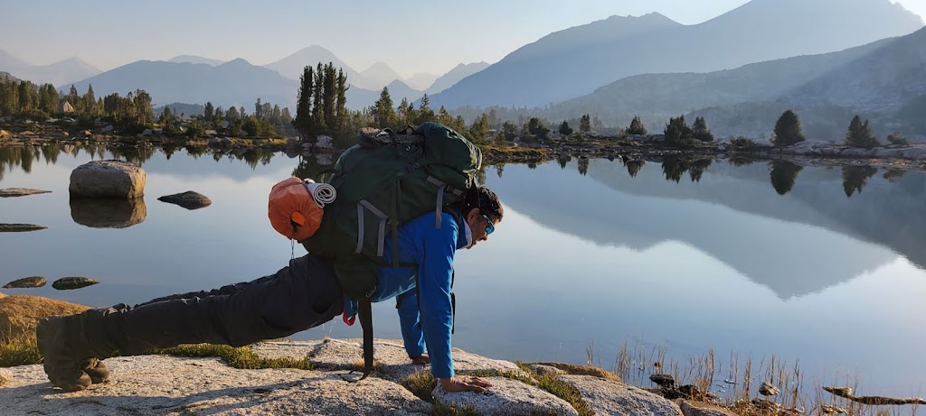
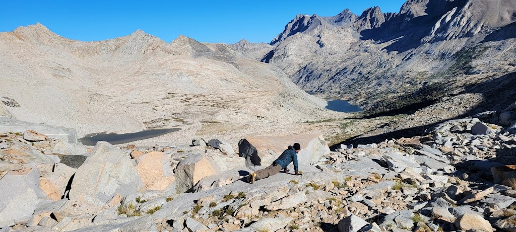
Top of Mather Pass. Ashutosh decided to do a plank at every mountain pass 🙂
From here we descended down 2,500 ft until we reached the South Fork Kings River crossing. I was trying to protect my left ankle while walking down but that meant that my gait was a bit off. I was still trying to walk at my normal speed. I lost my balance a couple of times and was chided by Anu to be careful. The third time I actually fell down and got some bruises on my palms and right knee. My pants had a tear as well. Anu and Ashutosh decided to flank me and controlled the pace to force me to slow down. I also decided that it was better to ignore the pain and walk normally than to try to protect the ankle and walk unsteadily.
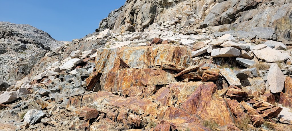
Avalanche chutes stopping at the trim line indicating how high the ice was in this area
We then started a 3 mile climb to our destination – Lake Marjorie. As we started the climb, I met many other hikers who were also planning to camp there. I decided to speed up to get enough campsites for our group and covered the 3 mile climb in about 1 hour. It turned out to be a good decision because there was only one area large enough to accommodate all of us and I got to it just minutes before another group showed up.
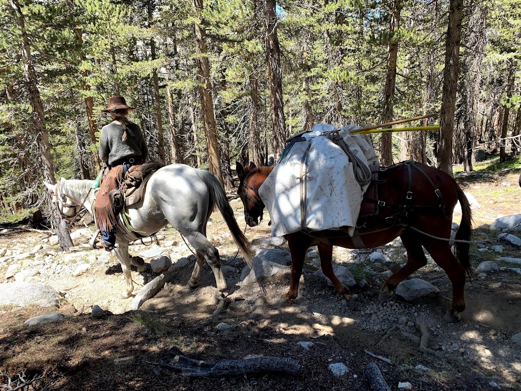
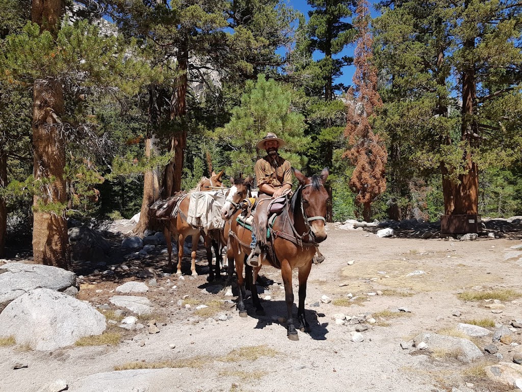
We saw a mule train along the way. There were two groups of mules/horses coming down the trail. It was fascinating to see them navigate the rocky terrain with ease.
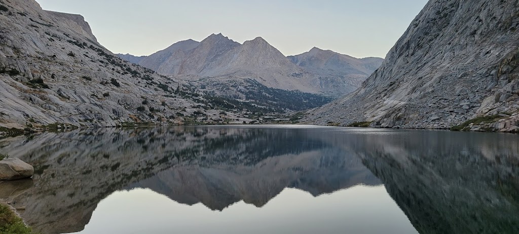
Lake Marjorie was shimmering with the sunlight and reflected the blue skies. It was really pretty but once again it was very windy here. There were very few trees to shelter us from the wind.
Our strategy of breaking up the big climbs across two days was working well. We had only 1,100 ft remaining to reach Pinchot Pass (12,100 ft).
View from Pinchot Pass
From here it was an easy hike down to Woods Creek. Woods Creek was our final food resupply point. We crossed a nice suspension bridge which is called the Golden Gate of the Sierra to get to Woods Creek.
We had hired a mule pack company (Sequoia Kings Pack Trains) to bring our food here. When we arrived at Woods Creek, we found the packer (Tom) waiting for us there. He had arrived the night before but had no idea when we were going to arrive! We had communicated our timing to the pack company but they had no way to communicate that back to Tom who was bringing our food. We had also asked them to bring a few fuel canisters for us but the pack company missed that. Fortunately Tom had two extra canisters with him and said he can bring two more later down the trail. Working with Sequoia Kings Pack Trains was a frustrating experience. They are really nice but are very unresponsive and in this case even missed our fuel canister request which would’ve been really problematic if Tom didn’t happen to have extra canisters. Fortunately it all worked out in the end. Interestingly Tom turned out to be from Fremont (Aknur’s home town) and mentioned that his mom and dad are both engineers!
Woods Creek campsite was really nice. We had a relaxed day here.
This was perhaps the easiest day of the trek. Ashutosh and I reached our destination at 10:30am despite taking multiple breaks including a long photo shoot at Dollar Lake which was the first interesting stop today. Not sure why it is called Dollar Lake but it sure was pretty – perhaps someone thought that the views were worth a million dollars? We could see the Fin Dome in the background perfectly reflected in the water. Ashutosh and I spent a fair amount of time here. At one point while climbing a rock few feet inside the lake, I slipped and got one of my feet wet. Wet feet are a recipe for getting blisters but we didn’t have too much distance left to cover so I decided to continue on. Putting on dry socks in a wet shoe wouldn’t have helped anyways. Fortunately I didn’t get any blisters.
Dollar Lake with Fin Dome in the background
We then crossed a somewhat better named Arrowhead Lake which can indeed look like an arrowhead with some extra imagination. We also saw a mountain named Painted Lady. It looked nice but honestly I didn’t think that it was colorful enough to earn that name. Perhaps I was being too cynical today 🙂
Arrowhead Lake + Painted Lady
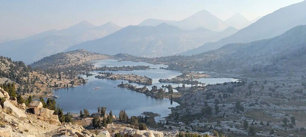
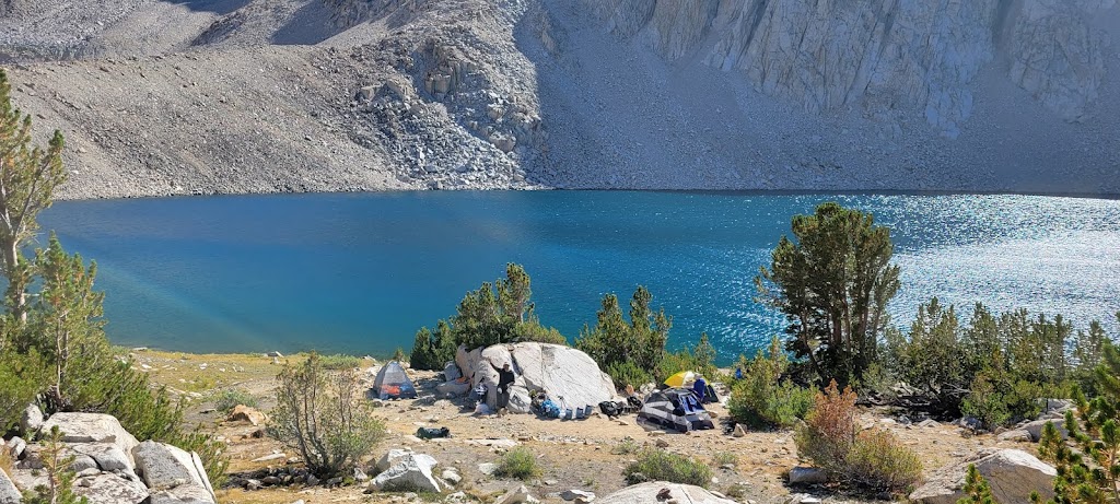
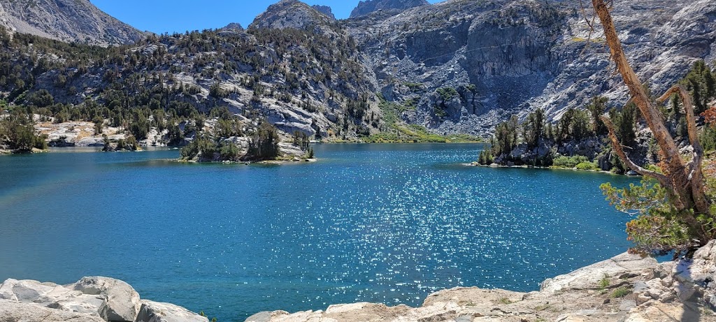
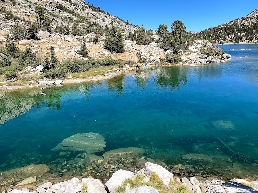
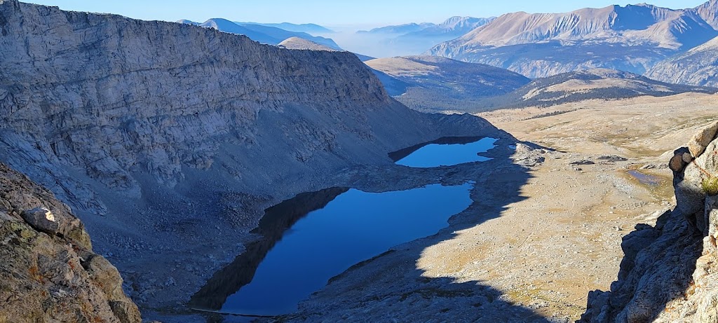
All that cynicism disappeared once we reached Rae Lakes. It is a collection of three spectacular lakes – Lower, Middle and Upper Rae Lakes. We crossed the isthmus joining the Middle and Upper Rae Lake and turned on the Sixty Lake Basins Trail for our campsite. We found an amazing site with uninterrupted views of multiple lakes and a private beach access. It was a small site so we had to cozy up our tents.
Rest of the group also arrived between 11:30 and noon which meant we had a lot of time to enjoy this beautiful place.
Ashutosh and I braved the cold water for our final alpine dip of the trek. Another interesting incident happened here – there were some really intrepid squirrels in this area. One of them ran away with Samir’s spoon! Fortunately I had a spare fork which Samir used for the remaining days.
The day started with us completing the remaining climb for Glen Pass. A 1,500 ft climb doesn’t sound very hard but when you are at 11,000+ ft elevation and carrying a heavy pack, it multiplies the difficulty. We once again marveled at the work of trail engineers. All we could see were vertical walls but as we started climbing we saw the trail and switchbacks come into view and how that vertical wall had been broken down into manageable sections for climbing.
Top of Glen Pass
The packer at Woods Creek had told us that he will bring additional fuel canisters at the Charlotte Lake Trail junction at around 11am. This was around 5 miles out. We decided that Samir and Ankur will wait for the packer at the junction while Ashutosh and I will continue on and secure a campsite.
We had tentatively picked a place to camp by looking at the maps but it was unclear whether there was any water there. As we got closer we kept asking hikers coming from the opposite direction about the water situation. They all gave us different accounts! Many of them said there was little or no water on the trail beyond Bubbs Creek. It gave us a pause and we discussed whether we should take a chance or play it safe and camp earlier. I thought it was worth a shot to continue and Ashutosh grudgingly agreed. However we were both anxious because if we didn’t find water, we would have to backtrack several miles back to Bubbs Creek. To make matters worse, it was a hot day, we were on a steep incline and already running low on water.
We finally met a father / son duo who clearly said that the campsite we were targeting was a really nice site with good water availability. This proved to be accurate. It was a lovely, shaded campsite nestled between the mountains with a well flowing stream nearby.
Views from the campsite
We also met a young ranger along the way – she was on her way to Forester Pass and was planning to camp at the top! She had heard that there was a tentpad there and sure enough we met her there the next morning. She was just packing up when we reached Forester Pass.
Waking up at 4:15am was proving to be very hard. It was usually the coldest hour of the night and we had to use our headlamps because it was still dark. It finally ‘dawned’ on me that Ashutosh and I could leave later than the rest because we were fast enough to make up the difference. We should’ve thought about it earlier but better late than never 🙂
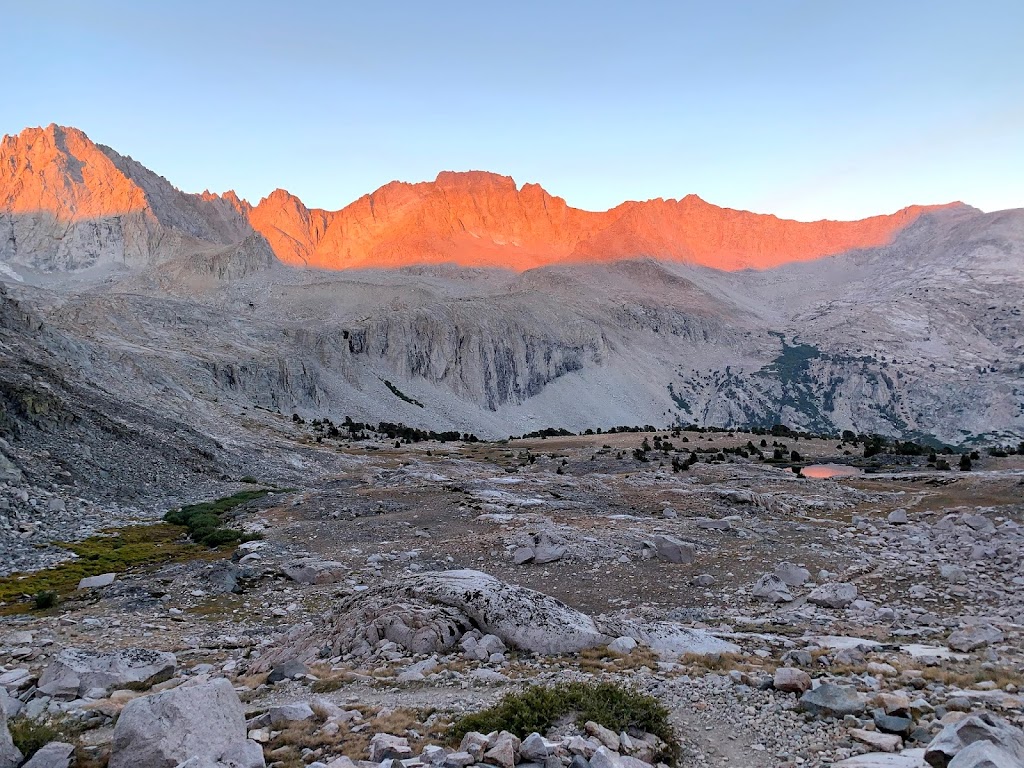
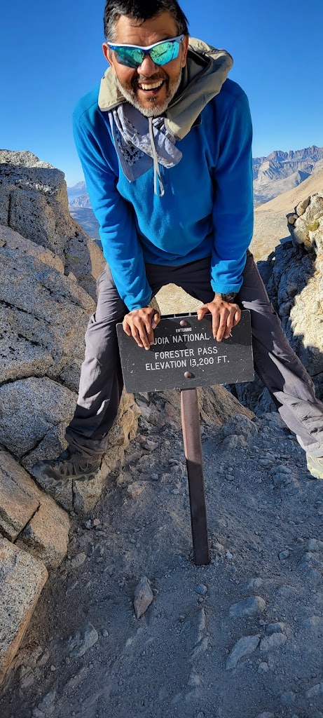
Therefore today we slept in a bit and started about an hour after the rest of the group. The first section was a 3 mile / 2,000 ft climb to Forester Pass (13,200 ft). We overtook our group on the way to the top and waited for them there. The views were simply amazing.
Climbing Forester Pass
Views from the top…
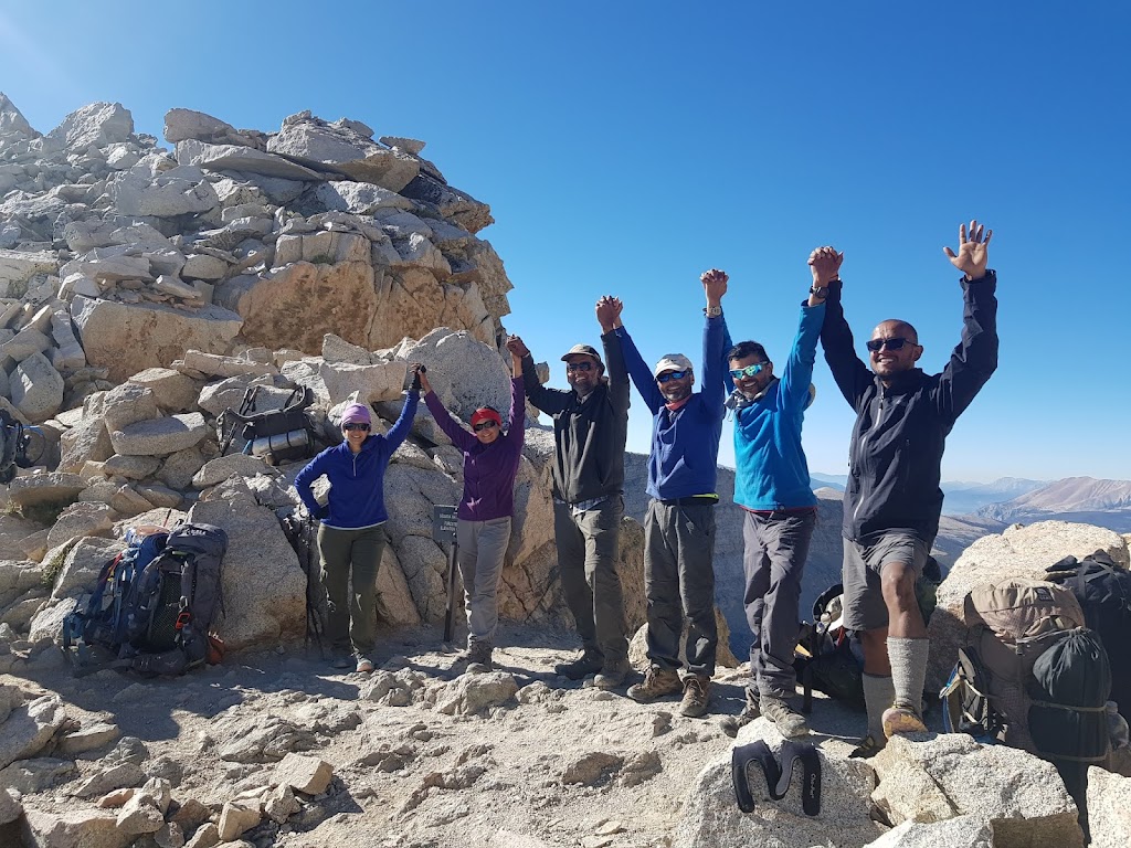
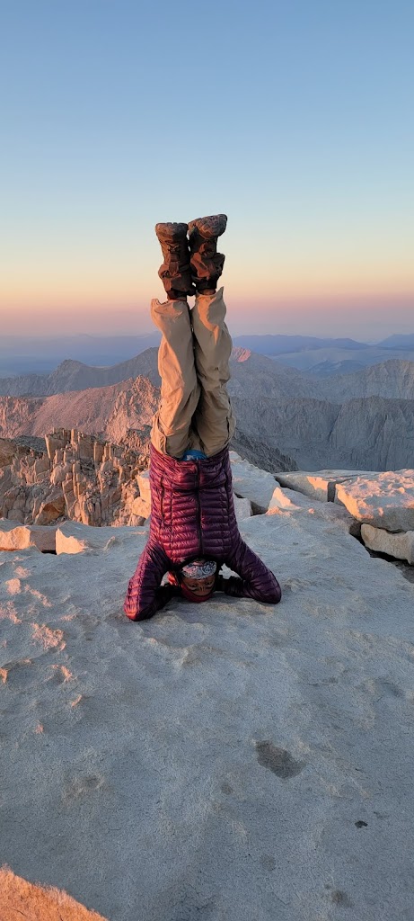
We all celebrated reaching the top in our own way…
This is where you enter Sequoia National Park
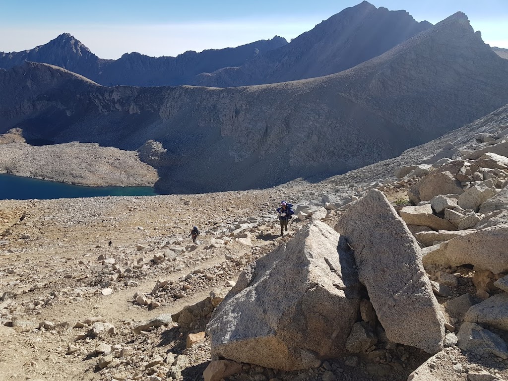
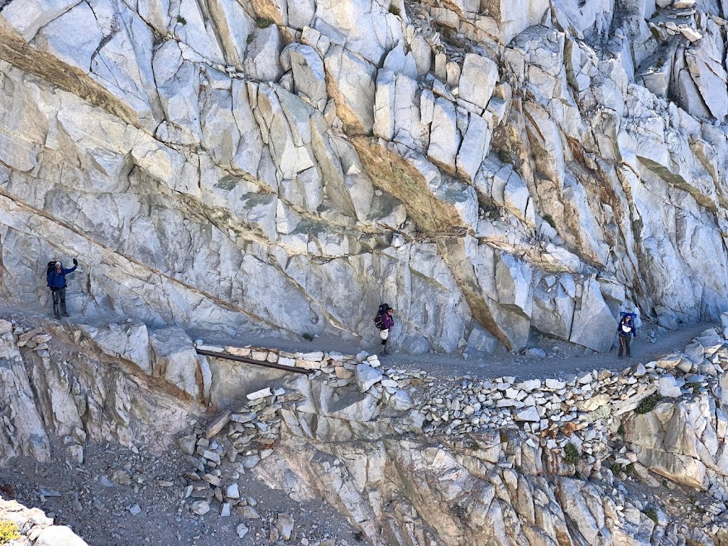
Climbing down from Forester Pass. You can appreciate how trails have been carved from vertical cliffs
After taking some group pictures we separated from the group again and reached Wright Creek at 1:45pm.
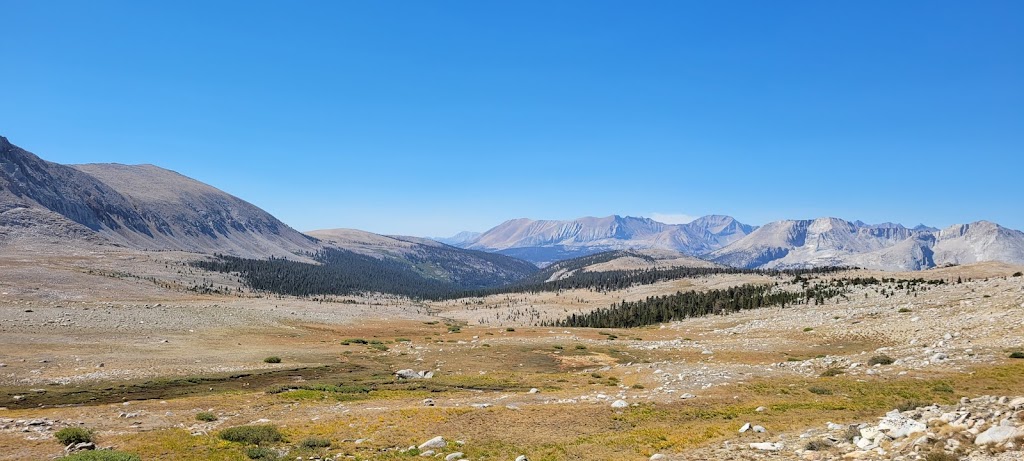
Along the way we stopped at a few places. Most notable were Tyndall Creek and Bighorn Plateau. Our original plan was to camp at Tyndall Creek but we decided to add a few miles today to shorten the distance to Guitar Lake. We thought an easier day before Whitney summit would be a good idea.
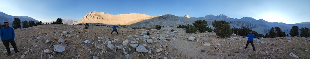
The views from Bighorn Plateau were simply magical but ironically you don’t see any sheep here! We did see panoramic views of the mountains including Mount Whitney.
Campsites at Wright Creek were really nice. We were surrounded by trees and could hear the flowing stream nearby.
Ashutosh and I again slept in and started one hour later. The extra hour in the morning felt so nice 🙂
Morning views
We stopped at the Crabtree guidepost where we caught up with the rest of the group. Samir had gone down to the ranger station to collect wagbags. It was a 0.5mile round trip to the ranger station. I decided to go there as well which turned out to be a good decision because the ranger was short on wagbags and only gave four bags to Samir. We needed two more which I collected. Wagbags are required in the Whitney zone.
We then passed Timberline Lake where you can see nice views of Mount Whitney reflected in the water.
Timberline Lake
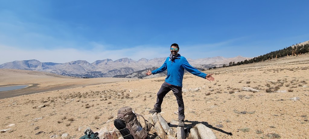
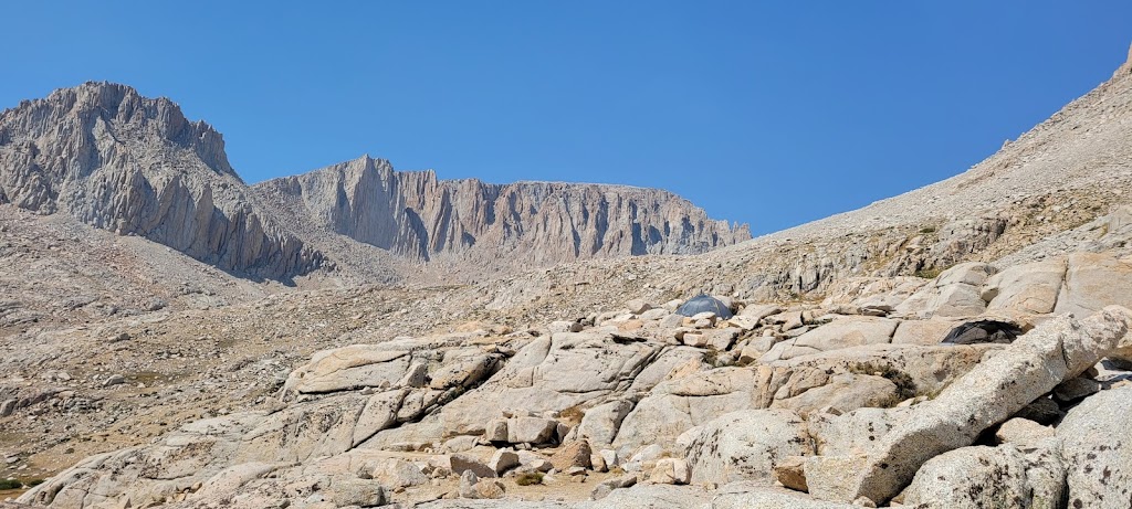
Soon thereafter we reached the aptly named Guitar Lake. We camped near a tarn a few hundred feet after Guitar Lake.
Playing guitar on my hiking pole in front of Guitar Lake 🙂
Anu photobombing my picture
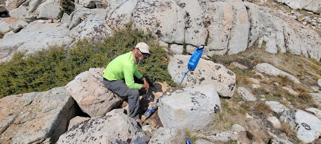
We were above the tree line and there was no place to hang our gravity water filters. Filtering water using the hand squeeze method takes too much time and effort. I found a rock with a vertical face and managed to engineer a solution (see picture). However in the process I lost one of my water bottles here – it fell through a crevice in the rocks and while we could see it clearly, it was completely unreachable.
Water bag is precariously balanced to facilitate gravity assisted filtering
Our tents were far apart at three different levels
Another group arrived soon after we did and gathered across the tarn from us. They started a photo shoot which was really strange because the women simply covered their front with US flag colored cloth. They remained completely uncovered from the back which made passing hikers uncomfortable. We thought this was a rather strange place for such a photo shoot.
Today was the last day before the final summit. We were all in a reminiscent mood. I was excited about completing the trek but was also somewhat sad that it was coming to an end.
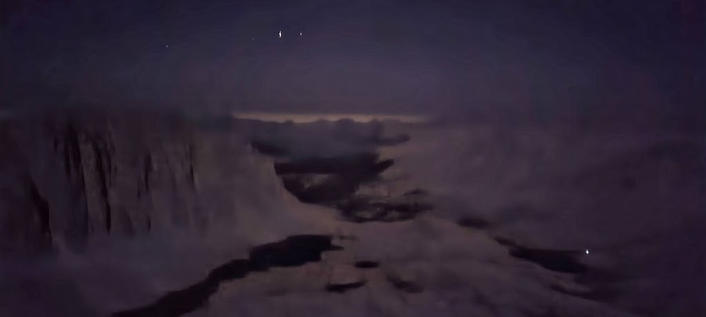
Our original plan was to leave at the usual early morning time. However, I suggested that we leave in the night to catch the sunrise at Whitney. Everyone agreed with the plan. Thankfully it wasn’t too cold.
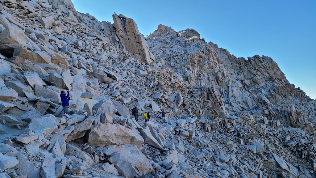
The first group left at around 1am. Anu, Ashutosh and I left at 2:30am. Anu usually has altitude related problems so we decided to go at a slower pace. We were using our headlamps to navigate. Shortly after we started my headlamp started behaving erratically and turned off. I managed to climb the rest of the trail using moonlight and the light from Anu and Ashutosh’s headlamps.
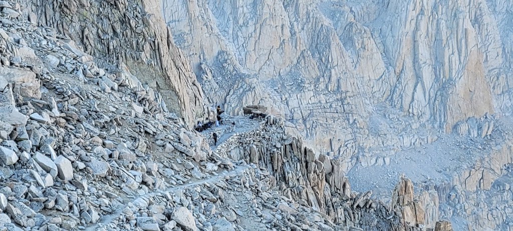
We met the first group at Trail Crest. This is a junction where the two trails, trail from Whitney Portal and trail from Guitar Lake, meet. We left our backpacks here and carried just water and snacks for the remaining climb.
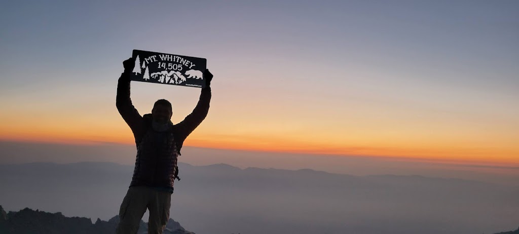
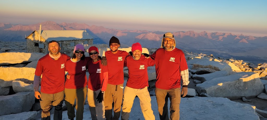
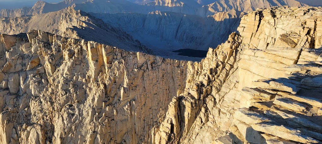
The timing worked perfectly. We reached the top just before the horizon started glowing. It was a spectacular sight. We were literally at the top of the world. We were able to get a cell phone signal and called our loved ones to let them know that we had officially completed our trek. It was an emotional moment full of cheers and tears.
From here it was a long, 11 mile and 6,000 ft descent down to Whitney Portal. Although the JMT trail was officially complete, we still had to cover this distance to reach the exit point.
This is where we had stowed our backpacks before the final ascent
It felt like a never ending trail. Finally after nearly 6 hours I reached Whitney Portal.
Emerging back into the civilized world 🙂
We had rented a shuttle from Whitney Portal to Lone Pine. We enjoyed some veggie burgers and fries while waiting for the shuttle to arrive. We had booked a hotel for our stay tonight.
We finally hung up our boots!
At Lone Pine we learned that due to the ongoing fires in California, all National Forests were being shut down as of Aug 31, 2021. All hikers were being evacuated. We were really lucky that we were able to complete our trek just one day before the closure. We met many hikers on our way back to the Bay Area who had to abandon their trek in the middle. I can only imagine how disappointing it must have been.
Aug 31, 2021: Return to the San Francisco Bay Area
Ashutosh stayed back in Lone Pine because his wife (Nidhi) was going to summit Whitney today. The rest of us took a bus from Lone Pine to Mammoth Lakes airport. Here we got a one way rental to the Bay Area. We dropped Ankur in Fremont and reached my home in Sunnyvale at around 6pm.
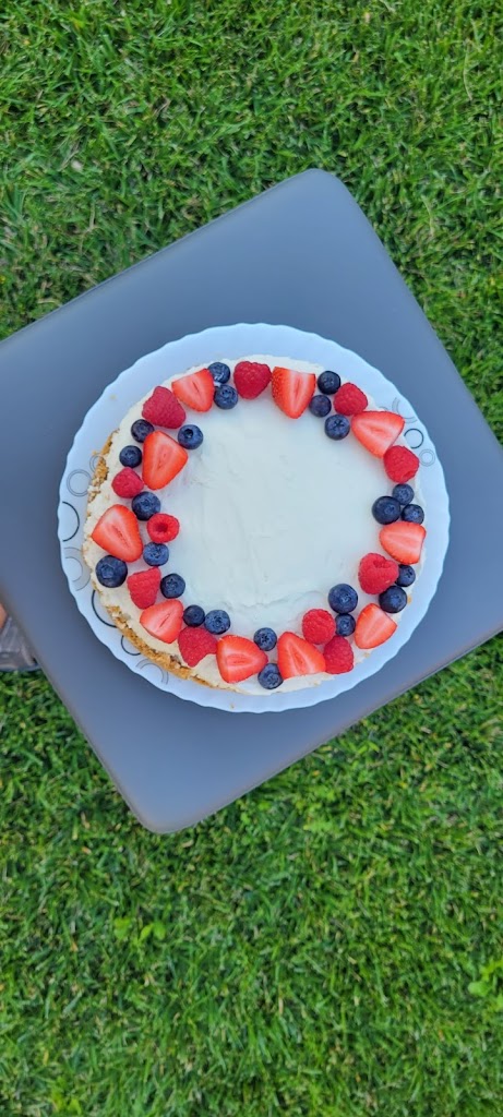
My family had prepared a welcome cake and poster for us 🙂
It was an incredible trek but it also felt great to be back home.
Currently Founder of Zinrelo - a loyalty rewards & referral marketing platform.
I live in Sunnyvale, California with my wife and three amazing kids. Having worked hard for 28 years of which the last 22 have been as an entrepreneur, I am now trying to find some work-life balance and learning to love outdoors. I have taken up running, biking and trekking and have done a few marathons, ultra-marathons and treks including Everest Base Camp (17,600 ft), Stok Kangri (20,187 ft), Grand Canyon Rim-to-Rim, Mount Shasta (14,200 ft), Mount Whitney (14,500 ft), Chadar Trek and bike ride from SF to LA. This has given me a different type of challenge that requires both mental and physical toughness and a high degree of discipline and commitment.


 – Summary : Aug 11-30, 2021")


 – Summary : Aug 11-30, 2021")
