Mount Whitney Climb: Aug 29, 2018
Climbing Mount Whitney - The Tallest Mountain in Mainland USA
At 14,505ft, Mount Whitney is the tallest mountain in the mainland USA. It is one of the most popular hikes because you can hike to the top without requiring any mountaineering skills. There are two options to climb Whitney:
- Day Hike: this is a 22 mile round trip which can take anywhere from 10 hours to 20+ hours depending on your fitness level, your speed and how much time you spend taking pictures :) It is fairly tough and not recommended unless you are in good physical condition.
- Overnight Hike: There are a few camp grounds along the trail. Although you have carry extra load, camping overnight makes it easier.
We decided to go for the Day Hike option. There were six of us - Ankur, Gunna, Vijay, Vikas, Vivek and myself.
Trail Overview
- Distance: 22 miles (35.4km)
- Total Climbing: 6,100 ft (1859m)
- Highest Elevation: 14,505ft (4421m)
 |
| Hiking route as captured by my Garmin Fenix 3 Watch |
Interactive Google Map of the hike. (Garmin added a straight line between Trail Camp and Trail Crest. Ignore that.)
The hike can be divided into the following sections:
- Whitney Portal (8,374ft) to Lone Pine Lake (10,000 ft). This is a roughly 2.8 mile stretch. Shortly after Lone Pine Lake, the permit area starts where you can only hike if you have a permit for that day.
 |
| Whitney Portal to Lone Pine Lake: About 2.8miles with 1,600ft elevation gain |
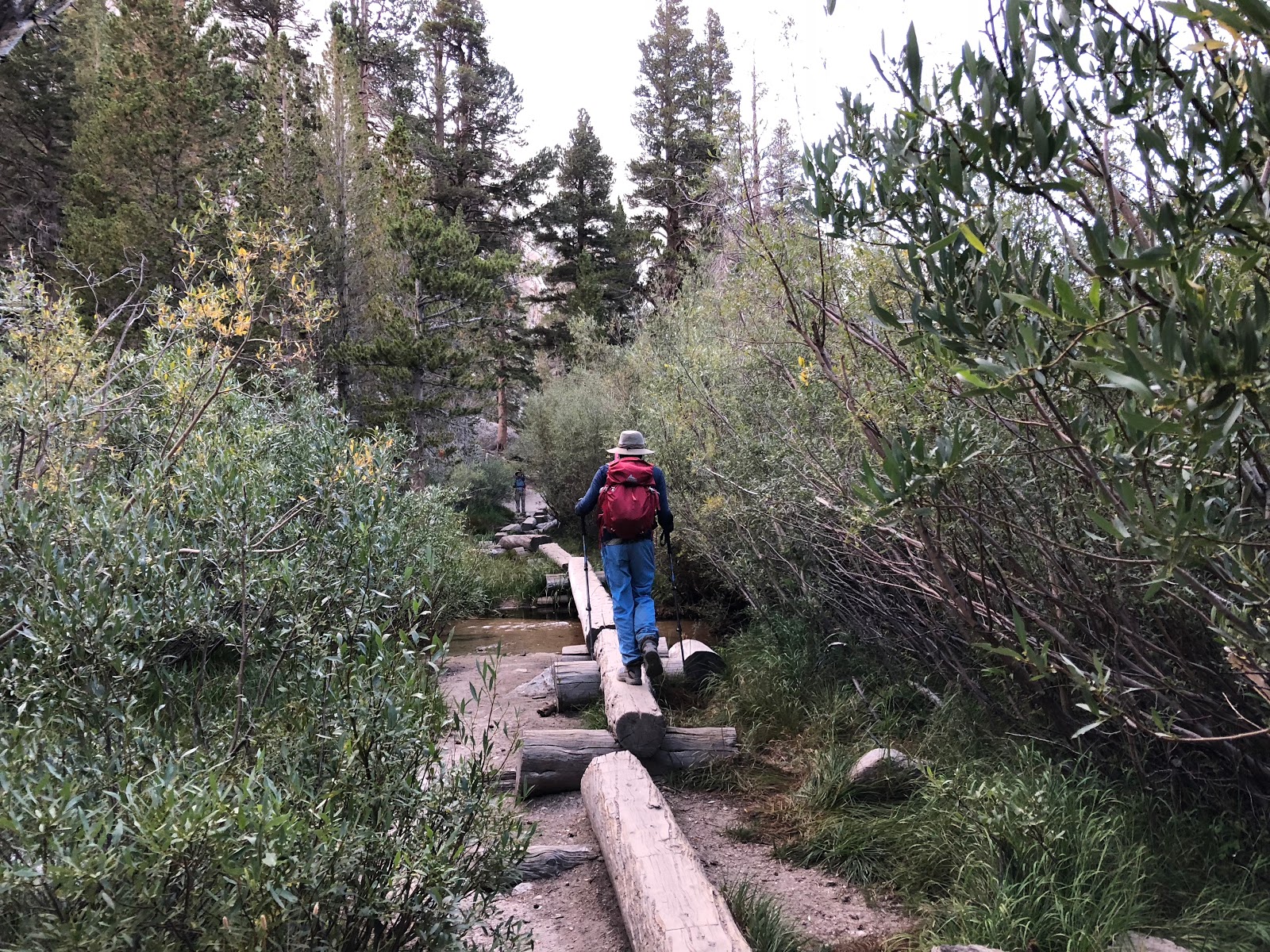
- Lone Pine Lake to Outpost Camp (10,400ft). Total distance: 3.8miles. This is only a 1 mile stretch. It is a flat area with lot of places to pitch tents. There's also a nice waterfall here which we only saw on our way back. Shortly after Outpost Camp you pass the Mirror Lake. Unfortunately it was too dark to see it on the way up and we were in a hurry to get back down on the way back - so we didn't really get to spend any time at the lake.
 |
| Lone Pine Lake (2.8miles) to Outpost Camp (3.8miles) and Mirror Lake (4miles) |
- Outpost Camp to Trail Camp (12,000 ft). Total distance: 6 miles. Trail camp is another popular camping place. This is the last place to refill water before the remaining 5 miles. You pass a big lake called Consultation Lake to the left.
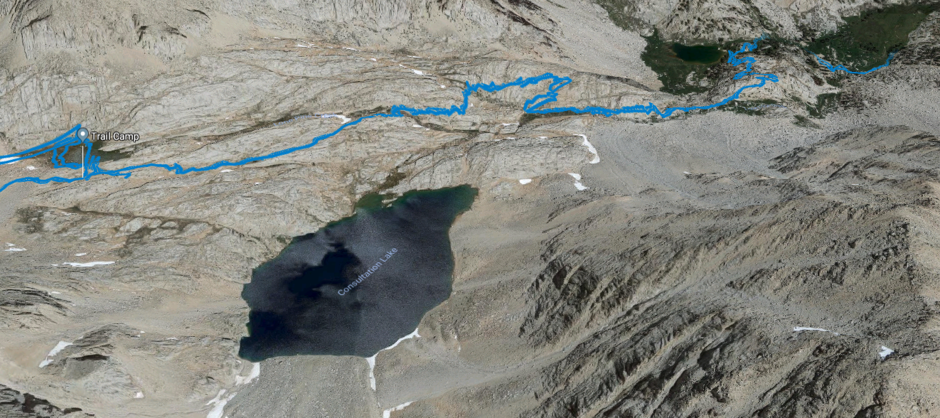 |
| Outpost Camp (3.8 miles, 10,400 ft) to Trail Camp (6 miles, 12,000 ft) |
- Trail Camp to Trail Crest (13,700 ft). Total Distance: 8.2 miles. This is usually considered the hardest section of the trail. You have to climb 99 switchbacks over the next 2 miles and gain 1,700 ft of elevation. It is also well above the tree line with no shade.
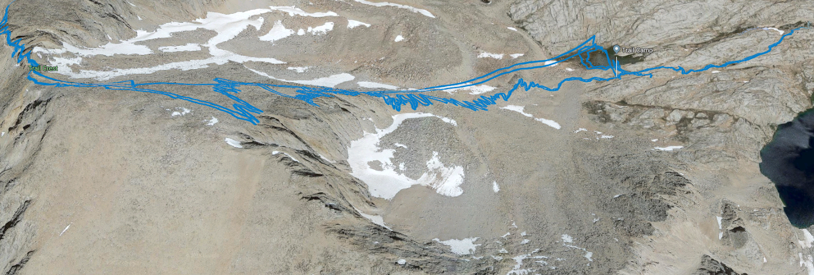 |
| Trail Camp (6 miles, 12,000 ft) to Trail Crest (8.2 miles, 13,700 ft). Crossing 99 switchbacks. Ignore the straight line - Garmin malfunction :( |
- Trail Crest to Summit (14,505 ft). Total Distance: 11 miles. You gain another 1,000 ft over 3 miles which is not too bad except that the actual elevation gain is higher due to ups and downs. Also, you are already tired and some of the sections are really rocky.
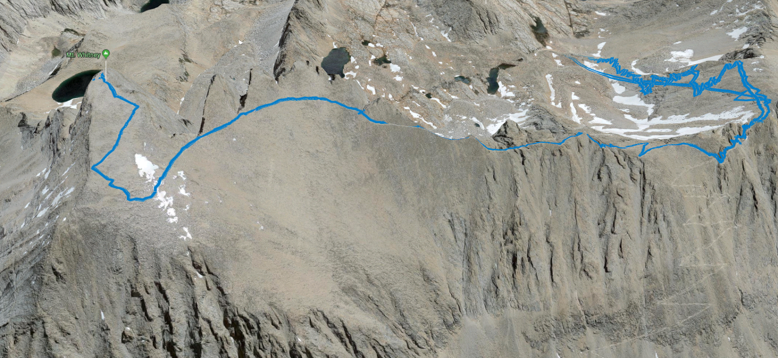 |
| Trail Crest (8.2 miles, 13,700 ft) to the Summit (11 miles, 14,505 ft). Most of it is along the ridge |
Here are the details of our hike with lots of pictures :)
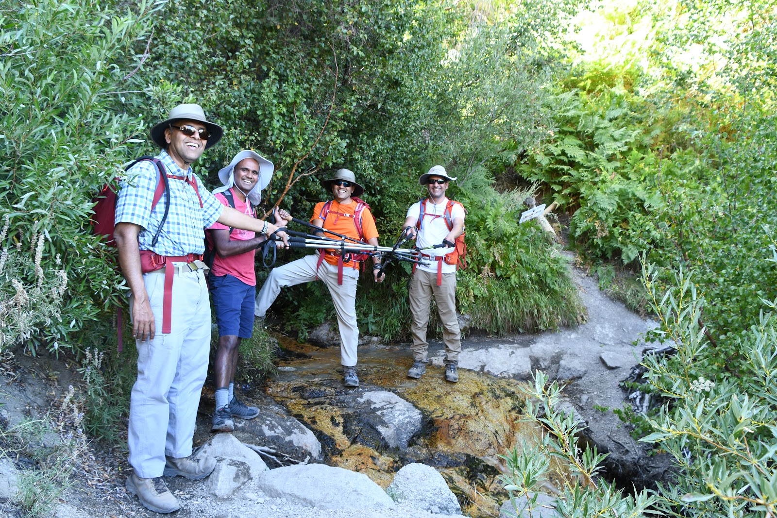
Day 1. Aug 27, 2018. Drive from San Jose to Lone Pine + Acclimation Hike
 |
| From Left to Right: Vikas, Ankur, Vijay, Jai (me) and Gunna |
We reached the visitor center at around 2:30pm and collected our permits and Wag Bags. Wag Bags are portable toilet waste bag. There are no toilets along the hiking route and you are not allowed to go potty in the nature. You are supposed to use these Wag Bags, seal them and the carry them with you all the way back!
 |
| Wag Bag - carry your own s***! |
 |
| Excited to start our acclimation hike |
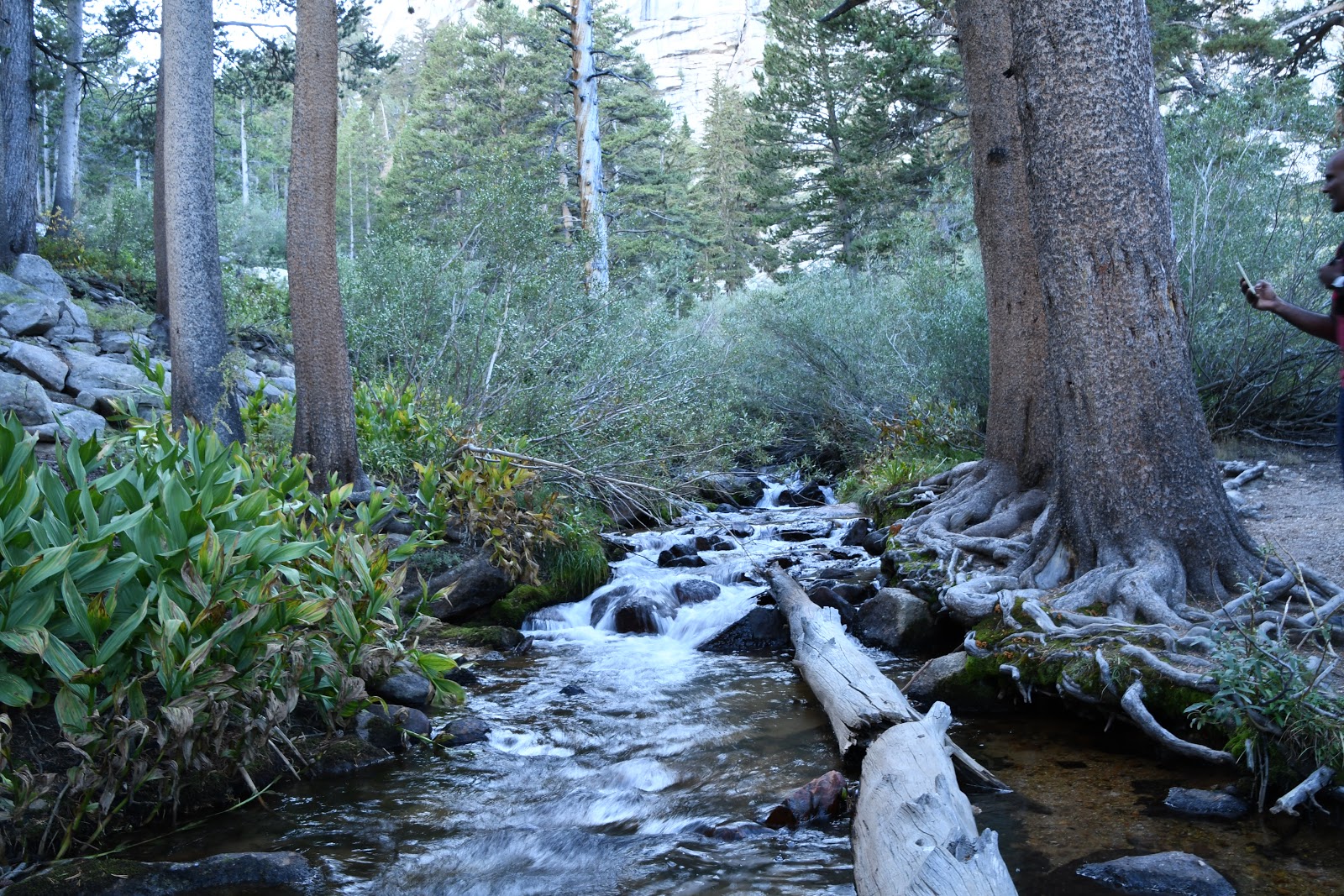
 |
| The terrain was surprisingly green. We crossed several steams along the way |
 |
| Heartfelt appeal from rangers to carry back your wag bag - otherwise they have to bring it back! |
 |
| Lone Pine Lake area, Elevation: 10,000 ft |
 |
| Beautiful view of the valley in the setting sun on the way back |
Day 2. Aug 28, 2018. More Acclimation, Rest and Get Ready
Today we decided to drive up to the Horseshoe Meadows Campground. It is at an elevation of 10,000ft. We spent an hour there to get our bodies further acclimated to higher altitude. We then got back to the town, had lunch and pretty much rested for the rest of the day.
 |
| Mount Whitney view from our hotel. Looks really far ! |
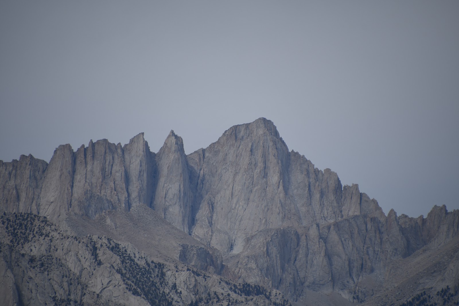 |
| Close up view |
 |
| Drive to Horseshoe Meadows Campground |
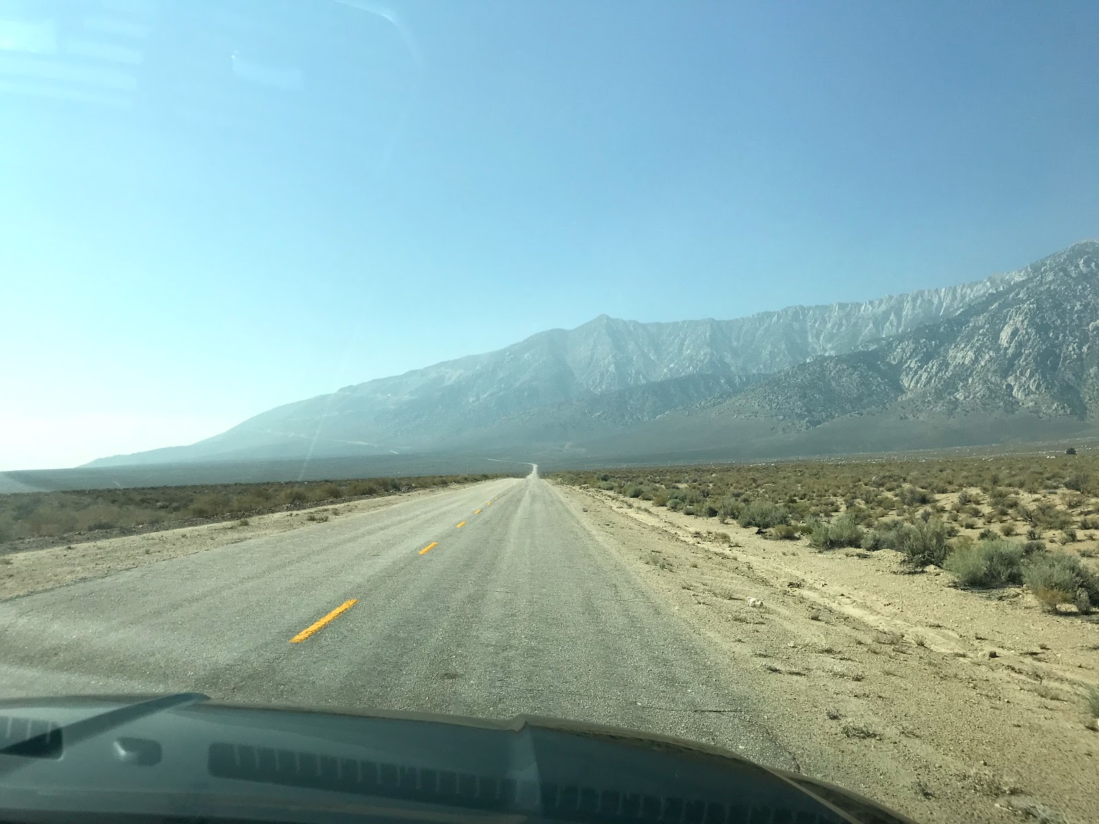 |
| Never ending road with no other cars or signs of life |
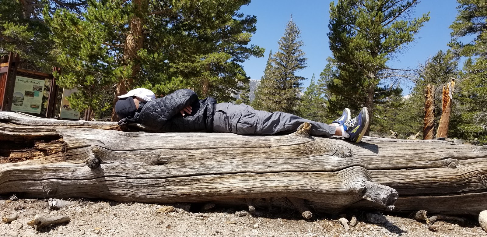 |
| Gunna decided to take a nap (slept like a log?) at the Horseshoe Meadows while we shot the breeze |
Day 3. Aug 29, 2018. Mount Whitney Hike
We woke up 30 past midnight, and loaded up our vehicle to drive to Whitney Portal which is the starting point for the Mount Whitney trail. We were told by the rangers that there are usually bears lurking around at that time of the night and that we should not take our eyes off our backpack! Bears are attracted by the smell of food. We also had to make sure that we did not leave any food in the car.
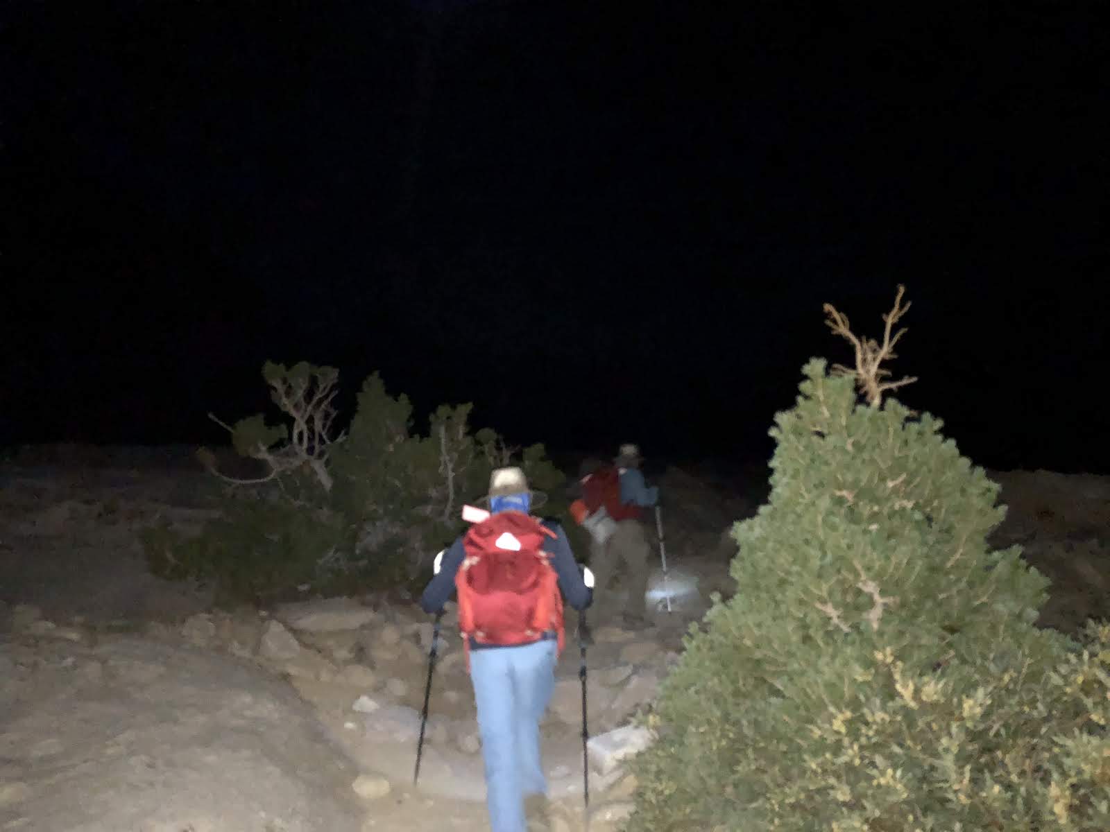
We started hiking at 1:50am in near darkness with our headlamps on.
 |
| Left to right: Jai (me), Vivek (can't see the face) and Vikas |
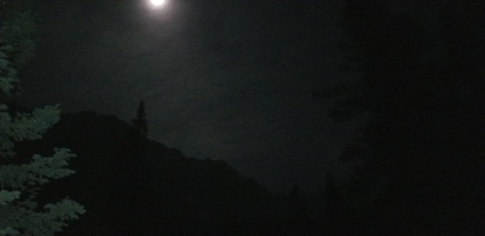 |
| Although there was some moonlight, it wasn't enough. The tree on the left is visible due to light from the headlamp. Everything else is totally dark |
 |
| It was really rocky and we had to walk carefully |
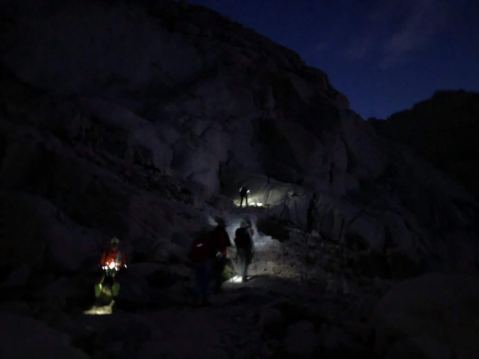 |
| Each man is an island :) |
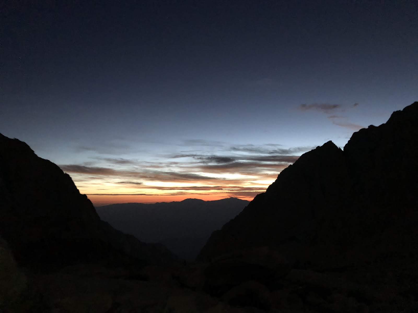 |
| Finally around 5:30am we can see the first glimpse of dawn |
 |
| There's something always magical about the morning Sun. Look at the colors! |
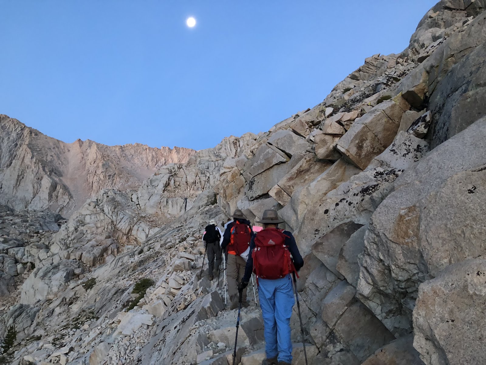 |
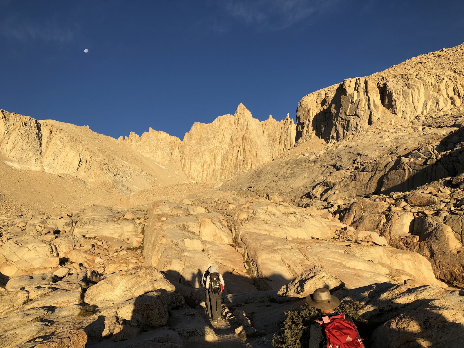
| The Moon is still around but sunlight is gradually asserting its presence making it a bit easier to navigate the rocky terrain |
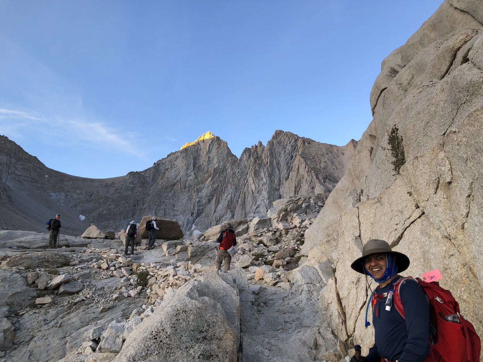 |
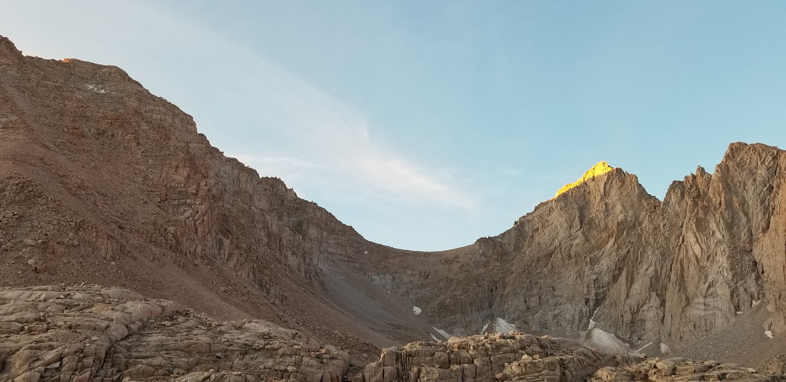
| Sunlight first starts hitting the peaks, making them look golden |
 |
| You can see some patches of ice. The trail was mostly ice-free barring a couple of sections |
 |
| No pain no gain. You can't get these views without putting in the effort |
 |
| And soon it is golden everywhere |
 |
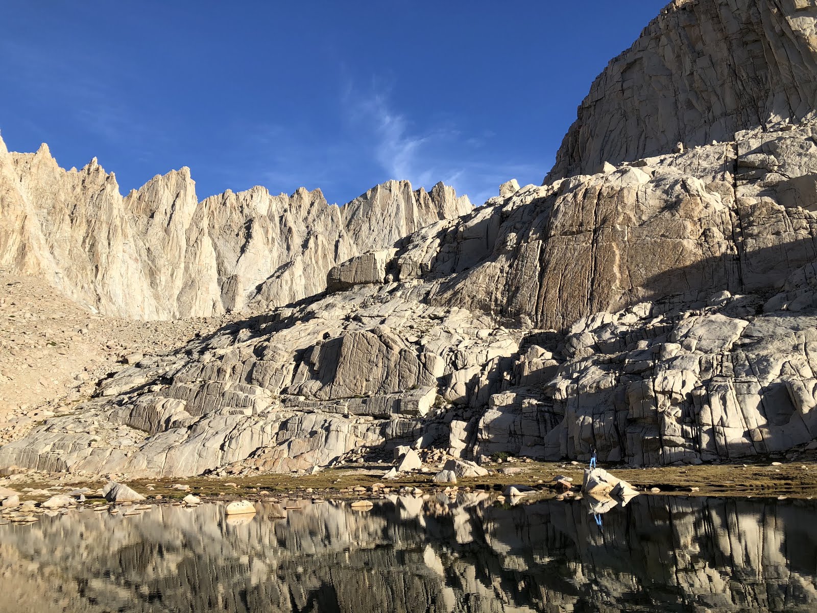
| Can you spot a little pond? Hint: look for reflections! |
We reached the Trail Camp at around 7am. It is at an elevation of 12,000 ft. It is a popular place for overnight campers. This is also the last place you can refill your water. We have covered 6 miles so far. 5 more to go!
 |
| Trail Camp Pond |
 |
| While everyone rested, I decided to go around the pond to pose for a picture :) |
 |
| Panoramic view of Trail Camp |
 |
| Two wildlings were spotted dueling it out :) |
The section after the Trail Camp is considered the hardest part of the hike. You gain 1,700 ft in elevation over 2 miles, crossing 99 switchbacks. Since you are above the tree line, there is no place to hide from the elements - other than may be under a rock :)
Although all of us had trained well and were quite fit, we all had our own natural pace. Walking at the natural pace is usually less tiring than going slower or faster. I felt I could go a bit faster and broke off from the group about 30min into the switchbacks. I reached the Trail Crest at around 9:45am. Vikas and Vijay arrived after 30 min and Gunna and Ankur arrived after another 30 min. I found a nice crack between the rocks to shield myself from the wind and had a nice nap in the meanwhile. I woke up with a stiff neck which resulted in a pain in the neck for the rest of the hike :(
 |
| Some switchbacks were short, some were long, some were really steep and some were precarious enough to warrant a hand rail |
 |
| And some sections were a bit more (d)icy than others! |
 |
| I tried to keep a count but couldn't keep it up. I will take other's word for it that there were 99 of these |
 |
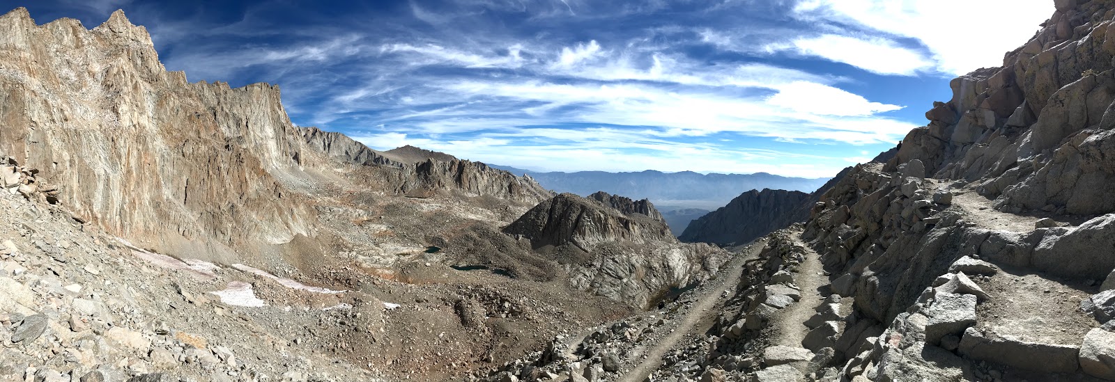
| View from Trail Crest |
 |
| 1.9 miles to go |
 |
| Immediately after Trail Crest is the JMT (John Muir Trail) intersection. It is a popular place for through hikers to leave their packs and go for the final summit. We did not do that |
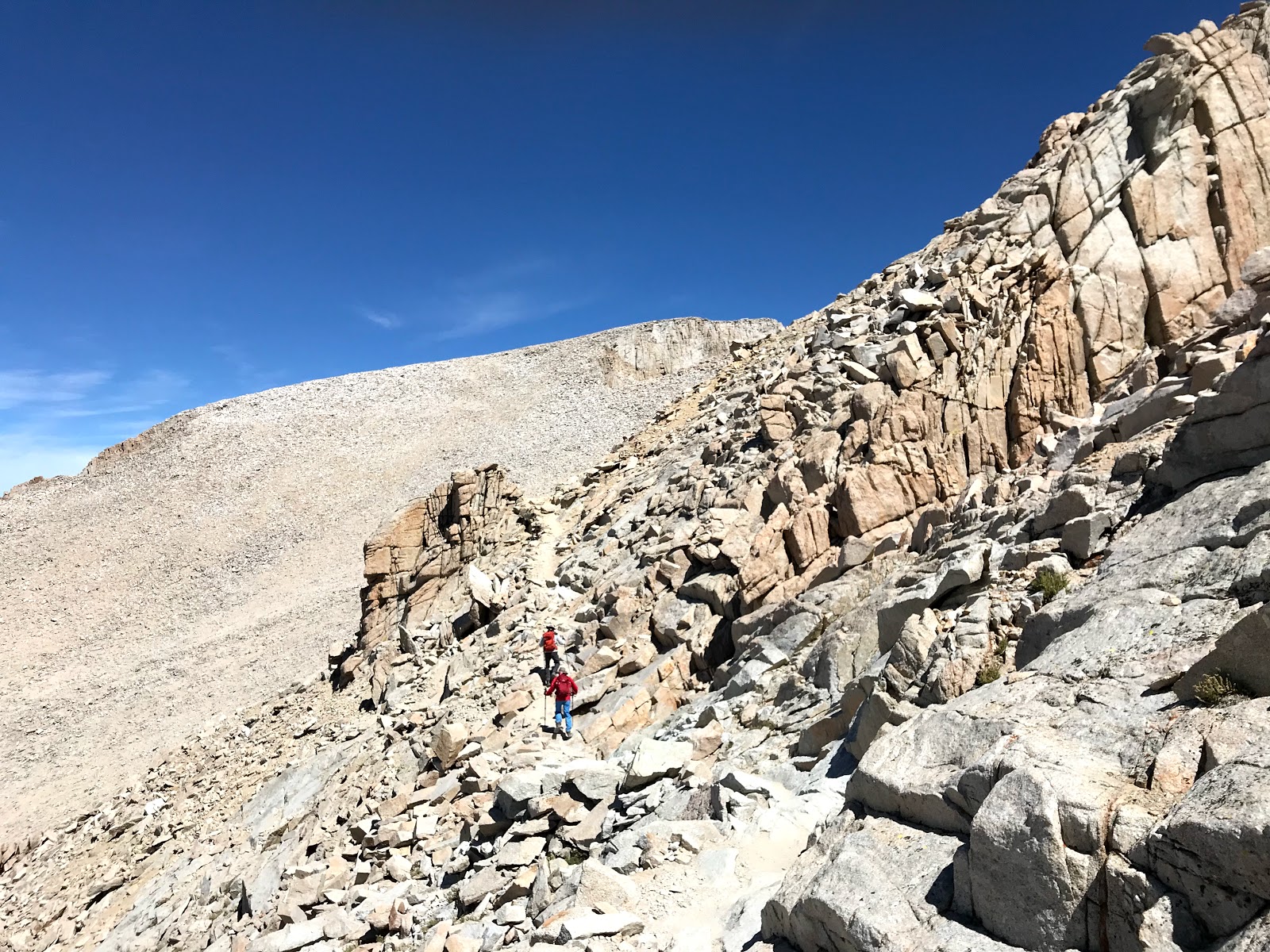 |
| Tired legs + uneven rocks = need to be extra careful |
 |
| There are some sections that are about 4ft wide with steep drops on either side. These are called Windows. Here's a view of the east side of the ridge from a Window section |
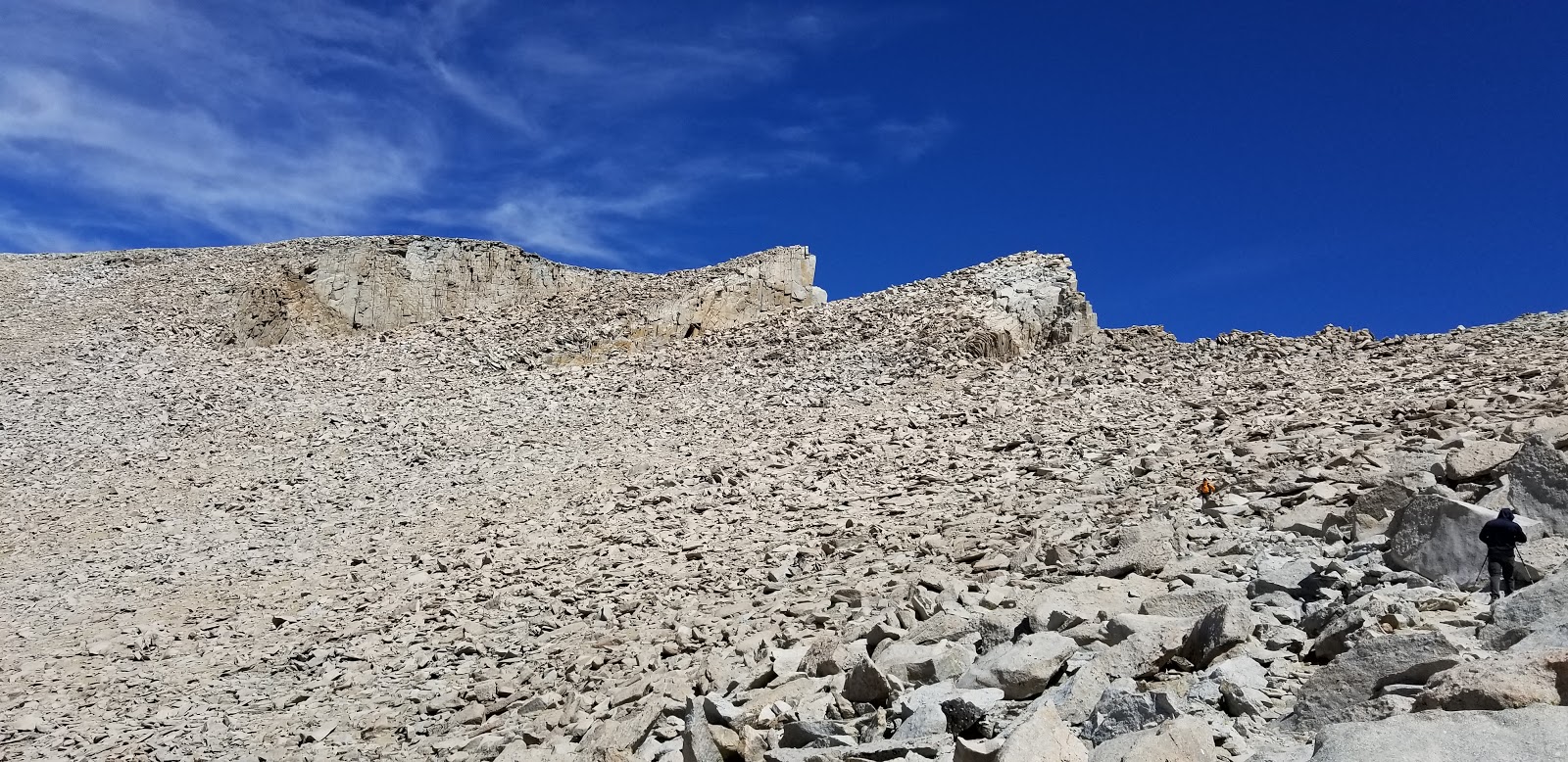 |
| Final approach to the summit. Very interesting terrain |
 |
| Someone had left a cardboard sign at the top so others could take a picture with it :) |
 |
| Official geological marker. As far as I can tell, it is from 1922 ! |
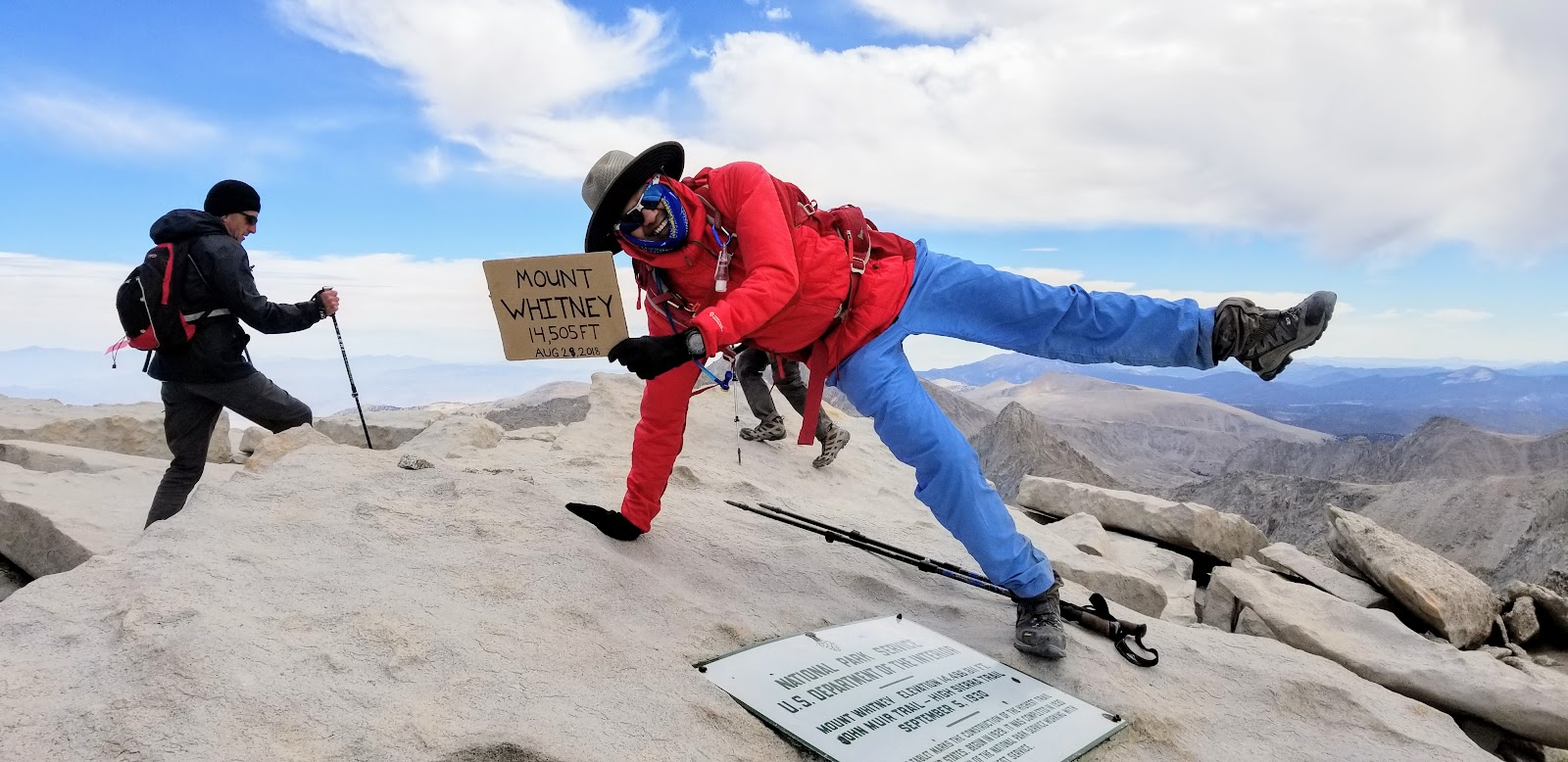 |
| Kicking it up a notch :) |
 |
| Top of the world! |
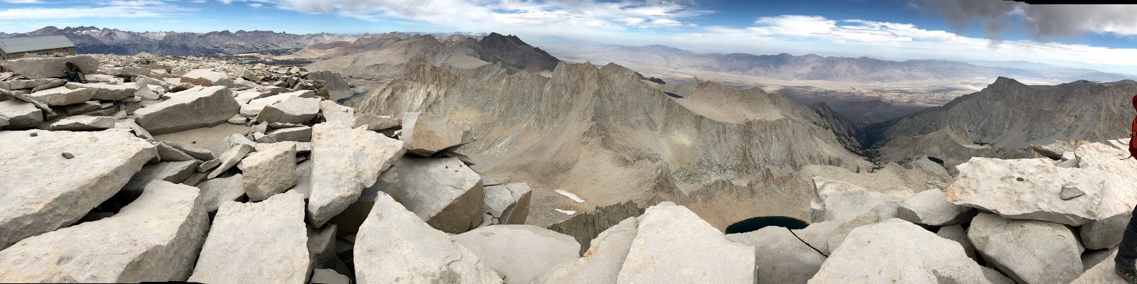 |
| Beautiful panoramic view. Good thing about being on the tallest mountain? The view is unobstructed in all directions ! |
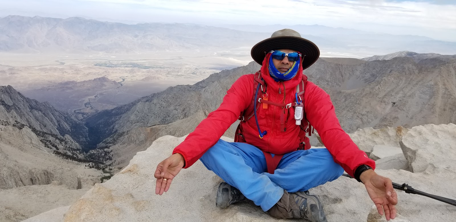 |
| Yoga time :) |
 |
| Adding another 5.5 ft to my climb ! |
 |
| There is a hut on the top of Mount Whitney which was built in 1909. It is officially called the Smithsonian Institute Shelter |
 |
| There is a register outside the hut which you can sign |
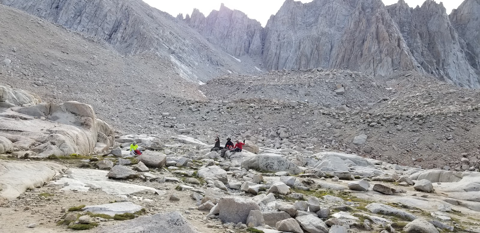 |
| Back at Trail Camp. 4:45pm |
 |
| Enjoyed some of the scenery we had missed on the way up |
 | |
|
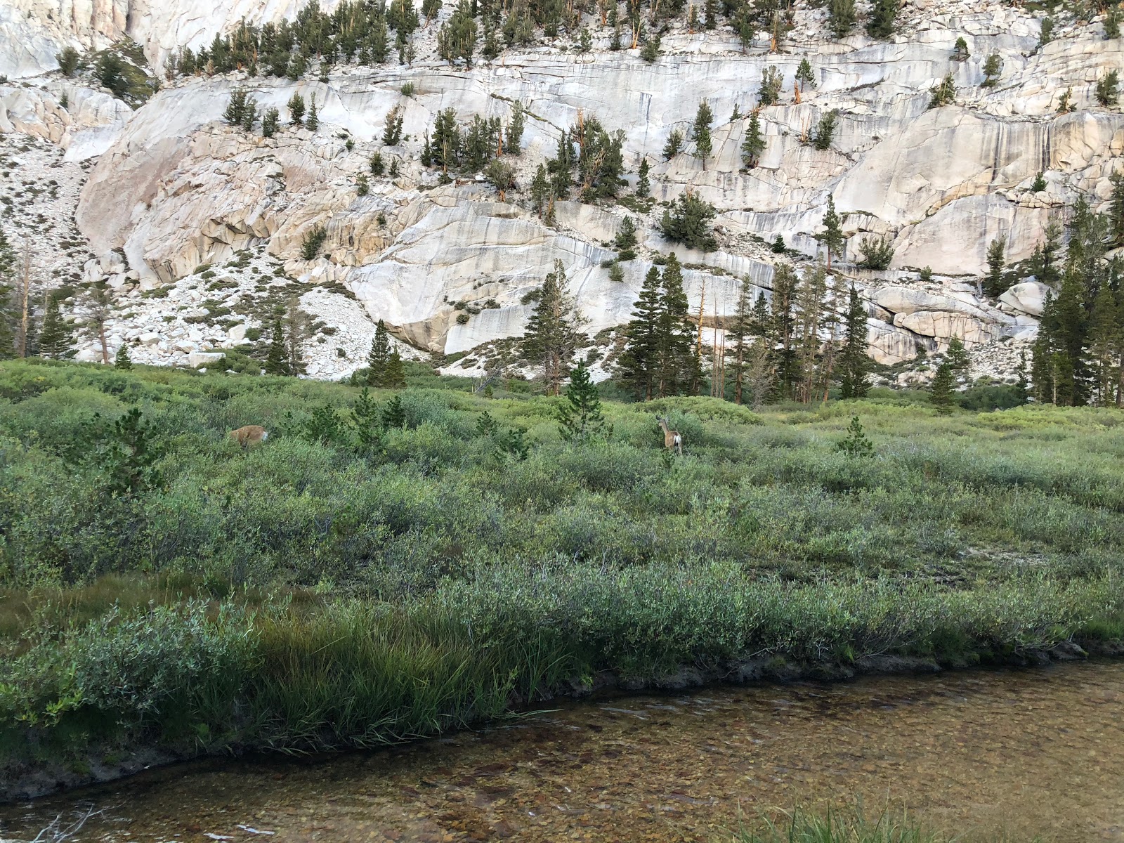 |
| Lush green meadows with a couple of deers grazing without worrying about the hikers. I guess they are used to humans now |
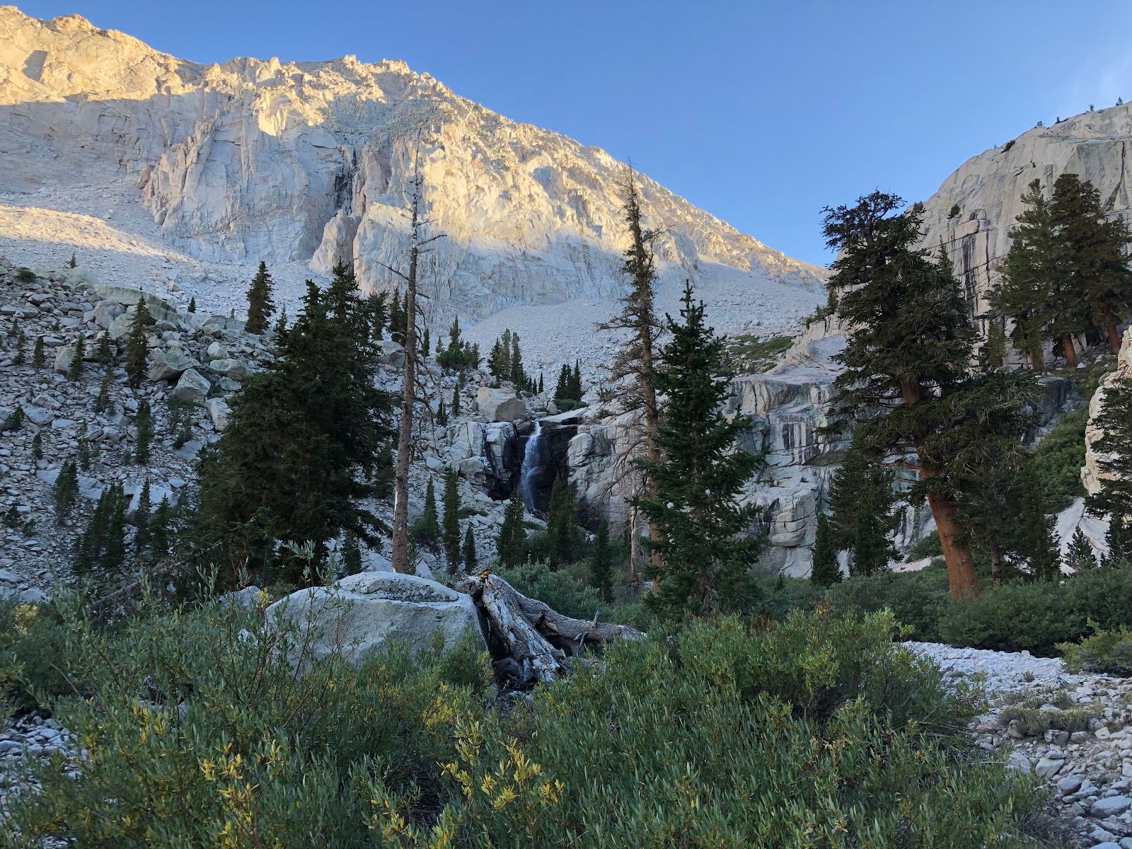 |
| Waterfall close to the Outpost Camp |
 |
| Can you find a better artist than nature? She has been painting the morning and evening sky uniquely every day for 4.5 billion years and it is a masterpiece every single time! |
I ran out of water again at Lone Pine lake with another 3 miles to go. Although tired, I decided to run the remaining distance. In part because we felt that Gunna and Vijay must be waiting for us and we had the car keys!
I reached the trail head at 7:20pm - exactly 17.5 hours after I started. Ankur and Vikas arrived shortly thereafter at 7:35pm.
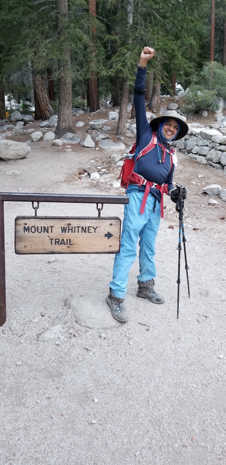 |
| Did it! |
 |
| Whitney Portal Store in the backgound |
If you have made it this far, can you please take a moment to write a comment below :)

1 comments
Another adventure in the books! Will wait for a book “tales of my trails” soon 😀
ReplyDeleteDivyesh